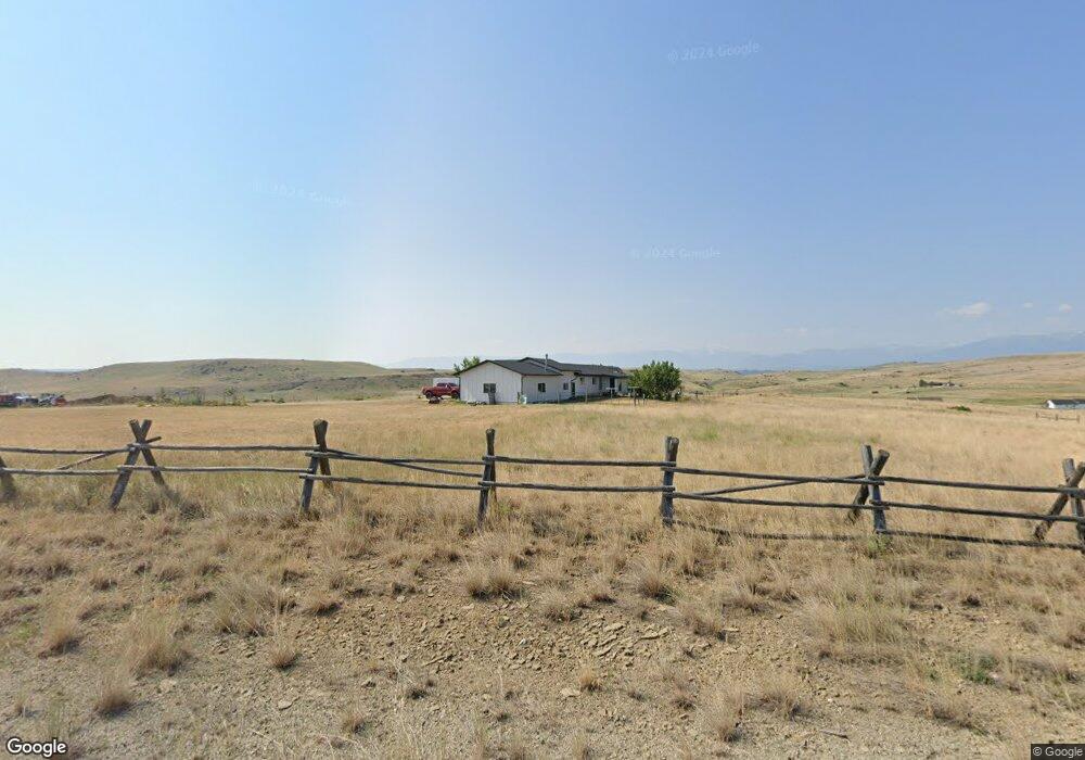
35 Plenty Coups Rd Absarokee, MT 59001
Estimated Value: $325,000 - $553,000
2
Beds
2
Baths
1,344
Sq Ft
$344/Sq Ft
Est. Value
About This Home
This home is located at 35 Plenty Coups Rd, Absarokee, MT 59001 and is currently estimated at $462,161, approximately $343 per square foot. 35 Plenty Coups Rd is a home located in Stillwater County with nearby schools including Absarokee School, Absarokee Junior High School, and Absarokee High School.
Ownership History
Date
Name
Owned For
Owner Type
Purchase Details
Closed on
Nov 9, 2017
Bought by
Gilman Shane and Gilman Ciara
Current Estimated Value
Purchase Details
Closed on
Sep 12, 2006
Sold by
Barnett Wc and Barnett Dorothe L
Bought by
Harvkey Steven Curtis and Harvkey Sonia
Home Financials for this Owner
Home Financials are based on the most recent Mortgage that was taken out on this home.
Original Mortgage
$224,730
Interest Rate
6.67%
Mortgage Type
VA
Create a Home Valuation Report for This Property
The Home Valuation Report is an in-depth analysis detailing your home's value as well as a comparison with similar homes in the area
Purchase History
| Date | Buyer | Sale Price | Title Company |
|---|---|---|---|
| Gilman Shane | -- | -- | |
| Harvkey Steven Curtis | -- | -- |
Source: Public Records
Mortgage History
| Date | Status | Borrower | Loan Amount |
|---|---|---|---|
| Previous Owner | Harvkey Steven Curtis | $224,730 |
Source: Public Records
Tax History
| Year | Tax Paid | Tax Assessment Tax Assessment Total Assessment is a certain percentage of the fair market value that is determined by local assessors to be the total taxable value of land and additions on the property. | Land | Improvement |
|---|---|---|---|---|
| 2025 | $1,558 | $436,400 | $0 | $0 |
| 2024 | $1,995 | $326,500 | $0 | $0 |
| 2023 | $2,043 | $326,500 | $0 | $0 |
| 2022 | $2,059 | $315,700 | $0 | $0 |
| 2021 | $1,873 | $315,700 | $0 | $0 |
| 2020 | $1,783 | $267,200 | $0 | $0 |
| 2019 | $1,812 | $267,200 | $0 | $0 |
| 2018 | $1,971 | $278,100 | $0 | $0 |
| 2017 | $1,767 | $278,600 | $0 | $0 |
| 2016 | $1,834 | $265,100 | $0 | $0 |
| 2015 | $1,583 | $254,300 | $0 | $0 |
| 2014 | $1,308 | $111,353 | $0 | $0 |
Source: Public Records
Map
Nearby Homes
- 20 Crow Child Trail
- 16 Crow Child Trail
- 12 Crow Child Trail
- 2994 Highway 78
- 119 S Woodard Ave
- 2825 & 2830 Highway 78 S
- 21 & 23 S Woodard Ave Unit 2 -HOMES For Price o
- A Johnson Dr Unit A
- 12 Avis St
- 30 Henry St
- 10 Alison Dr
- 59 Abattoir Rd
- 104 Running River Way
- 15.9 Ac Buck Creek Rd
- 287 Spring Creek Rd
- 91 Upper Hawk Valley Rd
- 37 Barham Rd
- 20-21 Turkey Creek Dr
- 1258 Stillwater River Rd Unit 4
- HWY 78 Parcel 1
- Lot 40 Plenty Coups Rd
- 31 Plenty Coups Rd
- 39 Plenty Coups Rd
- 171 Mason Rd
- 18 Crow Child Trail
- 26 Crow Child Trail
- 151 Mason Rd
- 43 Plenty Coups Rd
- 22 Crow Child Trail
- 6 Crow Child Trail
- 28 Crow Child Trail
- 0 Crow Child Trail
- 0 Crow Child Trail
- 27 Crow Child Trail
- TBD Crow Child Trail
- 21 Crow Child Trail
- Lot 21 Crow Child Trail
- 141 Mason Rd
- nhn Crow Child Trail
- 2 Crow Child Trail
Your Personal Tour Guide
Ask me questions while you tour the home.