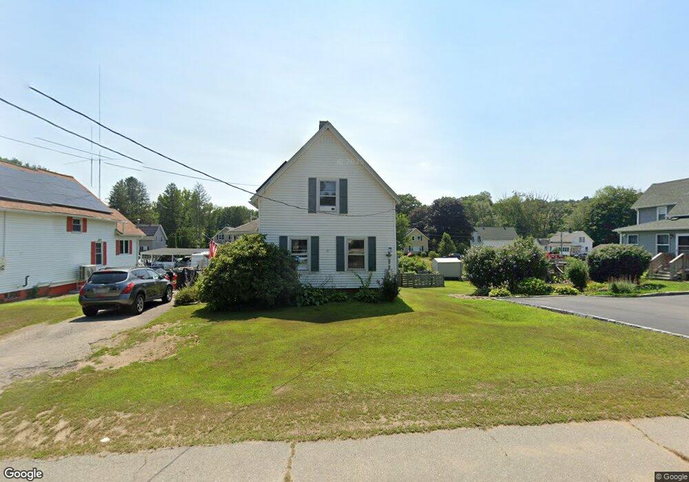
35 Quinebaug Rd Dudley, MA 01571
Estimated Value: $280,000 - $393,000
2
Beds
1
Bath
1,061
Sq Ft
$315/Sq Ft
Est. Value
About This Home
This home is located at 35 Quinebaug Rd, Dudley, MA 01571 and is currently estimated at $333,972, approximately $314 per square foot. 35 Quinebaug Rd is a home located in Worcester County with nearby schools including Shepherd Hill Regional High School, All Saints Academy, and St Joseph School.
Ownership History
Date
Name
Owned For
Owner Type
Purchase Details
Closed on
Jan 2, 2008
Sold by
Lane Danielle B and Beauvais Danielle
Bought by
Lane Danielle B and Lane Forrest K
Current Estimated Value
Home Financials for this Owner
Home Financials are based on the most recent Mortgage that was taken out on this home.
Original Mortgage
$150,000
Outstanding Balance
$96,074
Interest Rate
6.27%
Mortgage Type
Purchase Money Mortgage
Estimated Equity
$237,898
Purchase Details
Closed on
Jul 2, 1997
Sold by
Vail Walter L and Vail Eleanor B
Bought by
Linder Danielle B
Home Financials for this Owner
Home Financials are based on the most recent Mortgage that was taken out on this home.
Original Mortgage
$81,000
Interest Rate
7.86%
Mortgage Type
Purchase Money Mortgage
Create a Home Valuation Report for This Property
The Home Valuation Report is an in-depth analysis detailing your home's value as well as a comparison with similar homes in the area
Home Values in the Area
Average Home Value in this Area
Purchase History
| Date | Buyer | Sale Price | Title Company |
|---|---|---|---|
| Lane Danielle B | -- | -- | |
| Linder Danielle B | $81,000 | -- |
Source: Public Records
Mortgage History
| Date | Status | Borrower | Loan Amount |
|---|---|---|---|
| Open | Lane Danielle B | $150,000 | |
| Previous Owner | Linder Danielle B | $95,000 | |
| Previous Owner | Linder Danielle B | $93,200 | |
| Previous Owner | Linder Danielle B | $7,810 | |
| Previous Owner | Linder Danielle B | $81,000 |
Source: Public Records
Tax History
| Year | Tax Paid | Tax Assessment Tax Assessment Total Assessment is a certain percentage of the fair market value that is determined by local assessors to be the total taxable value of land and additions on the property. | Land | Improvement |
|---|---|---|---|---|
| 2025 | $27 | $255,800 | $63,900 | $191,900 |
| 2024 | $2,459 | $234,600 | $60,500 | $174,100 |
| 2023 | $2,286 | $225,000 | $55,900 | $169,100 |
| 2022 | $2,118 | $181,000 | $49,000 | $132,000 |
| 2021 | $2,031 | $165,100 | $45,600 | $119,500 |
| 2020 | $3,666 | $154,200 | $42,200 | $112,000 |
| 2019 | $3,646 | $148,900 | $42,200 | $106,700 |
| 2018 | $1,621 | $138,200 | $42,200 | $96,000 |
| 2017 | $3,202 | $132,700 | $42,200 | $90,500 |
| 2016 | $1,549 | $127,200 | $40,200 | $87,000 |
| 2015 | $1,460 | $119,100 | $37,800 | $81,300 |
Source: Public Records
Map
Nearby Homes
- 24 Railroad Ave
- 25 Quinebaug Rd
- 71 Donovan Dr
- 81 Parkway Dr
- 67 Breezy Ln
- 126 Old Southbridge Rd
- 180 Old Turnpike Rd
- 128 Old Southbridge Rd
- 10 Daves Way
- 470 Fabyan Rd
- 468 Fabyan Rd
- 4 W Dudley Rd
- 73 Dudley Hill Rd
- 249 Dudley Southbridge Rd
- 86 Ramshorn Rd
- 768 Ashland Ave
- 425 Route 197
- 72 NW Schoolhouse Rd
- 1669 Route 169
- 1023 N Woodstock Rd
- 33 Quinebaug Rd
- 37 Quinebaug Rd
- 31 Quinebaug Rd
- 36 Quinebaug Rd
- 34 Quinebaug Rd
- 38 Quinebaug Rd
- 40 Quinebaug Rd
- 32 Quinebaug Rd
- 42 Quinebaug Rd
- 20 River St
- 26 River St
- 13 Railroad Ave
- 13 Railroad Ave Unit 1
- 9 Railroad Ave
- 28 River St
- 28 River St Unit Left
- 22 River St
- 16 River St Unit 18
- 3 Railroad Ave
- 22 Quinebaug Rd
Your Personal Tour Guide
Ask me questions while you tour the home.