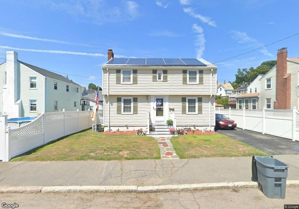
35 Reardon St Quincy, MA 02169
South Quincy NeighborhoodEstimated Value: $619,000 - $661,000
3
Beds
2
Baths
1,230
Sq Ft
$525/Sq Ft
Est. Value
About This Home
This home is located at 35 Reardon St, Quincy, MA 02169 and is currently estimated at $645,614, approximately $524 per square foot. 35 Reardon St is a home located in Norfolk County with nearby schools including South West Middle School, Lincoln-Hancock Community School, and Quincy High School.
Ownership History
Date
Name
Owned For
Owner Type
Purchase Details
Closed on
Oct 29, 2007
Sold by
Brenton Edwin R and Brenton Patricia T
Bought by
Murphy Geraldine and Murphy Thomas
Current Estimated Value
Home Financials for this Owner
Home Financials are based on the most recent Mortgage that was taken out on this home.
Original Mortgage
$299,200
Outstanding Balance
$187,678
Interest Rate
6.39%
Mortgage Type
Purchase Money Mortgage
Estimated Equity
$457,936
Purchase Details
Closed on
Jun 27, 2005
Sold by
Hennessey James E
Bought by
Brenton Edwin R and Brenton Patricia T
Purchase Details
Closed on
Oct 7, 2003
Sold by
Est Hennessey Nancy S and Hennessey James E
Bought by
Hennessey James E
Home Financials for this Owner
Home Financials are based on the most recent Mortgage that was taken out on this home.
Original Mortgage
$160,000
Interest Rate
6.25%
Mortgage Type
Purchase Money Mortgage
Create a Home Valuation Report for This Property
The Home Valuation Report is an in-depth analysis detailing your home's value as well as a comparison with similar homes in the area
Home Values in the Area
Average Home Value in this Area
Purchase History
| Date | Buyer | Sale Price | Title Company |
|---|---|---|---|
| Murphy Geraldine | $374,000 | -- | |
| Brenton Edwin R | $362,500 | -- | |
| Hennessey James E | $310,400 | -- |
Source: Public Records
Mortgage History
| Date | Status | Borrower | Loan Amount |
|---|---|---|---|
| Open | Murphy Geraldine | $299,200 | |
| Previous Owner | Hennessey James E | $160,000 |
Source: Public Records
Tax History Compared to Growth
Tax History
| Year | Tax Paid | Tax Assessment Tax Assessment Total Assessment is a certain percentage of the fair market value that is determined by local assessors to be the total taxable value of land and additions on the property. | Land | Improvement |
|---|---|---|---|---|
| 2025 | $6,169 | $535,000 | $265,000 | $270,000 |
| 2024 | $5,829 | $517,200 | $252,400 | $264,800 |
| 2023 | $5,426 | $487,500 | $240,400 | $247,100 |
| 2022 | $4,992 | $416,700 | $192,300 | $224,400 |
| 2021 | $4,960 | $408,600 | $192,300 | $216,300 |
| 2020 | $4,876 | $392,300 | $192,300 | $200,000 |
| 2019 | $4,741 | $377,800 | $186,700 | $191,100 |
| 2018 | $4,676 | $350,500 | $172,900 | $177,600 |
| 2017 | $4,628 | $326,600 | $164,600 | $162,000 |
| 2016 | $4,353 | $303,100 | $149,600 | $153,500 |
| 2015 | $4,209 | $288,300 | $141,200 | $147,100 |
| 2014 | $4,060 | $273,200 | $141,200 | $132,000 |
Source: Public Records
Map
Nearby Homes
- 211 Copeland St
- 1 Cityview Ln Unit 506
- 1 Cityview Ln Unit 210
- 1 Cityview Ln Unit 709
- 1 Cityview Ln Unit 204
- 73 Connell St
- 46 Suomi Rd
- 46 Suomi Rd Unit 46
- 46-48 Buckley St
- 57 Buckley St
- 25 Carrolls Ln
- 42 West St
- 10 White St
- 14 Arthur Ave
- 510 Willard St
- 12 Arthur Ave
- 21 Arthur St
- 89 Puritan Dr
- 91 Garfield St
- 29 Oconnell Ave
- 5 Harris St
- 29 Reardon St
- 11 Harris St
- 10 Barry St
- 4 Barry St
- 13 Harris St
- 36 Reardon St
- 1144 Furnace Brook Pkwy
- 1146 Furnace Brook Pkwy
- 14 Barry St
- 1138 Furnace Brook Pkwy
- 28 Reardon St
- 1150 Furnace Brook Pkwy
- 15 Harris St
- 17 Harris St
- 26 Reardon St
- 1132 Furnace Brook Pkwy
- 18 Barry St
- 12 Harris St
- 17 Reardon St