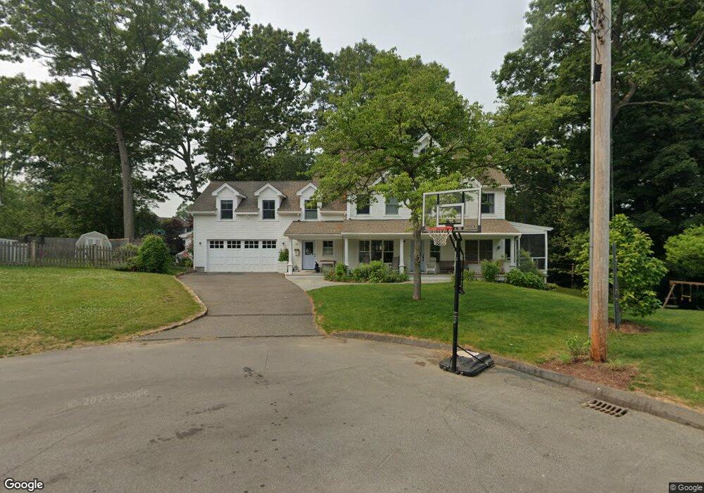
35 Riverfield Dr Fairfield, CT 06824
University NeighborhoodEstimated Value: $924,000 - $1,561,341
4
Beds
4
Baths
3,542
Sq Ft
$383/Sq Ft
Est. Value
About This Home
This home is located at 35 Riverfield Dr, Fairfield, CT 06824 and is currently estimated at $1,355,835, approximately $382 per square foot. 35 Riverfield Dr is a home located in Fairfield County with nearby schools including Riverfield Elementary School, Roger Ludlowe Middle School, and Fairfield Ludlowe High School.
Ownership History
Date
Name
Owned For
Owner Type
Purchase Details
Closed on
Feb 15, 2005
Sold by
Murphy Michael B and Murphy Kimberly A
Bought by
Negron Beth A and Mobley Kevin L
Current Estimated Value
Purchase Details
Closed on
Feb 9, 2004
Sold by
Karkot Ernest N and Karkot Joanne M
Bought by
Murphy Michael D
Purchase Details
Closed on
Dec 23, 2002
Sold by
Grella Edward P
Bought by
Karkut Ernest W and Karkut Joanne M
Create a Home Valuation Report for This Property
The Home Valuation Report is an in-depth analysis detailing your home's value as well as a comparison with similar homes in the area
Home Values in the Area
Average Home Value in this Area
Purchase History
| Date | Buyer | Sale Price | Title Company |
|---|---|---|---|
| Negron Beth A | $549,000 | -- | |
| Negron Beth A | $549,000 | -- | |
| Murphy Michael D | $465,000 | -- | |
| Murphy Michael D | $465,000 | -- | |
| Karkut Ernest W | $290,000 | -- | |
| Karkut Ernest W | $290,000 | -- |
Source: Public Records
Mortgage History
| Date | Status | Borrower | Loan Amount |
|---|---|---|---|
| Open | Karkut Ernest W | $688,000 | |
| Closed | Karkut Ernest W | $27,000 |
Source: Public Records
Tax History
| Year | Tax Paid | Tax Assessment Tax Assessment Total Assessment is a certain percentage of the fair market value that is determined by local assessors to be the total taxable value of land and additions on the property. | Land | Improvement |
|---|---|---|---|---|
| 2025 | $18,742 | $660,170 | $355,320 | $304,850 |
| 2024 | $18,419 | $660,170 | $355,320 | $304,850 |
| 2023 | $18,161 | $660,170 | $355,320 | $304,850 |
| 2022 | $17,983 | $660,170 | $355,320 | $304,850 |
| 2021 | $4,461 | $660,170 | $355,320 | $304,850 |
| 2020 | $18,582 | $693,630 | $351,330 | $342,300 |
| 2019 | $4,470 | $693,630 | $351,330 | $342,300 |
| 2018 | $18,284 | $693,630 | $351,330 | $342,300 |
| 2017 | $4,428 | $693,630 | $351,330 | $342,300 |
| 2016 | $17,653 | $693,630 | $351,330 | $342,300 |
| 2015 | $15,271 | $616,000 | $372,960 | $243,040 |
| 2014 | $15,030 | $616,000 | $372,960 | $243,040 |
Source: Public Records
Map
Nearby Homes
- 1353 Mill Plain Rd
- 1091 Round Hill Rd
- 20 Ermine St
- 647 Bronson Rd
- 360 Duck Farm Rd
- 164 Wakeman Rd
- 1478 Jennings Rd
- 245 Unquowa Rd Unit 2
- 245 Unquowa Rd Unit 82
- 245 Unquowa Rd Unit 6
- 188 Henderson Rd
- 15 Barton Rd
- 329 Bronson Rd
- 148 Millspaugh Dr
- 341 Crestwood Rd
- 218 Lower Farm Rd
- 53 Hilltop Dr
- 65 Thorpe St Unit 65
- 77 Meadowbrook Rd
- 25 Helen St
- 28 Riverfield Dr
- 29 Riverfield Dr
- 1177 Mill Plain Rd
- 1157 Mill Plain Rd
- 1205 Mill Plain Rd
- 16 Maple Dr
- 1137 Mill Plain Rd
- 40 Riverfield Dr
- 1200 Mill Plain Rd
- 1158 Mill Plain Rd
- 41 Pell Meadow Dr
- 1142 Mill Plain Rd
- 1135 Mill Plain Rd
- 1245 Mill Plain Rd
- 1234 Mill Plain Rd
- 57 Pell Meadow Dr
- 38 Maple Dr
- 23 Pell Meadow Dr
- 27 Maple Dr
- 54 Maple Dr
Your Personal Tour Guide
Ask me questions while you tour the home.