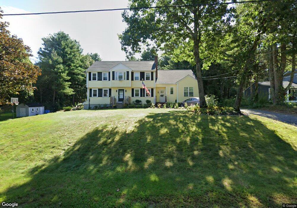
35 Robert Topham Dr Wrentham, MA 02093
Estimated Value: $740,320 - $865,000
4
Beds
3
Baths
2,000
Sq Ft
$402/Sq Ft
Est. Value
About This Home
This home is located at 35 Robert Topham Dr, Wrentham, MA 02093 and is currently estimated at $803,330, approximately $401 per square foot. 35 Robert Topham Dr is a home located in Norfolk County with nearby schools including Delaney Elementary School and Charles E Roderick.
Ownership History
Date
Name
Owned For
Owner Type
Purchase Details
Closed on
Jun 30, 2011
Sold by
Doherty George D and Doherty Jacqueline L
Bought by
Mcgrath William R
Current Estimated Value
Home Financials for this Owner
Home Financials are based on the most recent Mortgage that was taken out on this home.
Original Mortgage
$307,500
Outstanding Balance
$211,120
Interest Rate
4.62%
Mortgage Type
Purchase Money Mortgage
Estimated Equity
$592,210
Purchase Details
Closed on
Dec 29, 2004
Sold by
Roper Irene R and Roper Jonathan M
Bought by
Doherty George D and Doherty Jacqueline L
Home Financials for this Owner
Home Financials are based on the most recent Mortgage that was taken out on this home.
Original Mortgage
$355,200
Interest Rate
5.73%
Mortgage Type
Purchase Money Mortgage
Create a Home Valuation Report for This Property
The Home Valuation Report is an in-depth analysis detailing your home's value as well as a comparison with similar homes in the area
Home Values in the Area
Average Home Value in this Area
Purchase History
| Date | Buyer | Sale Price | Title Company |
|---|---|---|---|
| Mcgrath William R | $410,000 | -- | |
| Doherty George D | $444,000 | -- |
Source: Public Records
Mortgage History
| Date | Status | Borrower | Loan Amount |
|---|---|---|---|
| Open | Mcgrath William R | $307,500 | |
| Previous Owner | Doherty George D | $355,200 |
Source: Public Records
Tax History Compared to Growth
Tax History
| Year | Tax Paid | Tax Assessment Tax Assessment Total Assessment is a certain percentage of the fair market value that is determined by local assessors to be the total taxable value of land and additions on the property. | Land | Improvement |
|---|---|---|---|---|
| 2025 | $7,057 | $608,900 | $289,300 | $319,600 |
| 2024 | $6,887 | $573,900 | $289,300 | $284,600 |
| 2023 | $6,752 | $535,000 | $263,100 | $271,900 |
| 2022 | $6,407 | $468,700 | $245,500 | $223,200 |
| 2021 | $5,907 | $419,800 | $214,300 | $205,500 |
| 2020 | $5,823 | $408,600 | $190,600 | $218,000 |
| 2019 | $5,630 | $398,700 | $190,600 | $208,100 |
| 2018 | $5,945 | $417,500 | $190,700 | $226,800 |
| 2017 | $5,854 | $410,800 | $187,000 | $223,800 |
| 2016 | $5,728 | $401,100 | $181,600 | $219,500 |
| 2015 | $5,351 | $357,200 | $174,600 | $182,600 |
| 2014 | $5,296 | $345,900 | $167,900 | $178,000 |
Source: Public Records
Map
Nearby Homes
- 131 Creek St Unit 7
- 11 Earle Stewart Ln
- Lot 3 - 14 Earle Stewart Ln
- Lot 1 - Blueberry 2 Car Plan at King Philip Estates
- Lot 8 - Blueberry 2 Car Plan at King Philip Estates
- Lot 6 - Blueberry 3 Car Plan at King Philip Estates
- Lot 2 - Camden 2 Car Plan at King Philip Estates
- Lot 7 - Cedar Plan at King Philip Estates
- Lot 4 - Hemingway 2 Car Plan at King Philip Estates
- Lot 3 - Blueberry 2 Car Plan at King Philip Estates
- 10 Nature View Dr
- 15 Nature View Dr
- 319 Taunton St
- 570 Franklin St
- 791 South St Unit 5
- 270 Dedham St
- 1 Lorraine Metcalf Dr
- 362 East St
- 50 Reed Fulton Ave Unit Lot 61
- 120 Hawes St
- 35 Robert Topham Jr Dr
- 45 Robert Topham Dr
- 25 Robert Topham Dr
- 15 Robert Topham Dr
- 100 Eastside Rd
- 40 Robert Topham Dr
- 30 Robert Topham Dr
- 50 Robert Topham Dr
- 110 Eastside Rd
- 20 Robert Topham Dr
- 5 Robert Topham Dr
- 10 Robert Topham Dr
- 10 Roberttopham Dr
- 50 Deer Run Rd
- 130 Eastside Rd
- 40 Deer Run Rd
- 10 Deer Run Rd
- 30 Deer Run Rd
- 140 Eastside Rd
- 45 Creek St