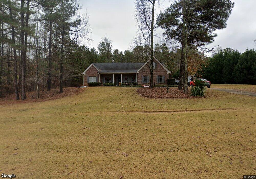
35 Rock Mill Trail Senoia, GA 30276
Estimated Value: $402,313 - $498,000
3
Beds
2
Baths
2,237
Sq Ft
$199/Sq Ft
Est. Value
About This Home
This home is located at 35 Rock Mill Trail, Senoia, GA 30276 and is currently estimated at $446,078, approximately $199 per square foot. 35 Rock Mill Trail is a home located in Coweta County with nearby schools including Poplar Road Elementary School, East Coweta Middle School, and East Coweta High School.
Ownership History
Date
Name
Owned For
Owner Type
Purchase Details
Closed on
Jan 23, 2002
Sold by
R C Development Inc
Bought by
Raptis Homes Inc
Current Estimated Value
Purchase Details
Closed on
May 4, 2001
Sold by
Stewart Walter L D D S P C Pro
Bought by
R C Development Inc
Purchase Details
Closed on
Oct 20, 2000
Sold by
Smith Carl E
Bought by
Profit Stewart Walter L D D S P C
Purchase Details
Closed on
Mar 29, 1991
Sold by
Vento Management Cor
Bought by
Smith Carl E
Purchase Details
Closed on
Jul 20, 1989
Bought by
Vento Management Cor
Create a Home Valuation Report for This Property
The Home Valuation Report is an in-depth analysis detailing your home's value as well as a comparison with similar homes in the area
Home Values in the Area
Average Home Value in this Area
Purchase History
| Date | Buyer | Sale Price | Title Company |
|---|---|---|---|
| Raptis Homes Inc | $315,000 | -- | |
| R C Development Inc | $791,800 | -- | |
| Profit Stewart Walter L D D S P C | $525,000 | -- | |
| Smith Carl E | $144,500 | -- | |
| Vento Management Cor | $232,800 | -- |
Source: Public Records
Tax History Compared to Growth
Tax History
| Year | Tax Paid | Tax Assessment Tax Assessment Total Assessment is a certain percentage of the fair market value that is determined by local assessors to be the total taxable value of land and additions on the property. | Land | Improvement |
|---|---|---|---|---|
| 2024 | $3,268 | $145,382 | $28,000 | $117,382 |
| 2023 | $3,268 | $131,722 | $28,000 | $103,722 |
| 2022 | $3,009 | $126,835 | $28,000 | $98,835 |
| 2021 | $2,322 | $92,861 | $16,000 | $76,861 |
| 2020 | $2,336 | $92,861 | $16,000 | $76,861 |
| 2019 | $2,290 | $83,043 | $14,000 | $69,043 |
| 2018 | $2,295 | $83,043 | $14,000 | $69,043 |
| 2017 | $2,294 | $83,043 | $14,000 | $69,043 |
| 2016 | $2,019 | $74,412 | $14,000 | $60,412 |
| 2015 | $1,872 | $70,385 | $14,000 | $56,385 |
| 2014 | $1,649 | $62,906 | $14,000 | $48,906 |
Source: Public Records
Map
Nearby Homes
- 409 Walden Pond Way
- 360 Walden Pond Way
- 215 Walden Pond Trail
- 59 Common Oak
- 1505 Elders Mill Rd
- 258 Bradshaw Farms Dr
- 752 Lawshe Rd
- 38 Chapman Farm Rd
- 290 Staffin Dr
- 280 Staffin Dr
- 73 Bourbon St Unit 5
- 166 Belvoir Place
- 291 Grove Park Unit 90
- 2000 Elders Mill Rd
- 306 Grove Park
- 0 Hwy 85 Unit 10534331
- 65 Crest Haven Ct
- 7 Belvoir Place
- 107 Barnsley Farms Dr
- 800 Rock House Rd
- 45 Rock Mill Trail Unit A-30
- 45 Rock Mill Trail
- 45 Rock Mill Trail
- 30 Rock Mill Trail
- 15 Rock Mill Trail Unit 32
- 15 Rock Mill Trail
- 55 Rock Mill Trail
- 5 Rock Mill Trail
- 65 Rock Mill Trail
- 50 Rock Mill Trail
- 60 Rock Mill Trail
- 10 Rock Mill Trail
- 1475 Rockhouse Rd
- 40 Rock Mill Trail
- 75 Rock Mill Trail
- 70 Rock Mill Trail
- 1445 Rockhouse Rd
- 85 Rock Mill Trail
- 1449 Rockhouse Rd
- 9 Walden Pond Way Unit 1