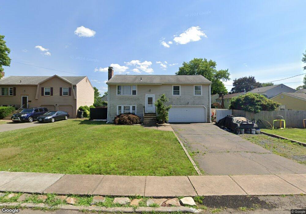
35 Saxon Rd Wethersfield, CT 06109
Estimated Value: $345,000 - $380,999
3
Beds
2
Baths
1,448
Sq Ft
$251/Sq Ft
Est. Value
About This Home
This home is located at 35 Saxon Rd, Wethersfield, CT 06109 and is currently estimated at $362,750, approximately $250 per square foot. 35 Saxon Rd is a home located in Hartford County with nearby schools including Charles Wright School, Silas Deane Middle School, and Wethersfield High School.
Ownership History
Date
Name
Owned For
Owner Type
Purchase Details
Closed on
Jun 5, 2006
Sold by
Decaro Anthony S and Decaro Susan M
Bought by
Cooper Joel H
Current Estimated Value
Home Financials for this Owner
Home Financials are based on the most recent Mortgage that was taken out on this home.
Original Mortgage
$168,000
Interest Rate
6.55%
Purchase Details
Closed on
Jul 30, 1991
Sold by
Allaben Paul B and Allaben Adrienne
Bought by
Decaro Anthony S and Decaro Susan M
Create a Home Valuation Report for This Property
The Home Valuation Report is an in-depth analysis detailing your home's value as well as a comparison with similar homes in the area
Home Values in the Area
Average Home Value in this Area
Purchase History
| Date | Buyer | Sale Price | Title Company |
|---|---|---|---|
| Cooper Joel H | $210,000 | -- | |
| Decaro Anthony S | $140,909 | -- |
Source: Public Records
Mortgage History
| Date | Status | Borrower | Loan Amount |
|---|---|---|---|
| Open | Decaro Anthony S | $156,000 | |
| Closed | Decaro Anthony S | $168,000 | |
| Previous Owner | Decaro Anthony S | $187,200 | |
| Previous Owner | Decaro Anthony S | $91,000 |
Source: Public Records
Tax History
| Year | Tax Paid | Tax Assessment Tax Assessment Total Assessment is a certain percentage of the fair market value that is determined by local assessors to be the total taxable value of land and additions on the property. | Land | Improvement |
|---|---|---|---|---|
| 2025 | $9,609 | $233,120 | $66,460 | $166,660 |
| 2024 | $6,808 | $157,530 | $58,680 | $98,850 |
| 2023 | $6,582 | $157,530 | $58,680 | $98,850 |
| 2022 | $6,471 | $157,530 | $58,680 | $98,850 |
| 2021 | $6,407 | $157,530 | $58,680 | $98,850 |
| 2020 | $6,410 | $157,530 | $58,680 | $98,850 |
| 2019 | $6,418 | $157,530 | $58,680 | $98,850 |
| 2018 | $6,460 | $158,400 | $56,600 | $101,800 |
| 2017 | $6,300 | $158,400 | $56,600 | $101,800 |
| 2016 | $6,105 | $158,400 | $56,600 | $101,800 |
| 2015 | $5,855 | $153,300 | $56,600 | $96,700 |
| 2014 | $5,632 | $153,300 | $56,600 | $96,700 |
Source: Public Records
Map
Nearby Homes
- 219-221 Jordan Ln
- 704 Franklin Ave
- 28 Bolton St
- 192 Wolcott Hill Rd
- 51 Hanmer St
- 19 Albert Ave
- 166 George St
- 18 Avalon Place
- 1 Bristol St
- 23 Hillcrest Ave
- 317-319 Garden St
- 1 Fernwood St
- 249 Ridge Rd
- 167 Campfield Ave
- 43 Yale St
- 103 Otis St
- 295 Ridge Rd Unit 8
- 70-72 Otis St
- 493 Main St
- 100 Campfield Ave
- 29 Saxon Rd
- 24 Goodrich Dr
- 41 Saxon Rd
- 18 Goodrich Dr
- 208 Jordan Ln Unit 210
- 214 Jordan Ln Unit 216
- 202 Jordan Ln Unit 204
- 202-204 Jordan Ln Unit 204
- 36 Saxon Rd
- 26 Saxon Rd
- 42 Saxon Rd
- 204 Jordan Ln
- 204 Jordan Ln
- 53 Wolcott Hill Rd Unit 68
- 53 Wolcott Hill Rd Unit 67
- 53 Wolcott Hill Rd Unit C23
- 53 Wolcott Hill Rd Unit C21
- 53 Wolcott Hill Rd Unit C20
- 53 Wolcott Hill Rd Unit C19
- 53 Wolcott Hill Rd Unit C18
Your Personal Tour Guide
Ask me questions while you tour the home.