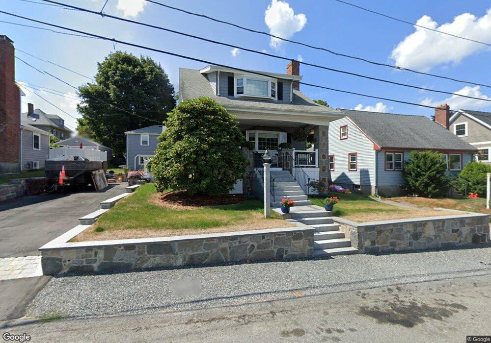
35 Shoreham St Quincy, MA 02171
Squantum NeighborhoodEstimated Value: $1,001,000 - $1,591,000
--
Bed
3
Baths
--
Sq Ft
6,926
Sq Ft Lot
About This Home
This home is located at 35 Shoreham St, Quincy, MA 02171 and is currently estimated at $1,232,209. 35 Shoreham St is a home located in Norfolk County with nearby schools including Squantum Elementary School, Atlantic Middle School, and North Quincy High School.
Ownership History
Date
Name
Owned For
Owner Type
Purchase Details
Closed on
Apr 12, 1995
Sold by
Belmont Michael F and Belmont Francine M
Bought by
Fitzgerald Scott A and Fitzgerald Shirley J
Current Estimated Value
Create a Home Valuation Report for This Property
The Home Valuation Report is an in-depth analysis detailing your home's value as well as a comparison with similar homes in the area
Home Values in the Area
Average Home Value in this Area
Purchase History
| Date | Buyer | Sale Price | Title Company |
|---|---|---|---|
| Fitzgerald Scott A | $254,000 | -- |
Source: Public Records
Mortgage History
| Date | Status | Borrower | Loan Amount |
|---|---|---|---|
| Open | Fitzgerald Scott A | $335,000 | |
| Closed | Fitzgerald Scott A | $236,000 | |
| Closed | Fitzgerald Scott A | $236,000 |
Source: Public Records
Tax History Compared to Growth
Tax History
| Year | Tax Paid | Tax Assessment Tax Assessment Total Assessment is a certain percentage of the fair market value that is determined by local assessors to be the total taxable value of land and additions on the property. | Land | Improvement |
|---|---|---|---|---|
| 2025 | $12,478 | $1,082,200 | $454,500 | $627,700 |
| 2024 | $11,893 | $1,055,300 | $432,800 | $622,500 |
| 2023 | $11,319 | $1,017,000 | $412,200 | $604,800 |
| 2022 | $11,428 | $953,900 | $359,800 | $594,100 |
| 2021 | $11,188 | $921,600 | $359,800 | $561,800 |
| 2020 | $10,773 | $866,700 | $327,100 | $539,600 |
| 2019 | $10,440 | $831,900 | $342,000 | $489,900 |
| 2018 | $10,716 | $803,300 | $339,800 | $463,500 |
| 2017 | $9,638 | $680,200 | $246,200 | $434,000 |
| 2016 | $9,232 | $642,900 | $223,900 | $419,000 |
| 2015 | $8,737 | $598,400 | $223,900 | $374,500 |
| 2014 | $8,298 | $558,400 | $223,900 | $334,500 |
Source: Public Records
Map
Nearby Homes
- 22 Winslow Rd
- 15 Huckins Ave
- 2 Parke Ave
- 1 Parke Ave
- 153 Bayside Rd
- 15 Knollwood Rd
- 19 Knollwood Rd
- 63 Crabtree Rd
- 116 Crabtree Rd
- 19 Harbourside Rd Unit 19
- 6 Schooner Ln
- 10 Sloop Ln
- 9 Whaler Ln
- 1001 Marina Dr Unit 801
- 1001 Marina Dr Unit 213
- 1001 Marina Dr Unit 612
- 2001 Marina Dr Unit 506W
- 2001 Marina Dr Unit 211
- 25 Tilden Commons Dr
- 10 Seaport Dr Unit 2311
- 37 Shoreham St
- 29 Shoreham St
- 27 Shoreham St
- 45 Shoreham St
- 38 Bellevue Rd
- 38 Shoreham St
- 42 Bellevue Rd
- 34 Shoreham St
- 23 Shoreham St
- 42 Shoreham St
- 28 Shoreham St
- 28 Bellevue Rd
- 30 Bellevue Rd
- 43 Standish Rd
- 26 Bellevue Rd
- 29 Standish Rd
- 19 Shoreham St
- 19 Shoreham St Unit 2
- 24 Shoreham St
- 50 Bellevue Rd