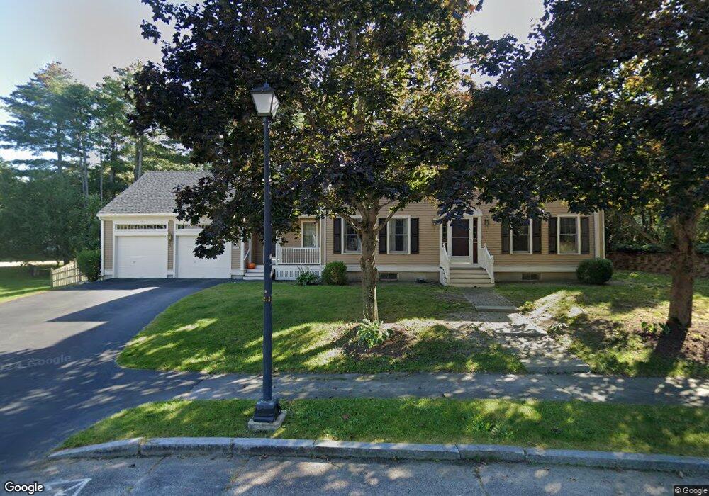
35 Spar Ln Portland, ME 04102
Stroudwater NeighborhoodEstimated Value: $932,000 - $1,022,000
4
Beds
3
Baths
3,914
Sq Ft
$247/Sq Ft
Est. Value
About This Home
This home is located at 35 Spar Ln, Portland, ME 04102 and is currently estimated at $966,204, approximately $246 per square foot. 35 Spar Ln is a home located in Cumberland County with nearby schools including Amanda C Rowe School, King Middle School, and Levey Day School.
Ownership History
Date
Name
Owned For
Owner Type
Purchase Details
Closed on
Aug 18, 2008
Sold by
Fitzgerald Daniel J and Fitzgerald Anna T
Bought by
Howe Allyson S and Howe David
Current Estimated Value
Home Financials for this Owner
Home Financials are based on the most recent Mortgage that was taken out on this home.
Original Mortgage
$417,000
Outstanding Balance
$274,627
Interest Rate
6.4%
Mortgage Type
Unknown
Estimated Equity
$691,577
Create a Home Valuation Report for This Property
The Home Valuation Report is an in-depth analysis detailing your home's value as well as a comparison with similar homes in the area
Home Values in the Area
Average Home Value in this Area
Purchase History
| Date | Buyer | Sale Price | Title Company |
|---|---|---|---|
| Howe Allyson S | -- | -- |
Source: Public Records
Mortgage History
| Date | Status | Borrower | Loan Amount |
|---|---|---|---|
| Open | Howe Allyson S | $417,000 |
Source: Public Records
Tax History Compared to Growth
Tax History
| Year | Tax Paid | Tax Assessment Tax Assessment Total Assessment is a certain percentage of the fair market value that is determined by local assessors to be the total taxable value of land and additions on the property. | Land | Improvement |
|---|---|---|---|---|
| 2024 | $9,177 | $611,400 | $88,900 | $522,500 |
| 2023 | $8,810 | $611,400 | $88,900 | $522,500 |
| 2022 | $8,321 | $611,400 | $88,900 | $522,500 |
| 2021 | $7,942 | $611,400 | $88,900 | $522,500 |
| 2020 | $8,727 | $374,400 | $75,500 | $298,900 |
| 2019 | $8,727 | $374,400 | $75,500 | $298,900 |
| 2018 | $8,417 | $374,400 | $75,500 | $298,900 |
| 2017 | $8,106 | $374,400 | $75,500 | $298,900 |
| 2016 | $7,904 | $374,400 | $75,500 | $298,900 |
| 2015 | $7,724 | $374,400 | $75,500 | $298,900 |
| 2014 | $7,488 | $374,400 | $75,500 | $298,900 |
Source: Public Records
Map
Nearby Homes
- 1549 Westbrook St
- 16 Black Sparrow Dr
- 1346 Westbrook St
- 2 Firefly St Unit 303
- 155 Owls Nest Rd
- 149 Owls Nest Rd
- 1 Firefly St Unit 402
- 1 Firefly St Unit 201
- 1 Firefly St Unit 303
- 1 Firefly St Unit 302
- 1 Firefly St Unit 403/103
- 1 Firefly St Unit 301
- 1 Firefly St Unit 401
- 1 Firefly St Unit 403
- 1 Firefly St Unit 202
- 63A Capisic St
- 99 Webb St
- 0 Hillcrest Ave
- 159 Bancroft St
- 89 Cobb Ave