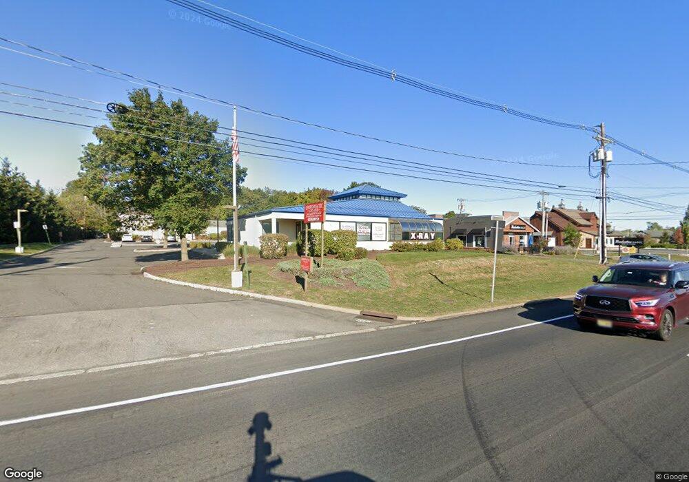
35 State Route 31 Unit 1 Flemington, NJ 08822
Estimated Value: $1,943,237
3
Beds
2
Baths
4,298
Sq Ft
$452/Sq Ft
Est. Value
About This Home
This home is located at 35 State Route 31 Unit 1, Flemington, NJ 08822 and is currently estimated at $1,943,237, approximately $452 per square foot. 35 State Route 31 Unit 1 is a home located in Hunterdon County with nearby schools including Francis A. Desmares Elementary School, Reading Fleming Intermediate School, and J.P. Case Middle School.
Ownership History
Date
Name
Owned For
Owner Type
Purchase Details
Closed on
Oct 22, 1999
Sold by
Ron D Llc
Bought by
Flemington Realty Associates
Current Estimated Value
Home Financials for this Owner
Home Financials are based on the most recent Mortgage that was taken out on this home.
Original Mortgage
$750,000
Outstanding Balance
$225,592
Interest Rate
7.78%
Mortgage Type
Commercial
Estimated Equity
$1,717,645
Purchase Details
Closed on
Jan 16, 1998
Sold by
Ron D Llc
Bought by
State Of New Jersey and Dept Of Transportation
Purchase Details
Closed on
Sep 30, 1996
Sold by
Dirienzo Orlando N
Bought by
Ron D Llc
Purchase Details
Closed on
Dec 23, 1994
Sold by
34 West Route 31 Flemington Corp
Bought by
Dirienzo Orlando N
Purchase Details
Closed on
Mar 23, 1992
Sold by
Warta Warta and Warta Reed
Bought by
34 West Route 31 Flemington Corp
Create a Home Valuation Report for This Property
The Home Valuation Report is an in-depth analysis detailing your home's value as well as a comparison with similar homes in the area
Home Values in the Area
Average Home Value in this Area
Purchase History
| Date | Buyer | Sale Price | Title Company |
|---|---|---|---|
| Flemington Realty Associates | $750,000 | -- | |
| State Of New Jersey | $31,200 | -- | |
| Ron D Llc | -- | -- | |
| Dirienzo Orlando N | $223,000 | -- | |
| 34 West Route 31 Flemington Corp | -- | -- |
Source: Public Records
Mortgage History
| Date | Status | Borrower | Loan Amount |
|---|---|---|---|
| Open | Flemington Realty Associates | $750,000 |
Source: Public Records
Tax History Compared to Growth
Tax History
| Year | Tax Paid | Tax Assessment Tax Assessment Total Assessment is a certain percentage of the fair market value that is determined by local assessors to be the total taxable value of land and additions on the property. | Land | Improvement |
|---|---|---|---|---|
| 2025 | $34,520 | $1,248,800 | $414,900 | $833,900 |
| 2024 | $30,632 | $1,167,800 | $387,700 | $780,100 |
| 2023 | $30,632 | $1,004,000 | $365,700 | $638,300 |
| 2022 | $30,724 | $967,700 | $348,300 | $619,400 |
| 2021 | $31,502 | $948,000 | $328,600 | $619,400 |
| 2020 | $31,711 | $948,000 | $328,600 | $619,400 |
| 2019 | $30,952 | $945,400 | $328,900 | $616,500 |
| 2018 | $30,268 | $940,000 | $325,000 | $615,000 |
| 2017 | $30,741 | $955,000 | $325,000 | $630,000 |
| 2016 | $31,681 | $965,000 | $325,000 | $640,000 |
| 2015 | $30,343 | $950,000 | $310,000 | $640,000 |
| 2014 | $29,004 | $935,000 | $295,000 | $640,000 |
Source: Public Records
Map
Nearby Homes
- 198 U S Highway 202
- 53A Broad St
- 29 Royal Rd
- 61 Park Ave
- 15 Hancock Ct
- 31 Hancock Ct
- 31 E Main St
- 410 Village Commons
- 613 Village Commons
- 402 Clark Cir
- 111 Franklin Ct
- 105 Franklin Ct Unit 237
- 106 Franklin Ct Unit 238
- 30 Capner St
- 92 Park Ave
- 107 Provincetown Ct
- 12 Corcoran St
- 5 William Martin Way Unit 5
- 15 Cedar Ct
- 21 Sherwood Ct
- 35 State Route 31 Unit 2
- 41 State Route 31
- 76 Church St
- 74 Church St
- 40 Hwy 31
- 40 Hwy 31 Unit B-6
- 40 New Jersey 31
- 40 New Jersey 31 Unit 3
- 44 Highway 31 Unit A
- 44 Nj-31
- 44 Nj Highway 31
- 70 Church St
- 44 Hwy 31 Suite B Unit B
- 45 Maple Ave
- 325 Us Highway 202 Unit 3
- 85 Elwood Ave
- 43 Maple Ave
- 41 Maple Ave
- 47 Maple Ave Unit A1
- 47 Maple Ave Unit 3