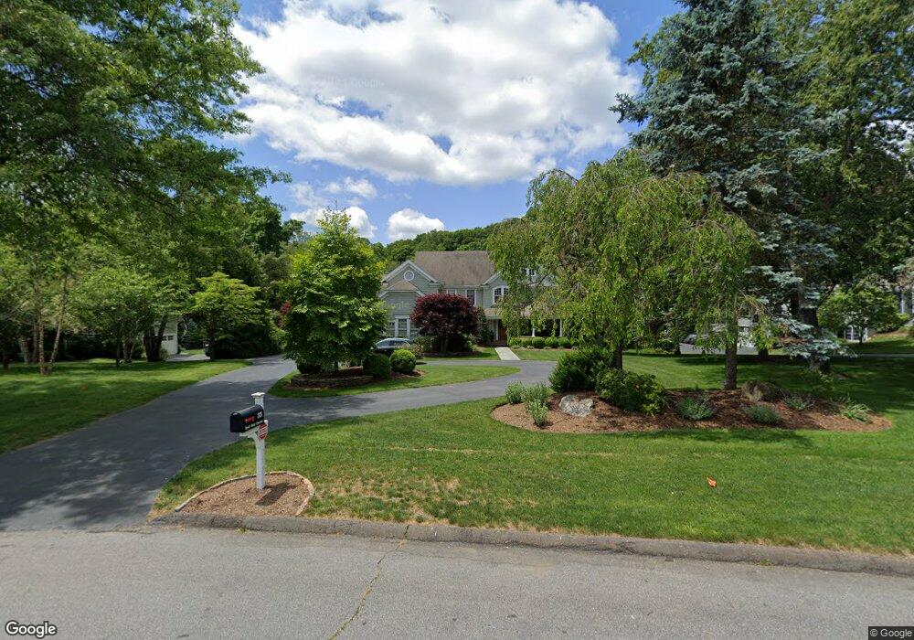
35 Stroll Rock Common Fairfield, CT 06824
Greenfield Hill NeighborhoodEstimated Value: $1,889,043 - $2,195,000
4
Beds
5
Baths
3,933
Sq Ft
$514/Sq Ft
Est. Value
About This Home
This home is located at 35 Stroll Rock Common, Fairfield, CT 06824 and is currently estimated at $2,021,261, approximately $513 per square foot. 35 Stroll Rock Common is a home located in Fairfield County with nearby schools including Burr Elementary School, Tomlinson Middle School, and Fairfield Warde High School.
Ownership History
Date
Name
Owned For
Owner Type
Purchase Details
Closed on
Jan 5, 1999
Sold by
Tenay Ronald K
Bought by
Scheetz Robert W and Scheetz Stephanie G
Current Estimated Value
Home Financials for this Owner
Home Financials are based on the most recent Mortgage that was taken out on this home.
Original Mortgage
$625,000
Interest Rate
6.84%
Create a Home Valuation Report for This Property
The Home Valuation Report is an in-depth analysis detailing your home's value as well as a comparison with similar homes in the area
Home Values in the Area
Average Home Value in this Area
Purchase History
We collect this data history from publicly available records. To have your information removed, we recommend requesting removal directly through your county’s website.
| Date | Buyer | Sale Price | Title Company |
|---|---|---|---|
| Scheetz Robert W | $879,900 | -- | |
| Scheetz Robert W | $879,900 | -- |
Source: Public Records
Mortgage History
We collect this data history from publicly available records. To have your information removed, we recommend requesting removal directly through your county’s website.
| Date | Status | Borrower | Loan Amount |
|---|---|---|---|
| Closed | Scheetz Robert W | $417,000 | |
| Closed | Scheetz Robert W | $83,000 | |
| Closed | Scheetz Robert W | $625,000 |
Source: Public Records
Tax History
| Year | Tax Paid | Tax Assessment Tax Assessment Total Assessment is a certain percentage of the fair market value that is determined by local assessors to be the total taxable value of land and additions on the property. | Land | Improvement |
|---|---|---|---|---|
| 2025 | $23,353 | $822,570 | $250,320 | $572,250 |
| 2024 | $22,950 | $822,570 | $250,320 | $572,250 |
| 2023 | $22,629 | $822,570 | $250,320 | $572,250 |
| 2022 | $22,407 | $822,570 | $250,320 | $572,250 |
| 2021 | $22,193 | $822,570 | $250,320 | $572,250 |
| 2020 | $22,676 | $846,440 | $217,140 | $629,300 |
| 2019 | $22,676 | $846,440 | $217,140 | $629,300 |
| 2018 | $22,312 | $846,440 | $217,140 | $629,300 |
| 2017 | $21,855 | $846,440 | $217,140 | $629,300 |
| 2016 | $21,542 | $846,440 | $217,140 | $629,300 |
| 2015 | $21,455 | $865,480 | $244,020 | $621,460 |
| 2014 | $21,118 | $865,480 | $244,020 | $621,460 |
Source: Public Records
Map
Nearby Homes
- 145 Galloping Hill Rd
- 757 Galloping Hill Rd
- 475 Springer Rd
- 750 Burr St
- 260 Pansy Rd
- 210 Pansy Rd
- 1090 Galloping Hill Rd
- 112 Calico Ln
- 251 Shelter Rock Rd
- 40 Hill Brook Ln
- 2465 Mill Plain Rd
- 692 Stillson Rd
- 1185 Stillson Rd
- 130 Stillson Rd
- 706 Judd St
- 200 Joan Dr
- 10 Millspaugh Dr
- 2032 N Benson Rd
- 70 Allen Rd
- 65 Tahmore Place
- 15 Stroll Rock Common
- 55 Stroll Rock Common
- 408 Mountain Laurel Rd
- 542 Mountain Laurel Rd
- 436 Mountain Laurel Rd
- 50 Stroll Rock Common
- 65 Stroll Rock Common
- 380 Mountain Laurel Rd
- 100 Stroll Rock Common
- 480 Mountain Laurel Rd
- 12 Stroll Rock Common
- 431 Mountain Laurel Rd
- 409 Mountain Laurel Rd
- 352 Mountain Laurel Rd
- 85 Stroll Rock Common
- 105 Stroll Rock Common
- 363 Mountain Laurel Rd
- 455 Mountain Laurel Rd
- 320 Mountain Laurel Rd
- 335 Mountain Laurel Rd
Your Personal Tour Guide
Ask me questions while you tour the home.