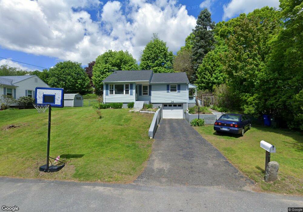
35 Stumpf Ave Thomaston, CT 06787
Estimated Value: $258,758 - $310,000
2
Beds
1
Bath
942
Sq Ft
$303/Sq Ft
Est. Value
About This Home
This home is located at 35 Stumpf Ave, Thomaston, CT 06787 and is currently estimated at $285,190, approximately $302 per square foot. 35 Stumpf Ave is a home located in Litchfield County with nearby schools including Black Rock School, Thomaston Center School, and Thomaston High School.
Ownership History
Date
Name
Owned For
Owner Type
Purchase Details
Closed on
Apr 1, 2004
Sold by
Nelson Kristofer
Bought by
Canfield Annette and Canfield Daniel
Current Estimated Value
Home Financials for this Owner
Home Financials are based on the most recent Mortgage that was taken out on this home.
Original Mortgage
$154,850
Outstanding Balance
$70,780
Interest Rate
5.25%
Estimated Equity
$214,410
Purchase Details
Closed on
Sep 17, 1990
Sold by
Sage Jay
Bought by
Nelson Kristopher A
Home Financials for this Owner
Home Financials are based on the most recent Mortgage that was taken out on this home.
Original Mortgage
$114,600
Interest Rate
9.76%
Create a Home Valuation Report for This Property
The Home Valuation Report is an in-depth analysis detailing your home's value as well as a comparison with similar homes in the area
Home Values in the Area
Average Home Value in this Area
Purchase History
| Date | Buyer | Sale Price | Title Company |
|---|---|---|---|
| Canfield Annette | $163,000 | -- | |
| Nelson Kristopher A | $128,000 | -- |
Source: Public Records
Mortgage History
| Date | Status | Borrower | Loan Amount |
|---|---|---|---|
| Open | Nelson Kristopher A | $154,850 | |
| Previous Owner | Nelson Kristopher A | $89,400 | |
| Previous Owner | Nelson Kristopher A | $114,600 |
Source: Public Records
Tax History Compared to Growth
Tax History
| Year | Tax Paid | Tax Assessment Tax Assessment Total Assessment is a certain percentage of the fair market value that is determined by local assessors to be the total taxable value of land and additions on the property. | Land | Improvement |
|---|---|---|---|---|
| 2025 | $4,016 | $112,140 | $43,750 | $68,390 |
| 2024 | $3,853 | $112,140 | $43,750 | $68,390 |
| 2023 | $3,771 | $112,140 | $43,750 | $68,390 |
| 2022 | $3,551 | $110,600 | $43,750 | $66,850 |
| 2021 | $3,564 | $98,630 | $43,750 | $54,880 |
| 2020 | $3,564 | $98,630 | $43,750 | $54,880 |
| 2019 | $3,603 | $98,630 | $43,750 | $54,880 |
| 2018 | $3,530 | $98,630 | $43,750 | $54,880 |
| 2017 | $3,457 | $98,630 | $43,750 | $54,880 |
| 2016 | $3,391 | $99,540 | $41,650 | $57,890 |
| 2015 | $3,348 | $99,540 | $41,650 | $57,890 |
| 2014 | $3,348 | $99,540 | $41,650 | $57,890 |
Source: Public Records
Map
Nearby Homes
- 43 Pine Hill Rd
- 34 Warner Ln
- 197 Pine Hill Rd Unit 2D
- 143 Pine Hill Rd Unit 15F
- 212 Branch Rd
- 203 Branch Rd Unit 5C
- 60 Cedar Mountain Rd
- 147 Cedar Mountain Rd
- 49 Center St
- 42 Litchfield St
- 96 Elm St
- 174 Litchfield St
- 22 Park St
- 496 Northfield Rd
- 104 Judson St
- 16 Tracy St
- 17 George St
- 56 Hillside Ave
- 297 Babbitt Rd
- 785 Main St
- 31 Stumpf Ave
- 41 Stumpf Ave
- 119 Watertown Rd
- 25 Stumpf Ave
- 49 Stumpf Ave
- 36 Stumpf Ave
- 105 Watertown Rd
- 32 Stumpf Ave
- 127 Watertown Rd
- 42 Stumpf Ave
- 21 Stumpf Ave
- 50 Stumpf Ave
- 97 Watertown Rd
- 57 Stumpf Ave
- 139 Watertown Rd
- 102 Pine Hill Rd
- 110 Pine Hill Rd
- 98 Pine Hill Rd
- 91 Watertown Rd
- 56 Stumpf Ave