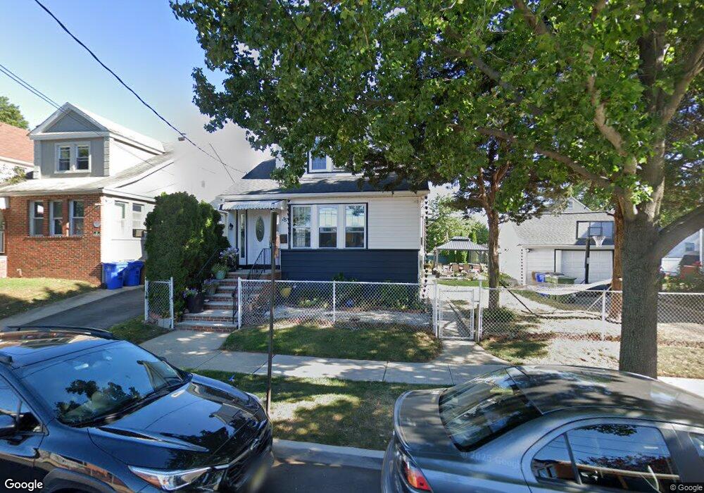
35 W 18th St Linden, NJ 07036
Estimated Value: $433,000 - $635,000
--
Bed
--
Bath
1,298
Sq Ft
$399/Sq Ft
Est. Value
About This Home
This home is located at 35 W 18th St, Linden, NJ 07036 and is currently estimated at $518,449, approximately $399 per square foot. 35 W 18th St is a home located in Union County with nearby schools including School No. 2, Myles J. McManus Middle School, and Linden High School.
Ownership History
Date
Name
Owned For
Owner Type
Purchase Details
Closed on
May 29, 2008
Sold by
Corona Hiris C and Hernandez Marco A
Bought by
Corona Hiris C and Hernandez Marco A
Current Estimated Value
Home Financials for this Owner
Home Financials are based on the most recent Mortgage that was taken out on this home.
Original Mortgage
$413,511
Outstanding Balance
$266,161
Interest Rate
6.11%
Mortgage Type
New Conventional
Estimated Equity
$252,288
Purchase Details
Closed on
Mar 28, 2007
Sold by
Zayas Magdalena
Bought by
Corona Hiris C and Hernandez Marco A
Home Financials for this Owner
Home Financials are based on the most recent Mortgage that was taken out on this home.
Original Mortgage
$396,500
Interest Rate
6.25%
Mortgage Type
Purchase Money Mortgage
Purchase Details
Closed on
Dec 8, 2004
Sold by
Liriano Yony
Bought by
Zayas Magdalena
Home Financials for this Owner
Home Financials are based on the most recent Mortgage that was taken out on this home.
Original Mortgage
$337,350
Interest Rate
5.63%
Create a Home Valuation Report for This Property
The Home Valuation Report is an in-depth analysis detailing your home's value as well as a comparison with similar homes in the area
Home Values in the Area
Average Home Value in this Area
Purchase History
| Date | Buyer | Sale Price | Title Company |
|---|---|---|---|
| Corona Hiris C | -- | Ats Title Agency Inc | |
| Corona Hiris C | $396,550 | Old Republic National Title | |
| Zayas Magdalena | $349,900 | -- |
Source: Public Records
Mortgage History
| Date | Status | Borrower | Loan Amount |
|---|---|---|---|
| Open | Corona Hiris C | $413,511 | |
| Closed | Corona Hiris C | $396,500 | |
| Previous Owner | Zayas Magdalena | $337,350 |
Source: Public Records
Tax History Compared to Growth
Tax History
| Year | Tax Paid | Tax Assessment Tax Assessment Total Assessment is a certain percentage of the fair market value that is determined by local assessors to be the total taxable value of land and additions on the property. | Land | Improvement |
|---|---|---|---|---|
| 2025 | $8,649 | $123,000 | $50,200 | $72,800 |
| 2024 | $8,460 | $123,000 | $50,200 | $72,800 |
| 2023 | $8,460 | $123,000 | $50,200 | $72,800 |
| 2022 | $8,504 | $123,000 | $50,200 | $72,800 |
| 2021 | $8,547 | $123,000 | $50,200 | $72,800 |
| 2020 | $8,502 | $123,000 | $50,200 | $72,800 |
| 2019 | $8,473 | $123,000 | $50,200 | $72,800 |
| 2018 | $8,471 | $123,000 | $50,200 | $72,800 |
| 2017 | $8,288 | $123,000 | $50,200 | $72,800 |
| 2016 | $8,027 | $123,000 | $50,200 | $72,800 |
| 2015 | $7,721 | $123,000 | $50,200 | $72,800 |
| 2014 | $7,571 | $123,000 | $50,200 | $72,800 |
Source: Public Records
Map
Nearby Homes
- 108 W 18th St
- 1713 S Wood Ave Unit 2
- 116 W 17th St
- 1519 Winans Ave
- 321 W 15th St Unit 1
- 111 E 13th St
- 20 W 10th St
- 111 E 10th St
- 2617 Grasselli Ave
- 210 Buchanan St
- 221 Madison St
- 2604 Parkway Ave Unit 2
- 118 Union Ave Unit 2
- 14 Arlington Place
- 317 Mitchell Ave
- 3202 Tremley Point Rd
- 214 Irene St
- 221 Jefferson Ave
- 212 W Morris Ave
- 226 Pennsylvania Railroad Ave