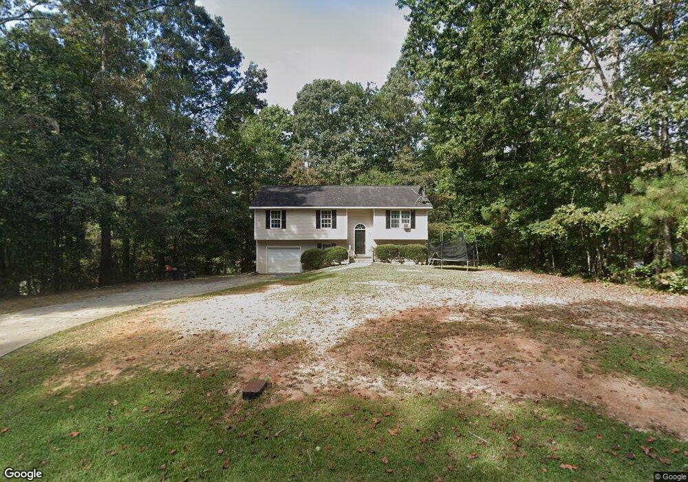
35 W Eli Dr Carrollton, GA 30117
Estimated Value: $235,000 - $259,000
3
Beds
3
Baths
1,200
Sq Ft
$209/Sq Ft
Est. Value
About This Home
This home is located at 35 W Eli Dr, Carrollton, GA 30117 and is currently estimated at $250,502, approximately $208 per square foot. 35 W Eli Dr is a home located in Carroll County with nearby schools including Mt. Zion Elementary School, Mt. Zion Middle School, and Mt. Zion High School.
Ownership History
Date
Name
Owned For
Owner Type
Purchase Details
Closed on
Jul 29, 2011
Sold by
Sfr 2010 2 Reo Corp
Bought by
Mcintosh Properties Llc
Current Estimated Value
Purchase Details
Closed on
Jul 27, 2011
Sold by
2 Sfr Venture
Bought by
Sfr 2010 2 Reo Corp
Purchase Details
Closed on
Feb 1, 2011
Sold by
2 Sfr Venture
Bought by
2010 & 2 Sfr Venture
Purchase Details
Closed on
Jun 24, 2003
Sold by
Hunter Ethel Etal
Bought by
Atlanta Contracting Inc
Purchase Details
Closed on
Jul 21, 1975
Bought by
Hunter
Create a Home Valuation Report for This Property
The Home Valuation Report is an in-depth analysis detailing your home's value as well as a comparison with similar homes in the area
Home Values in the Area
Average Home Value in this Area
Purchase History
| Date | Buyer | Sale Price | Title Company |
|---|---|---|---|
| Mcintosh Properties Llc | $21,000 | -- | |
| Sfr 2010 2 Reo Corp | -- | -- | |
| 2010 & 2 Sfr Venture | $69,000 | -- | |
| Atlanta Contracting Inc | $6,500 | -- | |
| Hunter | -- | -- |
Source: Public Records
Tax History
| Year | Tax Paid | Tax Assessment Tax Assessment Total Assessment is a certain percentage of the fair market value that is determined by local assessors to be the total taxable value of land and additions on the property. | Land | Improvement |
|---|---|---|---|---|
| 2025 | $2,189 | $97,875 | $7,552 | $90,323 |
| 2024 | $1,366 | $60,378 | $1,131 | $59,247 |
| 2023 | $1,366 | $60,379 | $1,132 | $59,247 |
| 2022 | $1,712 | $68,258 | $2,292 | $65,966 |
| 2021 | $1,030 | $40,192 | $1,069 | $39,123 |
| 2020 | $1,032 | $40,192 | $1,069 | $39,123 |
| 2019 | $1,236 | $47,776 | $1,666 | $46,110 |
| 2018 | $599 | $22,800 | $700 | $22,100 |
| 2017 | $601 | $22,800 | $700 | $22,100 |
| 2016 | $919 | $41,028 | $1,260 | $39,768 |
| 2015 | $464 | $16,600 | $3,200 | $13,400 |
| 2014 | $466 | $16,600 | $3,200 | $13,400 |
Source: Public Records
Map
Nearby Homes
- 676 Hog Liver Rd
- 00 Hog Liver Rd Unit 346
- 0 Hog Liver Rd Unit 148331
- 0 Hog Liver Rd Unit 10630257
- 0 Hog Liver Rd Unit 7671087
- 0 Hog Liver Rd Unit 10614601
- 0 Hog Liver Rd Unit 10630818
- 0 W Mandeville Rd Unit 10707210
- 0 W Mandeville Rd Unit 7732471
- 266 Lambert Overlook Cir
- 350 Lambert Overlook Cir
- 620 Smyrna Church Rd
- 0 Bethlehem Church Rd Unit 7719552
- 0 Bethlehem Church Rd Unit 10691788
- 0 Hwy 27 N
- 125 Bethlehem Church Rd
- 174 Katie Ln
- 217 Little River Rd
- 229 Little River Rd
- 898 Bowdon Junction Rd
Your Personal Tour Guide
Ask me questions while you tour the home.