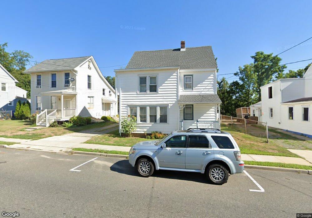
35 W Main St Wrightstown, NJ 08562
Estimated Value: $178,000 - $311,000
Studio
--
Bath
1,462
Sq Ft
$162/Sq Ft
Est. Value
About This Home
This home is located at 35 W Main St, Wrightstown, NJ 08562 and is currently estimated at $236,201, approximately $161 per square foot. 35 W Main St is a home located in Burlington County with nearby schools including New Hanover Township School.
Ownership History
Date
Name
Owned For
Owner Type
Purchase Details
Closed on
Apr 10, 2023
Sold by
Legacies Unlimited Llc
Bought by
Lennon Shirley
Current Estimated Value
Home Financials for this Owner
Home Financials are based on the most recent Mortgage that was taken out on this home.
Original Mortgage
$120,000
Interest Rate
6.71%
Mortgage Type
New Conventional
Purchase Details
Closed on
Feb 10, 2021
Sold by
Lennon Shirley Ann
Bought by
Legacies Unlimited Llc
Purchase Details
Closed on
May 8, 2002
Sold by
Mundell Robert J and Mundell Elizabeth A
Bought by
Lennon Shirley Ann
Home Financials for this Owner
Home Financials are based on the most recent Mortgage that was taken out on this home.
Original Mortgage
$63,000
Interest Rate
7.01%
Create a Home Valuation Report for This Property
The Home Valuation Report is an in-depth analysis detailing your home's value as well as a comparison with similar homes in the area
Home Values in the Area
Average Home Value in this Area
Purchase History
| Date | Buyer | Sale Price | Title Company |
|---|---|---|---|
| Lennon Shirley | -- | None Listed On Document | |
| Lennon Shirley | -- | None Listed On Document | |
| Legacies Unlimited Llc | -- | Congress Title | |
| Legacies Unlimited Llc | -- | None Listed On Document | |
| Lennon Shirley Ann | $70,000 | Congress Title Corp |
Source: Public Records
Mortgage History
| Date | Status | Borrower | Loan Amount |
|---|---|---|---|
| Previous Owner | Lennon Shirley | $120,000 | |
| Previous Owner | Lennon Shirley Ann | $63,000 |
Source: Public Records
Tax History
| Year | Tax Paid | Tax Assessment Tax Assessment Total Assessment is a certain percentage of the fair market value that is determined by local assessors to be the total taxable value of land and additions on the property. | Land | Improvement |
|---|---|---|---|---|
| 2025 | $3,649 | $99,800 | $15,000 | $84,800 |
| 2024 | $3,277 | $99,800 | $15,000 | $84,800 |
| 2023 | $3,277 | $99,800 | $15,000 | $84,800 |
| 2022 | $2,992 | $99,800 | $15,000 | $84,800 |
| 2021 | $2,901 | $99,800 | $15,000 | $84,800 |
| 2020 | $2,937 | $99,800 | $15,000 | $84,800 |
| 2019 | $2,907 | $99,800 | $15,000 | $84,800 |
| 2018 | $2,772 | $99,800 | $15,000 | $84,800 |
| 2017 | $2,488 | $99,800 | $15,000 | $84,800 |
| 2016 | $3,004 | $80,150 | $10,100 | $70,050 |
| 2015 | $2,945 | $80,150 | $10,100 | $70,050 |
| 2014 | $3,152 | $80,150 | $10,100 | $70,050 |
Source: Public Records
Map
Nearby Homes
- 45 W Main St
- 511 25 Wrightstown Sykesville Rd Unit 25
- 511 Sykesville Rd Unit 116
- 1 Mcguire St
- 511 Wrightstown Sykesville Rd Unit 89
- 511 Wrightstown Sykesville Rd Unit 116
- 511 Wrightstown Sykesville Rd Unit 16
- 464 Wrightstown Sykesville Rd
- 701 Monmouth Rd
- 697 Monmouth Rd
- 2795 Monmouth Rd
- 2717 Monmouth Rd
- 2707 Monmouth Rd
- 347 Jacobstown Cookstown Rd
- 410 Lewistown Rd
- 384 Juliustown Rd
- 83 Chesterfield Jacobstown Rd
- 2551 Saylors Pond Rd
- 20 Bunting Bridge Rd
- 282 Chesterfield Jacobstown Rd
Your Personal Tour Guide
Ask me questions while you tour the home.