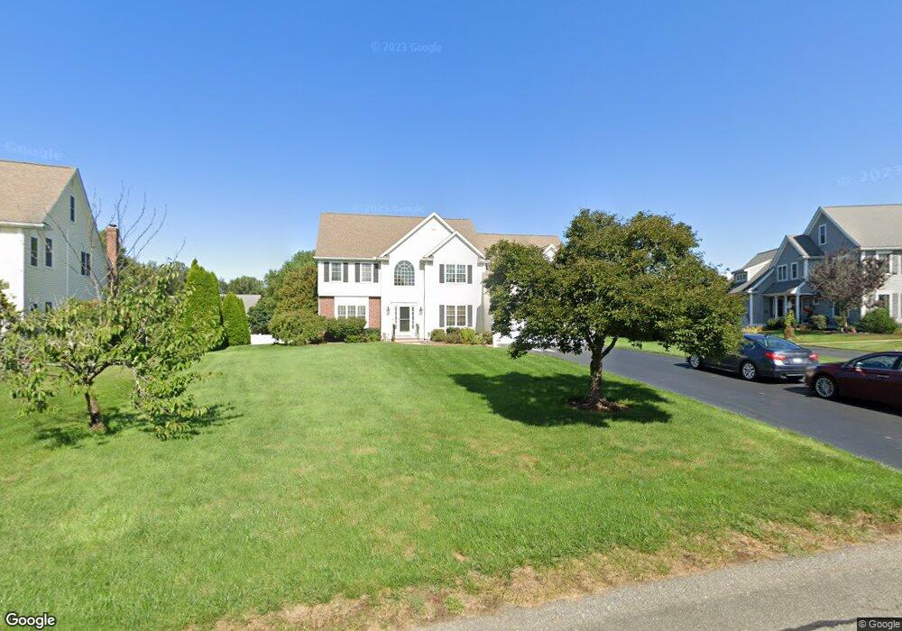
35 Weetamoo Way Wrentham, MA 02093
Estimated Value: $1,163,000 - $1,266,000
4
Beds
3
Baths
3,614
Sq Ft
$333/Sq Ft
Est. Value
About This Home
This home is located at 35 Weetamoo Way, Wrentham, MA 02093 and is currently estimated at $1,201,670, approximately $332 per square foot. 35 Weetamoo Way is a home located in Norfolk County with nearby schools including Delaney Elementary School and Charles E Roderick.
Ownership History
Date
Name
Owned For
Owner Type
Purchase Details
Closed on
Sep 30, 2004
Sold by
Diplacido Dev Corp
Bought by
Degidio David M and Degidio Lynn C
Current Estimated Value
Home Financials for this Owner
Home Financials are based on the most recent Mortgage that was taken out on this home.
Original Mortgage
$465,000
Outstanding Balance
$227,674
Interest Rate
5.81%
Mortgage Type
Purchase Money Mortgage
Estimated Equity
$973,996
Create a Home Valuation Report for This Property
The Home Valuation Report is an in-depth analysis detailing your home's value as well as a comparison with similar homes in the area
Home Values in the Area
Average Home Value in this Area
Purchase History
| Date | Buyer | Sale Price | Title Company |
|---|---|---|---|
| Degidio David M | $645,000 | -- |
Source: Public Records
Mortgage History
| Date | Status | Borrower | Loan Amount |
|---|---|---|---|
| Open | Degidio David M | $465,000 |
Source: Public Records
Tax History Compared to Growth
Tax History
| Year | Tax Paid | Tax Assessment Tax Assessment Total Assessment is a certain percentage of the fair market value that is determined by local assessors to be the total taxable value of land and additions on the property. | Land | Improvement |
|---|---|---|---|---|
| 2025 | $11,683 | $1,008,000 | $317,400 | $690,600 |
| 2024 | $11,075 | $922,900 | $317,400 | $605,500 |
| 2023 | $10,950 | $867,700 | $288,500 | $579,200 |
| 2022 | $10,391 | $760,100 | $262,300 | $497,800 |
| 2021 | $10,121 | $719,300 | $262,300 | $457,000 |
| 2020 | $10,313 | $723,700 | $215,600 | $508,100 |
| 2019 | $9,885 | $700,100 | $215,600 | $484,500 |
| 2018 | $9,246 | $649,300 | $215,900 | $433,400 |
| 2017 | $8,952 | $628,200 | $211,700 | $416,500 |
| 2016 | $8,835 | $618,700 | $205,600 | $413,100 |
| 2015 | $9,022 | $602,300 | $197,700 | $404,600 |
| 2014 | $8,936 | $583,700 | $190,100 | $393,600 |
Source: Public Records
Map
Nearby Homes
- Lot 1 - Blueberry 2 Car Plan at King Philip Estates
- Lot 8 - Blueberry 2 Car Plan at King Philip Estates
- Lot 5 - Hughes 2 car Plan at King Philip Estates
- Lot 6 - Blueberry 3 Car Plan at King Philip Estates
- Lot 2 - Camden 2 Car Plan at King Philip Estates
- Lot 7 - Cedar Plan at King Philip Estates
- Lot 4 - Hemingway 2 Car Plan at King Philip Estates
- 14 Earle Stewart Ln
- Lot 3 - Blueberry 2 Car Plan at King Philip Estates
- 11 Earle Stewart Ln
- 131 Creek St Unit 7
- 791 South St Unit 5
- 570 Franklin St
- 500 Franklin St
- 10 Nature View Dr
- 15 Nature View Dr
- 440 Chestnut St
- 80 Carriage House Ln
- 1222 South St
- 155 Clark Rd Unit 155
- 25 Weetamoo Way
- 45 Weetamoo Way
- 50 Pokanoket Path
- 60 Pokanoket Path
- 15 Weetamoo Way
- 55 Weetamoo Way
- 30 Weetamoo Way
- 70 Pokanoket Path
- 65 Weetamoo Way
- 40 Weetamoo Way
- 30 Pokanoket Path
- 40 Pokanoket Path
- 20 Weetamoo Way
- 120 Riverside Dr
- 75 Weetamoo Way
- 50 Weetamoo Way
- 124 Riverside Dr
- 135 Annawon Ave
- 125 Annawon Ave
- 10 Weetamoo Way