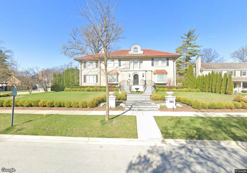
350 Blackstone Ave La Grange, IL 60525
Estimated Value: $1,731,000 - $1,911,000
4
Beds
4
Baths
4,003
Sq Ft
$448/Sq Ft
Est. Value
About This Home
This home is located at 350 Blackstone Ave, La Grange, IL 60525 and is currently estimated at $1,794,814, approximately $448 per square foot. 350 Blackstone Ave is a home located in Cook County with nearby schools including Cossitt Avenue Elementary School, Park Junior High School, and Lyons Township High School.
Ownership History
Date
Name
Owned For
Owner Type
Purchase Details
Closed on
Sep 12, 2023
Sold by
Mcmahon James P
Bought by
James P Mcmahon Trust and Mcmahon
Current Estimated Value
Purchase Details
Closed on
Jun 14, 2012
Sold by
Rudolph Ralph and Rudolph Amy
Bought by
Mcmahon James P
Home Financials for this Owner
Home Financials are based on the most recent Mortgage that was taken out on this home.
Original Mortgage
$750,000
Interest Rate
3.87%
Mortgage Type
Unknown
Purchase Details
Closed on
Feb 8, 2006
Sold by
Chicago Title Land Trust Co
Bought by
Rudolph Ralph and Rudolph Amy
Home Financials for this Owner
Home Financials are based on the most recent Mortgage that was taken out on this home.
Original Mortgage
$1,000,000
Interest Rate
6.2%
Mortgage Type
Fannie Mae Freddie Mac
Create a Home Valuation Report for This Property
The Home Valuation Report is an in-depth analysis detailing your home's value as well as a comparison with similar homes in the area
Home Values in the Area
Average Home Value in this Area
Purchase History
| Date | Buyer | Sale Price | Title Company |
|---|---|---|---|
| James P Mcmahon Trust | -- | First American Title | |
| Mcmahon James P | $1,420,000 | Premier Title | |
| Rudolph Ralph | $1,511,000 | Rtc |
Source: Public Records
Mortgage History
| Date | Status | Borrower | Loan Amount |
|---|---|---|---|
| Previous Owner | Mcmahon James P | $750,000 | |
| Previous Owner | Rudolph Ralph | $1,000,000 |
Source: Public Records
Tax History Compared to Growth
Tax History
| Year | Tax Paid | Tax Assessment Tax Assessment Total Assessment is a certain percentage of the fair market value that is determined by local assessors to be the total taxable value of land and additions on the property. | Land | Improvement |
|---|---|---|---|---|
| 2024 | $29,907 | $130,022 | $21,600 | $108,422 |
| 2023 | $24,564 | $123,877 | $21,600 | $102,277 |
| 2022 | $24,564 | $87,078 | $16,200 | $70,878 |
| 2021 | $23,620 | $87,077 | $16,200 | $70,877 |
| 2020 | $23,181 | $87,077 | $16,200 | $70,877 |
| 2019 | $27,436 | $102,876 | $14,850 | $88,026 |
| 2018 | $26,911 | $102,876 | $14,850 | $88,026 |
| 2017 | $26,216 | $102,876 | $14,850 | $88,026 |
| 2016 | $26,982 | $94,711 | $13,050 | $81,661 |
| 2015 | $25,188 | $94,711 | $13,050 | $81,661 |
| 2014 | $26,529 | $101,116 | $13,050 | $88,066 |
| 2013 | $22,018 | $83,343 | $13,050 | $70,293 |
Source: Public Records
Map
Nearby Homes
- 500 S Edgewood Ave
- 509 S Brainard Ave
- 416 Leitch Ave
- 519 Banyon Ln Unit A
- 405 S Gilbert Ave
- 413 S Kensington Ave
- 518 W Cossitt Ave
- 115 S Spring Ave
- 1105 W Hillgrove Ave Unit 4
- 334 S Ashland Ave
- 27 S Waiola Ave Unit 103
- 524 S Ashland Ave
- 4537 Clausen Ave
- 208 47th St
- 17-19 N Brainard Ave
- 48 N Park Rd
- 430 S La Grange Rd
- 715 S Catherine Ave
- 4443 Howard Ave
- 617 S Madison Ave
- 340 Blackstone Ave
- 347 Sunset Ave
- 400 S Blackstone Ave
- 347 S Sunset Ave
- 400 Blackstone Ave
- 337 Sunset Ave
- 330 Blackstone Ave
- 347 Blackstone Ave
- 401 Sunset Ave
- 337 Blackstone Ave
- 333 Sunset Ave
- 410 Blackstone Ave
- 401 S Sunset Ave
- 405 Blackstone Ave
- 331 Blackstone Ave
- 405 Sunset Ave
- 322 Blackstone Ave
- 411 Blackstone Ave
- 321 Sunset Ave
- 420 Blackstone Ave