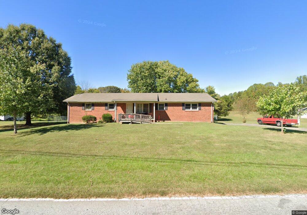
350 Jarrett Rd Thomasville, NC 27360
Estimated Value: $227,000 - $291,427
3
Beds
2
Baths
3,695
Sq Ft
$70/Sq Ft
Est. Value
About This Home
This home is located at 350 Jarrett Rd, Thomasville, NC 27360 and is currently estimated at $257,107, approximately $69 per square foot. 350 Jarrett Rd is a home located in Davidson County with nearby schools including Fair Grove Elementary School, E. Lawson Brown Middle School, and East Davidson High School.
Ownership History
Date
Name
Owned For
Owner Type
Purchase Details
Closed on
Oct 27, 2021
Sold by
Alford Garland Bryce and Alford Selena C
Bought by
Goins Harold Dean and Goins Brenda
Current Estimated Value
Purchase Details
Closed on
Aug 8, 2014
Sold by
Alford Garland Bryce and Alford Selena C
Bought by
Alford Garland Bryce and Alford Selena C
Home Financials for this Owner
Home Financials are based on the most recent Mortgage that was taken out on this home.
Original Mortgage
$60,000
Interest Rate
4.2%
Mortgage Type
New Conventional
Purchase Details
Closed on
Sep 30, 2005
Sold by
Alford Bernice F
Bought by
Alford Bryce and Goins Brenda
Purchase Details
Closed on
Jan 3, 2002
Sold by
Alford Bryce Et Als
Bought by
Alford Bernice F
Purchase Details
Closed on
Dec 21, 2001
Sold by
Alford Bernice F
Bought by
Alford Bryce Et Als
Purchase Details
Closed on
Jan 1, 1996
Create a Home Valuation Report for This Property
The Home Valuation Report is an in-depth analysis detailing your home's value as well as a comparison with similar homes in the area
Home Values in the Area
Average Home Value in this Area
Purchase History
| Date | Buyer | Sale Price | Title Company |
|---|---|---|---|
| Goins Harold Dean | -- | None Available | |
| Alford Garland Bryce | $88,000 | None Available | |
| Alford Bryce | -- | Chicago Title Insurance Co | |
| Alford Bernice F | -- | -- | |
| Alford Bryce Et Als | -- | -- | |
| -- | -- | -- |
Source: Public Records
Mortgage History
| Date | Status | Borrower | Loan Amount |
|---|---|---|---|
| Previous Owner | Alford Garland Bryce | $60,000 |
Source: Public Records
Tax History Compared to Growth
Tax History
| Year | Tax Paid | Tax Assessment Tax Assessment Total Assessment is a certain percentage of the fair market value that is determined by local assessors to be the total taxable value of land and additions on the property. | Land | Improvement |
|---|---|---|---|---|
| 2025 | $1,650 | $144,450 | $0 | $0 |
| 2024 | $1,590 | $139,130 | $0 | $0 |
| 2023 | $1,614 | $139,130 | $0 | $0 |
| 2022 | $1,590 | $139,130 | $0 | $0 |
| 2021 | $1,630 | $142,680 | $0 | $0 |
| 2020 | $1,483 | $132,030 | $0 | $0 |
| 2019 | $1,505 | $132,030 | $0 | $0 |
| 2018 | $1,505 | $132,030 | $0 | $0 |
| 2017 | $1,505 | $132,030 | $0 | $0 |
| 2016 | $1,452 | $132,030 | $0 | $0 |
| 2015 | $1,452 | $132,030 | $0 | $0 |
| 2014 | $1,856 | $168,710 | $0 | $0 |
Source: Public Records
Map
Nearby Homes
- 109 Fletcher's Farm Dr
- 107 Fletcher's Farm Dr
- 1111 Forest Ln
- 122 S Old Fisher Ferry Rd
- 73 Harris Farm Ct
- 1 Westwood Ave
- 223 S Westwood Ave
- 123 Brooke Ridge Dr
- 106 Kincemac Dr
- 307 Fisher Ferry St
- 1142 Kendall Mill Rd
- 0 Smith Dr
- 300 Willowbrook Dr
- 296 Fairgrove Rd
- 2501 Denton Rd
- 1125 Hillcrest Dr
- 708 Ferndale Dr
- 0 Hillcrest Dr Unit 90 CAR4240649
- 25 Cedar Lodge Rd
- 283 Reid Rd
- 354 Jarrett Rd
- 342 Jarrett Rd
- 356 Jarrett Rd
- 358 Jarrett Rd
- 338 Jarrett Rd
- 360 Jarrett Rd
- 327 Kendall Mill Rd
- 325 Kendall Mill Rd
- 362 Jarrett Rd
- 323 Kendall Mill Rd
- 337 Jarrett Rd
- Lot 11 Jarrett Rd
- 204 John Mills Ln
- 343 Jarrett Rd
- lot 12 Kendall Mill Rd
- lot 11 Kendall Mill Rd
- 335 Jarrett Rd
- 205 John Mills Ln
- 340 Jarrett Rd
- 202 John Mills Ln