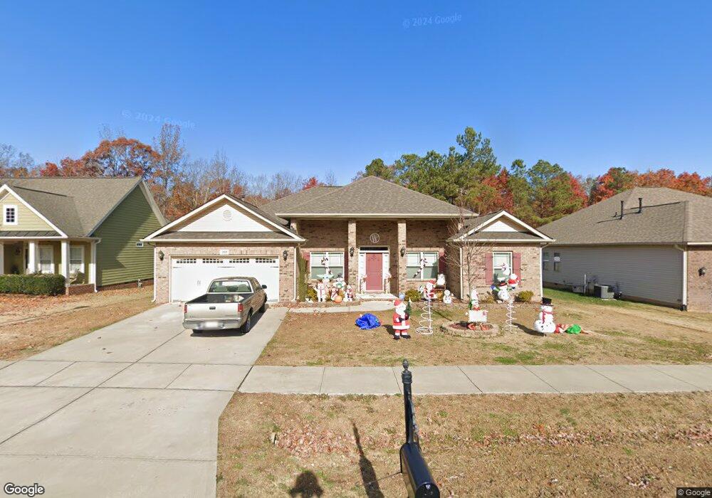
350 Long View Dr Franklinton, NC 27525
Estimated Value: $384,000 - $425,000
4
Beds
2
Baths
2,292
Sq Ft
$178/Sq Ft
Est. Value
About This Home
This home is located at 350 Long View Dr, Franklinton, NC 27525 and is currently estimated at $407,006, approximately $177 per square foot. 350 Long View Dr is a home located in Franklin County with nearby schools including Long Mill Elementary, Franklinton Middle School, and Franklinton High School.
Ownership History
Date
Name
Owned For
Owner Type
Purchase Details
Closed on
Feb 25, 2016
Sold by
Adams Homes Aec Llc
Bought by
Weathers Ronnie and Weathers Kristy
Current Estimated Value
Home Financials for this Owner
Home Financials are based on the most recent Mortgage that was taken out on this home.
Original Mortgage
$218,046
Outstanding Balance
$174,115
Interest Rate
3.92%
Mortgage Type
New Conventional
Estimated Equity
$232,891
Purchase Details
Closed on
Jul 2, 2014
Sold by
Morcorp Investments Llc
Bought by
Adams Homes Aec Llc
Purchase Details
Closed on
Jul 17, 2013
Sold by
W T Barker Construction Company
Bought by
Morcorp Investments Llc
Purchase Details
Closed on
Jul 12, 2013
Sold by
Federal Deposit Insurance Corporation
Bought by
W T Barker Construction Company
Create a Home Valuation Report for This Property
The Home Valuation Report is an in-depth analysis detailing your home's value as well as a comparison with similar homes in the area
Home Values in the Area
Average Home Value in this Area
Purchase History
| Date | Buyer | Sale Price | Title Company |
|---|---|---|---|
| Weathers Ronnie | $212,500 | None Available | |
| Adams Homes Aec Llc | $215,000 | None Available | |
| Morcorp Investments Llc | $274,500 | None Available | |
| W T Barker Construction Company | $240,000 | None Available |
Source: Public Records
Mortgage History
| Date | Status | Borrower | Loan Amount |
|---|---|---|---|
| Open | Weathers Ronnie | $218,046 |
Source: Public Records
Tax History Compared to Growth
Tax History
| Year | Tax Paid | Tax Assessment Tax Assessment Total Assessment is a certain percentage of the fair market value that is determined by local assessors to be the total taxable value of land and additions on the property. | Land | Improvement |
|---|---|---|---|---|
| 2024 | $2,353 | $396,950 | $80,000 | $316,950 |
| 2023 | $2,187 | $240,130 | $43,200 | $196,930 |
| 2022 | $2,153 | $240,130 | $43,200 | $196,930 |
| 2021 | $2,177 | $240,130 | $43,200 | $196,930 |
| 2020 | $2,191 | $240,130 | $43,200 | $196,930 |
| 2019 | $2,163 | $240,130 | $43,200 | $196,930 |
| 2018 | $2,158 | $240,130 | $43,200 | $196,930 |
| 2017 | $1,968 | $196,670 | $25,200 | $171,470 |
| 2016 | $1,489 | $150,800 | $25,200 | $125,600 |
| 2015 | $247 | $25,200 | $25,200 | $0 |
| 2014 | $234 | $25,200 | $25,200 | $0 |
Source: Public Records
Map
Nearby Homes
- 295 Long View Dr
- 120 Sutherland Dr
- 35 Clubhouse Dr
- 30 Waterview Way
- 80 Clubhouse Dr
- 170 Sutherland Dr
- 100 Turnberry Ct
- 235 Ashberry Ln
- 40 Turnberry Ct
- 60 Silent Brook Trail
- 815 Harmony Ranch Ln
- 110 Point View Way
- 20 Turnberry Ct
- 30 Junius Birch Trail
- 140 Hickory Run Ln
- 65 Hickory Run Ln
- 325 Sutherland Dr
- Mayflower III Plan at Sutherland Station - Olde Liberty
- Tryon III Plan at Sutherland Station - Olde Liberty
- Landrum III Plan at Sutherland Station - Olde Liberty
- 350 Long View Dr Unit 228
- 390 Long View Dr
- 390 Long View Dr Unit 224
- 360 Long View Dr
- 340 Long View Dr
- 340 Long View Dr Unit 229
- 370 Long View Dr
- 330 Long View Dr
- 330 Long View Dr Unit 230
- 375 Long View Dr
- 365 Long View Dr
- 385 Long View Dr
- 380 Long View Dr
- 380 Long View Dr Unit 225
- 180 Long View Dr
- 385 Ashberry Ln Unit LOT 00.0045
- 375 Ashberry Ln Unit LOT 00.0044
- 205 Ashberry Ln
- 225 Ashberry Ln
- 215 Ashberry Ln