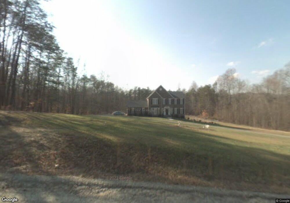
350 Nubbin Ridge Rd Reidsville, NC 27320
Estimated Value: $287,000 - $609,241
4
Beds
3
Baths
2,409
Sq Ft
$185/Sq Ft
Est. Value
About This Home
This home is located at 350 Nubbin Ridge Rd, Reidsville, NC 27320 and is currently estimated at $445,810, approximately $185 per square foot. 350 Nubbin Ridge Rd is a home located in Rockingham County with nearby schools including Bethany Elementary School, Rockingham County Middle School, and Rockingham County High School.
Ownership History
Date
Name
Owned For
Owner Type
Purchase Details
Closed on
Apr 13, 2021
Sold by
Arnold Nathan A and Arnold Michele D
Bought by
Crooked Pine Land & Timber Llc
Current Estimated Value
Purchase Details
Closed on
Apr 4, 2014
Sold by
Brown Melissa W and Brown John Mark
Bought by
Arnold Nathan and Arnold Michele
Home Financials for this Owner
Home Financials are based on the most recent Mortgage that was taken out on this home.
Original Mortgage
$242,250
Interest Rate
4.43%
Mortgage Type
New Conventional
Create a Home Valuation Report for This Property
The Home Valuation Report is an in-depth analysis detailing your home's value as well as a comparison with similar homes in the area
Home Values in the Area
Average Home Value in this Area
Purchase History
| Date | Buyer | Sale Price | Title Company |
|---|---|---|---|
| Crooked Pine Land & Timber Llc | -- | None Available | |
| Arnold Nathan | $255,000 | Chicago Title Insurance Co |
Source: Public Records
Mortgage History
| Date | Status | Borrower | Loan Amount |
|---|---|---|---|
| Previous Owner | Arnold Nathan | $242,250 |
Source: Public Records
Tax History Compared to Growth
Tax History
| Year | Tax Paid | Tax Assessment Tax Assessment Total Assessment is a certain percentage of the fair market value that is determined by local assessors to be the total taxable value of land and additions on the property. | Land | Improvement |
|---|---|---|---|---|
| 2025 | $2,960 | $414,915 | $55,371 | $359,544 |
| 2024 | $2,793 | $414,915 | $55,371 | $359,544 |
| 2023 | $2,793 | $256,928 | $35,236 | $221,692 |
| 2022 | $2,166 | $256,928 | $35,236 | $221,692 |
| 2021 | $2,068 | $256,928 | $35,236 | $221,692 |
| 2020 | $2,076 | $256,928 | $35,236 | $221,692 |
| 2019 | $2,079 | $256,928 | $35,236 | $221,692 |
| 2018 | $2,028 | $247,715 | $40,202 | $207,513 |
| 2017 | $2,037 | $247,715 | $40,202 | $207,513 |
| 2015 | $2,044 | $247,715 | $40,202 | $207,513 |
| 2014 | $1,997 | $247,715 | $40,202 | $207,513 |
Source: Public Records
Map
Nearby Homes
- 64.88 Ac Purcell Rd
- 00 Almond Rd
- 0 Jones Chapel Rd
- 2041 Sandy Cross Rd
- 1731 Sandy Cross Rd
- 4830 Nc Highway 65
- 387 Vernon Rd
- Parcel C Iron Works Rd
- 309 Vernon Rd
- 00 Rock Spring Dr
- 898 Sandy Cross Rd
- 0 Boyd Rd
- 744 Monroeton Rd
- 214 Lake Hunt Dr
- 3447 Country Ln
- 3437 Country Ln
- 00 Massey Creek Rd
- 171 Roberson Ln
- 00 Roberson Ln
- 135 Roberson Ln
- 323 Nubbin Ridge Rd
- 301 Buckhorn Trail
- 193 Nubbin Ridge Rd
- 245 Buckhorn Trail
- 291 Buckhorn Trail
- 551 Nubbin Ridge Rd
- 1331 Purcell Rd
- 601 Nubbin Ridge Rd
- 833 Purcell Rd
- 464 Purcell Rd
- 0 Purcell Rd
- 1324 Purcell Rd
- 361 Jones Chapel Rd
- 320 Jones Chapel Rd
- 743 Almond Rd
- 1344 Purcell Rd
- 310 Jones Chapel Rd
- 779 Almond Rd
- 799 Almond Rd
- 329 Jones Chapel Rd