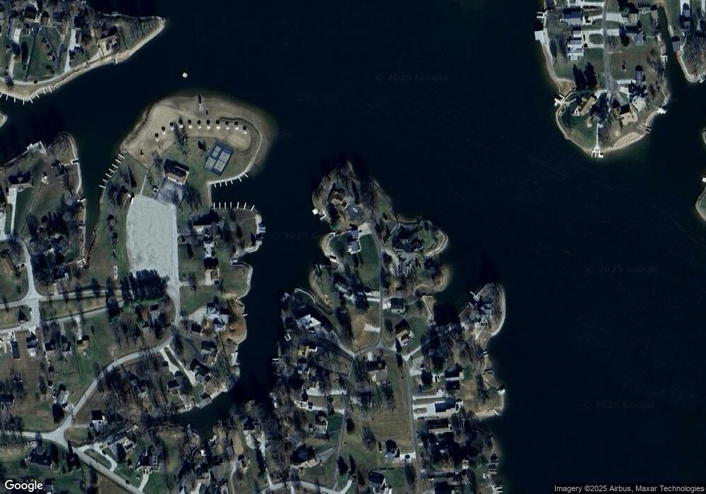
350 SW Shoshone Trail Greensburg, IN 47240
Estimated Value: $284,000 - $455,000
3
Beds
1
Bath
960
Sq Ft
$367/Sq Ft
Est. Value
About This Home
This home is located at 350 SW Shoshone Trail, Greensburg, IN 47240 and is currently estimated at $352,230, approximately $366 per square foot. 350 SW Shoshone Trail is a home located in Decatur County with nearby schools including North Decatur Elementary School and North Decatur Junior/Senior High School.
Ownership History
Date
Name
Owned For
Owner Type
Purchase Details
Closed on
Jun 23, 2022
Sold by
Boyer Phyllis J
Bought by
Manlick Michael John and Manlick Kimberly Rae
Current Estimated Value
Home Financials for this Owner
Home Financials are based on the most recent Mortgage that was taken out on this home.
Original Mortgage
$340,000
Outstanding Balance
$323,028
Interest Rate
5.1%
Mortgage Type
New Conventional
Estimated Equity
$29,202
Purchase Details
Closed on
Jun 1, 2022
Sold by
Seward Sandra J
Bought by
Boyer Phyllis J
Home Financials for this Owner
Home Financials are based on the most recent Mortgage that was taken out on this home.
Original Mortgage
$340,000
Outstanding Balance
$323,028
Interest Rate
5.1%
Mortgage Type
New Conventional
Estimated Equity
$29,202
Purchase Details
Closed on
Dec 8, 2016
Sold by
Boyer Phyllis J
Bought by
Boyer Phyllis J and Seward Sandra J
Create a Home Valuation Report for This Property
The Home Valuation Report is an in-depth analysis detailing your home's value as well as a comparison with similar homes in the area
Home Values in the Area
Average Home Value in this Area
Purchase History
| Date | Buyer | Sale Price | Title Company |
|---|---|---|---|
| Manlick Michael John | $425,000 | Hooker Janet Davis | |
| Boyer Phyllis J | -- | Johnson H Curtis | |
| Boyer Phyllis J | -- | None Available |
Source: Public Records
Mortgage History
| Date | Status | Borrower | Loan Amount |
|---|---|---|---|
| Open | Manlick Michael John | $340,000 |
Source: Public Records
Tax History Compared to Growth
Tax History
| Year | Tax Paid | Tax Assessment Tax Assessment Total Assessment is a certain percentage of the fair market value that is determined by local assessors to be the total taxable value of land and additions on the property. | Land | Improvement |
|---|---|---|---|---|
| 2024 | $1,607 | $306,000 | $193,700 | $112,300 |
| 2023 | $1,628 | $294,800 | $193,700 | $101,100 |
| 2022 | $1,565 | $270,300 | $173,500 | $96,800 |
| 2021 | $1,602 | $222,400 | $130,100 | $92,300 |
| 2020 | $1,318 | $212,200 | $123,700 | $88,500 |
| 2019 | $1,174 | $193,400 | $117,300 | $76,100 |
| 2018 | $893 | $178,400 | $106,700 | $71,700 |
| 2017 | $925 | $192,000 | $112,500 | $79,500 |
| 2016 | $692 | $177,400 | $97,700 | $79,700 |
| 2014 | $683 | $178,800 | $97,700 | $81,100 |
| 2013 | $726 | $168,400 | $78,100 | $90,300 |
Source: Public Records
Map
Nearby Homes
- 348 SW Shoshone Trail
- 321 E Santee Dr
- 320 E Santee Dr
- 186 Seneca Trail
- 1070 E Mohican Trail
- 8907 E County Road 400 N
- 1080 E Mohican Trail
- 1156 E Mohican Trail
- 402 W Black Foot Trail
- 620 W Apache Trail
- 1428 N Mohican Trail
- 1446 NE Kutenai Trail
- 746 NW Santee Dr
- 1594 N Cowlitz Trail
- 26161 Stipps Hill Rd
- 26157 Stipps Hill Rd
- 10008 Elm St
- 6813 E County Road 200 N
- 10009 Elm St
- 6964 E County Road 640 N
- 349 SW Shoshone Trail
- 352 SW Shoshone Trail
- 354 SW Shoshone Trail
- 346 SW Shoshone Trail
- 355 SW Pawnee Trail
- 354 SW Pawnee Trail
- 345 SW Pawnee Trail
- 356 SW Pawnee Trail
- 331 SW Pawnee Trail
- 1 SW Wrenn Pkwy
- 357 SW Pawnee Trail
- 3 SW Wrenn Pkwy
- 2 SW Wrenn Pkwy
- 358 SW Pawnee Trail
- 343 SW Pawnee Trail
- 344 SW Pawnee Trail
- 5 SW Santee Dr
- 342 SW Pawnee Trail
- 359 SW Pawnee Trail
- 7 SW Santee Dr
