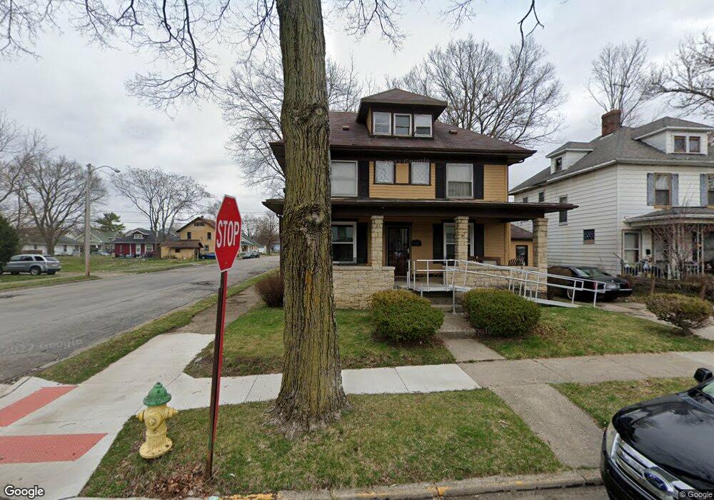
350 W Euclid Ave Springfield, OH 45506
Estimated Value: $92,000 - $131,000
3
Beds
2
Baths
1,953
Sq Ft
$54/Sq Ft
Est. Value
About This Home
This home is located at 350 W Euclid Ave, Springfield, OH 45506 and is currently estimated at $105,437, approximately $53 per square foot. 350 W Euclid Ave is a home located in Clark County with nearby schools including Fulton Elementary School, Hayward Middle School, and Springfield High School.
Ownership History
Date
Name
Owned For
Owner Type
Purchase Details
Closed on
May 31, 1996
Sold by
Palace and Renovatio
Bought by
Belle Richard S and Belle Josephine
Current Estimated Value
Home Financials for this Owner
Home Financials are based on the most recent Mortgage that was taken out on this home.
Original Mortgage
$35,000
Outstanding Balance
$1,504
Interest Rate
7.99%
Mortgage Type
New Conventional
Estimated Equity
$103,933
Purchase Details
Closed on
Jun 18, 1990
Create a Home Valuation Report for This Property
The Home Valuation Report is an in-depth analysis detailing your home's value as well as a comparison with similar homes in the area
Home Values in the Area
Average Home Value in this Area
Purchase History
| Date | Buyer | Sale Price | Title Company |
|---|---|---|---|
| Belle Richard S | $46,000 | -- | |
| -- | $17,500 | -- |
Source: Public Records
Mortgage History
| Date | Status | Borrower | Loan Amount |
|---|---|---|---|
| Open | Belle Richard S | $35,000 |
Source: Public Records
Tax History
| Year | Tax Paid | Tax Assessment Tax Assessment Total Assessment is a certain percentage of the fair market value that is determined by local assessors to be the total taxable value of land and additions on the property. | Land | Improvement |
|---|---|---|---|---|
| 2025 | $618 | $30,490 | $1,890 | $28,600 |
| 2024 | $594 | $22,290 | $1,630 | $20,660 |
| 2023 | $594 | $22,290 | $1,630 | $20,660 |
| 2022 | $620 | $22,290 | $1,630 | $20,660 |
| 2021 | $504 | $18,420 | $1,350 | $17,070 |
| 2020 | $507 | $18,420 | $1,350 | $17,070 |
| 2019 | $509 | $18,420 | $1,350 | $17,070 |
| 2018 | $338 | $14,800 | $1,160 | $13,640 |
| 2017 | $338 | $14,791 | $1,155 | $13,636 |
| 2016 | $339 | $14,791 | $1,155 | $13,636 |
| 2015 | $345 | $14,791 | $1,155 | $13,636 |
| 2014 | $344 | $14,791 | $1,155 | $13,636 |
| 2013 | $340 | $14,791 | $1,155 | $13,636 |
Source: Public Records
Map
Nearby Homes
- 326 W Grand Ave
- 410 W Liberty St
- 311 W Grand Ave
- 209 W Liberty St
- 405 W Southern Ave
- 506 W Southern Ave
- 1002 S Yellow Springs St
- 702 S Wittenberg Ave
- 802 Innisfallen Ave
- 770 W State St
- 550 W Parkwood Ave
- 525 S Light St
- 830 Dibert Ave
- 907-913 S Limestone St
- 916 Innisfallen Ave
- 659 W Mulberry St Unit 661
- 1355 S Fountain Ave
- 0 W Perrin Ave Unit 1043508
- 0 W Perrin Ave Unit 951292
- 709-711 W Mulberry St
- 346 W Euclid Ave
- 336 W Euclid Ave Unit 338
- 336-338 W Euclid Ave
- 402 W Euclid Ave Unit 404
- 332 W Euclid Ave
- 345 W Liberty St
- 343 W Liberty St
- 406 W Euclid Ave Unit 408
- 408 W Euclid Ave
- 339 W Liberty St
- 401 W Liberty St
- 330 W Euclid Ave Unit 330
- 351 W Euclid Ave
- 335 W Liberty St
- 345 W Euclid Ave
- 405 W Liberty St
- 414 W Euclid Ave
- 341 W Euclid Ave
- 405 W Euclid Ave
- 331 W Liberty St
Your Personal Tour Guide
Ask me questions while you tour the home.