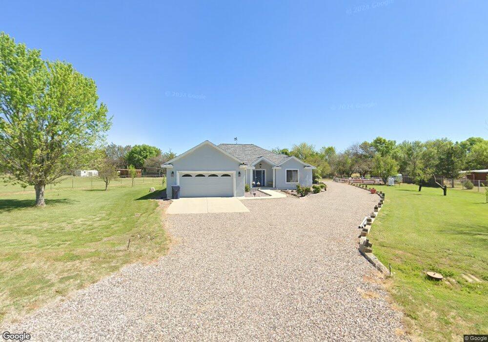
350 W Pheasant Run Cir Camp Verde, AZ 86322
Estimated Value: $569,902 - $705,000
--
Bed
--
Bath
2,478
Sq Ft
$259/Sq Ft
Est. Value
About This Home
This home is located at 350 W Pheasant Run Cir, Camp Verde, AZ 86322 and is currently estimated at $640,976, approximately $258 per square foot. 350 W Pheasant Run Cir is a home located in Yavapai County with nearby schools including Camp Verde Elementary School, Camp Verde Middle School, and Camp Verde High School.
Ownership History
Date
Name
Owned For
Owner Type
Purchase Details
Closed on
Jul 22, 2019
Sold by
Boyer Marjory and Estate Of Sallie Dillon
Bought by
Boyer Daniel and Boyer Marjory
Current Estimated Value
Purchase Details
Closed on
Mar 24, 2004
Sold by
Buckner Yvonne T
Bought by
Biondi John Leland and Buckner Yvonne T
Purchase Details
Closed on
Jan 27, 1997
Sold by
Ward Claudia and Greeson Gary
Bought by
Dillon Wallace and Dillon Sallie
Home Financials for this Owner
Home Financials are based on the most recent Mortgage that was taken out on this home.
Original Mortgage
$11,500
Interest Rate
7.62%
Mortgage Type
Seller Take Back
Purchase Details
Closed on
Jul 20, 1977
Sold by
Edge John N and Edge Margaret E
Bought by
Mizokami Brian M and Mizokami Peggy K
Create a Home Valuation Report for This Property
The Home Valuation Report is an in-depth analysis detailing your home's value as well as a comparison with similar homes in the area
Home Values in the Area
Average Home Value in this Area
Purchase History
| Date | Buyer | Sale Price | Title Company |
|---|---|---|---|
| Boyer Daniel | $250,000 | Clear Title Main Office | |
| Biondi John Leland | -- | -- | |
| Dillon Wallace | $31,500 | Westitle Agency Inc | |
| Mizokami Brian M | -- | Capital Title Agency |
Source: Public Records
Mortgage History
| Date | Status | Borrower | Loan Amount |
|---|---|---|---|
| Previous Owner | Dillon Wallace | $11,500 |
Source: Public Records
Tax History Compared to Growth
Tax History
| Year | Tax Paid | Tax Assessment Tax Assessment Total Assessment is a certain percentage of the fair market value that is determined by local assessors to be the total taxable value of land and additions on the property. | Land | Improvement |
|---|---|---|---|---|
| 2026 | $2,204 | $51,678 | -- | -- |
| 2024 | $2,233 | $52,035 | -- | -- |
| 2023 | $2,233 | $37,341 | $7,255 | $30,086 |
| 2022 | $2,120 | $30,213 | $5,349 | $24,864 |
| 2021 | $2,166 | $28,302 | $5,668 | $22,634 |
| 2020 | $2,098 | $0 | $0 | $0 |
| 2019 | $1,753 | $0 | $0 | $0 |
| 2018 | $1,694 | $0 | $0 | $0 |
| 2017 | $1,605 | $0 | $0 | $0 |
| 2016 | $1,543 | $0 | $0 | $0 |
| 2015 | -- | $0 | $0 | $0 |
| 2014 | -- | $0 | $0 | $0 |
Source: Public Records
Map
Nearby Homes
- 2095 S Hillcrest Dr
- 1785 S Fort Apache Rd
- 2050 S Hillcrest Dr
- 2045 S Hillcrest Dr
- 1844 S Quarterhorse Ln
- 1993 S Salt Mine Rd
- 1846 S Dodge Rd
- 1616 S Reeves Arena Rd
- 452 E Cole Blvd Unit 17
- 452 E Cole Blvd
- 1703 S Parrish Ln
- 451 W Salt Mine Rd
- 955 W Copperhead Rd
- 469 E Cole Blvd Unit 6
- 356 E Cole Blvd Unit 15
- 328 E Cole Blvd Unit 14
- 405 E Cole Blvd Unit 8
- 437 E Cole Blvd Unit 7
- 270 E Cole Blvd Unit 13
- 414 E Cole Blvd
- 380 W Pheasant Run Cir
- 320 W Pheasant Run Cir
- 335 W Pheasant Run Cir
- 390 W Pheasant Run Cir
- 355 W Pheasant Run Cir
- 270 W Linda Vista Dr
- 305 W Fort McDowell Place
- 395 W Pheasant Run Cir
- 275 W Fort McDowell Place
- 325 W Fort McDowell Place
- 415 W Pheasant Run Cir
- 420 W Pheasant Run Cir
- 255 W Fort McDowell Place
- 204 W Linda Vista Dr
- 179 W Linda Vista Dr
- 462 W Spruce St
- 452 W Spruce St
- 1945 S Pearl Dr
- 302 W Fort McDowell Place
- 352 W Pheasant Run Cir