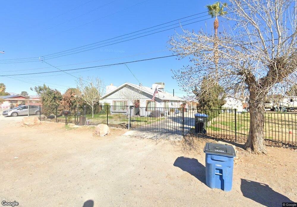
3500 Anderson Ln Las Vegas, NV 89106
West Las Vegas NeighborhoodEstimated Value: $336,000 - $353,000
2
Beds
1
Bath
1,140
Sq Ft
$300/Sq Ft
Est. Value
About This Home
This home is located at 3500 Anderson Ln, Las Vegas, NV 89106 and is currently estimated at $342,563, approximately $300 per square foot. 3500 Anderson Ln is a home located in Clark County with nearby schools including Ollie Detwiler Elementary School, West Prepatory Academy At Charlles I West Hall Sec, and Western High School.
Ownership History
Date
Name
Owned For
Owner Type
Purchase Details
Closed on
May 12, 2025
Sold by
Chet And Sharyle Gregg Trust and Gregg Sharyle M
Bought by
Jam Family Trust and Messmore
Current Estimated Value
Purchase Details
Closed on
Sep 27, 2024
Sold by
Messmore John D and Messmore Allison L
Bought by
Jam Family Trust and Messmore
Purchase Details
Closed on
Mar 1, 2018
Sold by
David Ladene and Lytle Mary Jean
Bought by
Messmore John D and Messmore Allison L
Home Financials for this Owner
Home Financials are based on the most recent Mortgage that was taken out on this home.
Original Mortgage
$266,000
Interest Rate
4.22%
Mortgage Type
New Conventional
Purchase Details
Closed on
Jun 28, 2005
Sold by
Metz Sharon
Bought by
David Ladene and Lytle Mary Jean
Purchase Details
Closed on
Dec 5, 2001
Sold by
Mcdaniel Louise
Bought by
Mcdaniel Dean and Mcdaniel Louise
Create a Home Valuation Report for This Property
The Home Valuation Report is an in-depth analysis detailing your home's value as well as a comparison with similar homes in the area
Home Values in the Area
Average Home Value in this Area
Purchase History
| Date | Buyer | Sale Price | Title Company |
|---|---|---|---|
| Jam Family Trust | -- | None Listed On Document | |
| Jam Family Trust | -- | None Listed On Document | |
| Messmore John D | $280,000 | Wfg National Title Company | |
| David Ladene | -- | -- | |
| Mcdaniel Dean | -- | -- |
Source: Public Records
Mortgage History
| Date | Status | Borrower | Loan Amount |
|---|---|---|---|
| Previous Owner | Messmore John D | $266,000 |
Source: Public Records
Tax History Compared to Growth
Tax History
| Year | Tax Paid | Tax Assessment Tax Assessment Total Assessment is a certain percentage of the fair market value that is determined by local assessors to be the total taxable value of land and additions on the property. | Land | Improvement |
|---|---|---|---|---|
| 2025 | $631 | $43,497 | $26,250 | $17,247 |
| 2024 | $613 | $43,497 | $26,250 | $17,247 |
| 2023 | $613 | $41,638 | $26,250 | $15,388 |
| 2022 | $595 | $39,925 | $26,250 | $13,675 |
| 2021 | $578 | $35,500 | $22,750 | $12,750 |
| 2020 | $558 | $30,602 | $18,200 | $12,402 |
| 2019 | $542 | $30,156 | $18,200 | $11,956 |
| 2018 | $526 | $27,688 | $16,450 | $11,238 |
| 2017 | $733 | $26,803 | $15,750 | $11,053 |
| 2016 | $500 | $18,852 | $8,190 | $10,662 |
| 2015 | $497 | $17,575 | $7,280 | $10,295 |
| 2014 | $483 | $17,093 | $7,280 | $9,813 |
Source: Public Records
Map
Nearby Homes
- 3509 Arcadian King Ave
- 3634 Hestia Ave
- 3493 Arcadian King Ave
- 3017 Holly Ave
- 3610 Tripoli Cove Ave
- 3634 Tripoli Cove Ave
- 3494 Alpheus River Ave
- 3534 Alpheus River Ave
- 3541 Alpheus River Ave
- Cambridge Plan at Rosa Point
- Albany Plan at Rosa Point
- Caden Plan at Arcadia
- Alma Plan at Arcadia
- Eden Plan at Arcadia
- 0 N Rancho Dr
- 3621 Arcadian Sea St
- 3541 Arcadian Sea St
- 1700 Ferrell St
- 2633 Sierra Seco Ave Unit 105
- 2621 Adelante Ave Unit 104
- 3576 Anderson Ln
- 3452 Anderson Ln
- 1953 Alwill St
- 3471 W Lake Mead Blvd
- 3471 Anderson Ln
- 1949 Alwill St
- 3580 Anderson Ln
- 3453 Anderson Ln
- 1952 Cindysue St Unit 1
- 1945 Alwill St
- 3390 Anderson Ln
- 1948 Cindysue St
- 3421 Anderson Ln
- 1941 Alwill St
- 1944 Cindysue St
- 3516 Coran Ln
- 3600 Anderson Ln
- 3395 Anderson Ln
- 1940 Cindysue St
- 1937 Alwill St