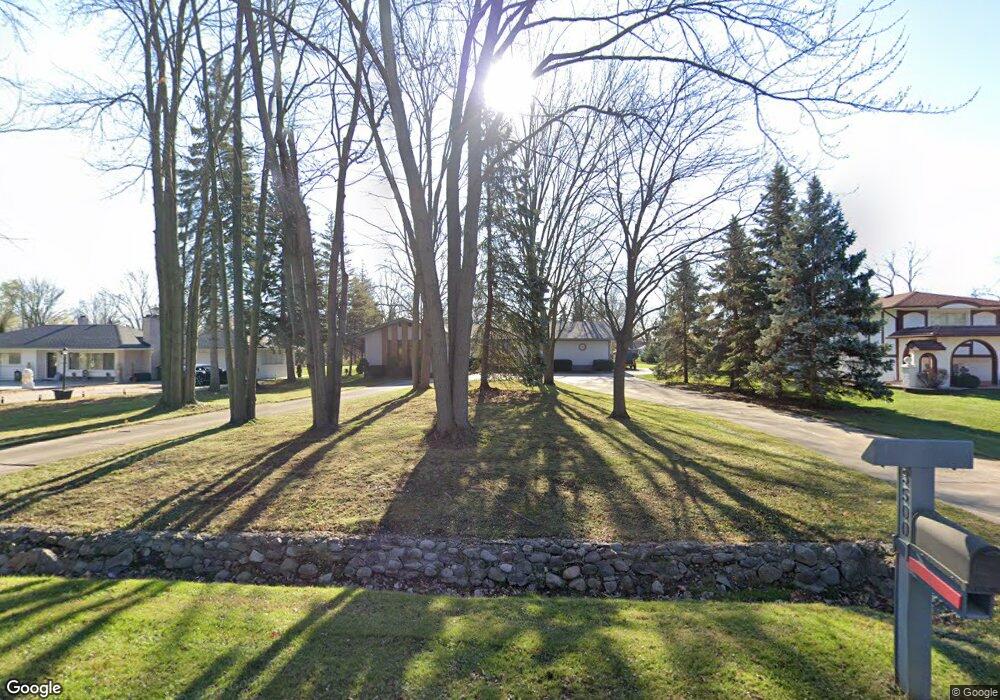
3500 Denson Dr Sterling Heights, MI 48310
Estimated Value: $358,842 - $394,000
--
Bed
2
Baths
1,992
Sq Ft
$186/Sq Ft
Est. Value
About This Home
This home is located at 3500 Denson Dr, Sterling Heights, MI 48310 and is currently estimated at $370,461, approximately $185 per square foot. 3500 Denson Dr is a home located in Macomb County with nearby schools including Holden Elementary School, Grissom Middle School, and Sterling Heights Senior H.S..
Ownership History
Date
Name
Owned For
Owner Type
Purchase Details
Closed on
Aug 9, 2017
Sold by
Montville Dennis W
Bought by
Montville Dennis W and Dennis W Montville Trust
Current Estimated Value
Purchase Details
Closed on
Aug 31, 1999
Sold by
Reif Adolf J
Bought by
Montville Dennis W
Home Financials for this Owner
Home Financials are based on the most recent Mortgage that was taken out on this home.
Original Mortgage
$142,000
Interest Rate
7.87%
Mortgage Type
Purchase Money Mortgage
Create a Home Valuation Report for This Property
The Home Valuation Report is an in-depth analysis detailing your home's value as well as a comparison with similar homes in the area
Home Values in the Area
Average Home Value in this Area
Purchase History
| Date | Buyer | Sale Price | Title Company |
|---|---|---|---|
| Montville Dennis W | -- | None Available | |
| Montville Dennis W | $222,000 | -- |
Source: Public Records
Mortgage History
| Date | Status | Borrower | Loan Amount |
|---|---|---|---|
| Previous Owner | Montville Dennis W | $142,000 |
Source: Public Records
Tax History Compared to Growth
Tax History
| Year | Tax Paid | Tax Assessment Tax Assessment Total Assessment is a certain percentage of the fair market value that is determined by local assessors to be the total taxable value of land and additions on the property. | Land | Improvement |
|---|---|---|---|---|
| 2025 | $3,939 | $171,600 | $0 | $0 |
| 2024 | $3,799 | $164,800 | $0 | $0 |
| 2023 | $3,607 | $149,300 | $0 | $0 |
| 2022 | $3,498 | $134,200 | $0 | $0 |
| 2021 | $3,441 | $126,100 | $0 | $0 |
| 2020 | $3,271 | $125,500 | $0 | $0 |
| 2019 | $3,070 | $110,500 | $0 | $0 |
| 2018 | $3,254 | $94,600 | $0 | $0 |
| 2017 | $3,137 | $87,400 | $23,400 | $64,000 |
| 2016 | $3,070 | $87,400 | $0 | $0 |
| 2015 | -- | $79,100 | $0 | $0 |
| 2014 | -- | $66,800 | $0 | $0 |
Source: Public Records
Map
Nearby Homes
- 3601 Denson Dr
- 3096 Reese Dr
- 3217 Barton Dr
- 37011 Tricia Dr
- 36862 Park Place Dr Unit 2
- 3349 Dobbin Dr
- 3426 Janet Dr
- 37440 Curwood Dr
- 4325 Fox Hill Dr
- 37258 Carpathia Blvd
- 38338 Coronation Dr
- 36268 Jeffrey Dr
- 36614 Park Place Dr Unit 68
- 3542 Marc Dr
- 36619 Park Place Dr
- 36687 La Marra Dr
- 37183 Curwood Dr
- 3261 Lancaster Dr
- 3038 Donna Dr
- 4231 Chris Dr
- 3520 Denson Dr
- 3480 Denson Dr
- 3460 Denson Dr
- 3540 Denson Dr
- 3410 Denson Dr
- 3560 Denson Dr
- 3501 Leason Rd
- 3521 Leason Rd
- 3481 Leason Rd
- 3541 Leason Rd
- 37336 Hanson Dr
- 3501 Denson Dr
- 3461 Leason Rd
- 3481 Denson Dr
- 3521 Denson Dr
- 3402 Denson Dr
- 3461 Denson Dr
- 3541 Denson Dr
- 3561 Leason Rd Unit Bldg-Unit
- 3561 Leason Rd
