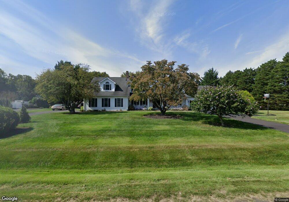
3500 Foxhall Dr Davidsonville, MD 21035
Davidsonville NeighborhoodEstimated Value: $934,000 - $1,299,000
4
Beds
4
Baths
3,919
Sq Ft
$290/Sq Ft
Est. Value
About This Home
This home is located at 3500 Foxhall Dr, Davidsonville, MD 21035 and is currently estimated at $1,136,059, approximately $289 per square foot. 3500 Foxhall Dr is a home located in Anne Arundel County with nearby schools including Davidsonville Elementary School, Central Middle School, and South River High School.
Ownership History
Date
Name
Owned For
Owner Type
Purchase Details
Closed on
Jul 13, 1999
Sold by
Collett Ralph W
Bought by
Konkel Gerald P and Lemanski Susan M
Current Estimated Value
Create a Home Valuation Report for This Property
The Home Valuation Report is an in-depth analysis detailing your home's value as well as a comparison with similar homes in the area
Home Values in the Area
Average Home Value in this Area
Purchase History
| Date | Buyer | Sale Price | Title Company |
|---|---|---|---|
| Konkel Gerald P | $270,000 | -- |
Source: Public Records
Mortgage History
| Date | Status | Borrower | Loan Amount |
|---|---|---|---|
| Closed | Konkel Gerald P | -- |
Source: Public Records
Tax History Compared to Growth
Tax History
| Year | Tax Paid | Tax Assessment Tax Assessment Total Assessment is a certain percentage of the fair market value that is determined by local assessors to be the total taxable value of land and additions on the property. | Land | Improvement |
|---|---|---|---|---|
| 2025 | $8,972 | $945,200 | -- | -- |
| 2024 | $8,972 | $857,300 | $0 | $0 |
| 2023 | $8,059 | $769,400 | $263,500 | $505,900 |
| 2022 | $8,148 | $759,700 | $0 | $0 |
| 2021 | $16,011 | $750,000 | $0 | $0 |
| 2020 | $7,829 | $740,300 | $263,500 | $476,800 |
| 2019 | $7,709 | $740,300 | $263,500 | $476,800 |
| 2018 | $7,507 | $740,300 | $263,500 | $476,800 |
| 2017 | $7,279 | $746,800 | $0 | $0 |
| 2016 | -- | $706,967 | $0 | $0 |
| 2015 | -- | $667,133 | $0 | $0 |
| 2014 | -- | $627,300 | $0 | $0 |
Source: Public Records
Map
Nearby Homes
- 3501 Foxhall Dr
- 873 Benjamin Branch
- 1008 W Central Ave
- 3520 Castle Way
- 1080 Mount Airy Rd
- 3514 Williamsburg Rd
- 3509 Russell Thomas Ln
- 1203 Double Gate Rd
- 1527 Patuxent Manor Rd
- Preston Plan at Stillview Acres
- Stonehaven Plan at Stillview Acres
- Hampton II Plan at Stillview Acres
- 3451 Blandford Way
- 1544 Manor View Rd
- 1805 Stillview Acres Rd
- 3732 Nile Rd
- 2901 George Howard Way
- 3565 Riva Rd
- 1575 Alcova Dr
- 1101 Meredith Ln
- 3502 Foxhall Dr
- 3504 Foxhall Dr
- 3503 Foxhall Dr
- 3506 Foxhall Dr
- 3505 Foxhall Dr
- 3508 Foxhall Dr
- 962 W Central Ave
- 3507 Foxhall Dr
- 960 Stable Ct
- 3510 Foxhall Dr
- 1001 W Central Ave
- 962 Stable Ct
- 900 W Central Ave
- 961 Stable Ct
- 3512 Foxhall Dr
- 864 Bridle Way
- 860 Bridle Way
- 3514 Foxhall Dr
- 3526 Queen Anne Bridge Rd
- 964 Stable Ct