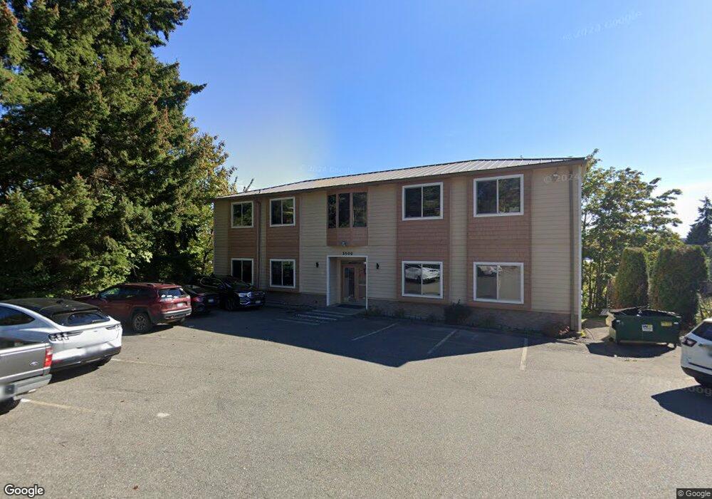
3500 NW Anderson Hill Rd Unit 101 Silverdale, WA 98383
Estimated Value: $623,242
--
Bed
1
Bath
3,872
Sq Ft
$161/Sq Ft
Est. Value
About This Home
This home is located at 3500 NW Anderson Hill Rd Unit 101, Silverdale, WA 98383 and is currently estimated at $623,242, approximately $160 per square foot. 3500 NW Anderson Hill Rd Unit 101 is a home located in Kitsap County with nearby schools including Silverdale Elementary School, Central Kitsap Middle School, and Central Kitsap High School.
Ownership History
Date
Name
Owned For
Owner Type
Purchase Details
Closed on
Jan 29, 2024
Sold by
Cook Decedents Trust
Bought by
3500 Anderson Llc
Current Estimated Value
Home Financials for this Owner
Home Financials are based on the most recent Mortgage that was taken out on this home.
Original Mortgage
$580,000
Outstanding Balance
$569,750
Interest Rate
6.61%
Mortgage Type
Seller Take Back
Estimated Equity
$53,492
Purchase Details
Closed on
Mar 29, 2022
Sold by
Cook Trust
Bought by
Cook Decedents Trust
Purchase Details
Closed on
Sep 24, 2001
Sold by
Cook David N
Bought by
Cook David N and Cook Lorraine
Create a Home Valuation Report for This Property
The Home Valuation Report is an in-depth analysis detailing your home's value as well as a comparison with similar homes in the area
Home Values in the Area
Average Home Value in this Area
Purchase History
| Date | Buyer | Sale Price | Title Company |
|---|---|---|---|
| 3500 Anderson Llc | $600,000 | Land Title | |
| Cook Decedents Trust | $313 | Sherrard Mcgonagle Tizzano & L | |
| Cook David N | -- | -- |
Source: Public Records
Mortgage History
| Date | Status | Borrower | Loan Amount |
|---|---|---|---|
| Open | 3500 Anderson Llc | $580,000 |
Source: Public Records
Tax History Compared to Growth
Tax History
| Year | Tax Paid | Tax Assessment Tax Assessment Total Assessment is a certain percentage of the fair market value that is determined by local assessors to be the total taxable value of land and additions on the property. | Land | Improvement |
|---|---|---|---|---|
| 2026 | $6,050 | $597,750 | $216,960 | $380,790 |
| 2025 | $6,050 | $632,170 | $216,960 | $415,210 |
| 2024 | $6,149 | $661,920 | $216,960 | $444,960 |
| 2023 | $6,170 | $661,920 | $234,280 | $427,640 |
| 2022 | $6,652 | $632,170 | $234,280 | $397,890 |
| 2021 | $6,929 | $629,010 | $234,280 | $394,730 |
| 2020 | $6,218 | $570,590 | $234,280 | $336,310 |
| 2019 | $5,274 | $466,510 | $190,830 | $275,680 |
| 2018 | $6,089 | $459,040 | $247,890 | $211,150 |
| 2017 | $5,900 | $459,040 | $247,890 | $211,150 |
| 2016 | $6,362 | $459,040 | $224,890 | $234,150 |
| 2015 | $6,092 | $459,040 | $224,890 | $234,150 |
| 2014 | -- | $459,040 | $204,440 | $254,600 |
| 2013 | -- | $459,060 | $255,550 | $203,510 |
Source: Public Records
Map
Nearby Homes
- 3658 NW Munson St
- 1111 NW Lowell St
- 8755 Shore Place NW
- 9009 Martin Ave NW
- 0 NW Anderson Hill Rd Unit NWM2348272
- 3761 NW Highland Ct
- 8147 Knute Ln NW
- 8194 Silverdale Way NW
- 4460 NW Arriva Way
- 12812 Jammer Place NW
- 4931 Knute Anderson Rd NW
- 8702 Schoolway Place NW
- 5021 NW Cedarside Loop
- 5052 NW Cedarside Loop
- 5053 NW Cedarside Loop
- 5044 NW Cedarside Loop
- 5077 NW Cedarside Loop
- 4495 Newberry Ln NW
- 9428 Tracyton Blvd NW
- 4844 NW Walgren Dr
- 3500 NW Anderson Hill Rd Unit 301
- 3500 NW Anderson Hill Rd
- 3505 3510 NW Anderson Hill Rd
- 3505 NW Anderson Hill Rd
- 9305 Silverdale Way NW
- 3510 NW Anderson Hill Rd
- 3491 NW Anderson Hill Rd
- 3656 NW Munson St Unit 1
- 9222 Silverdale Way NW
- 3525 NW Anderson Hill Rd
- 3523 NW Anderson Hill Rd
- 3525 NW Anderson Hill Rd
- 3662 NW Munson St
- 3540 NW Anderson Hill Rd
- 3672 NW Munson St
- 0 Munson St Unit 852211
- 0 Munson St Unit 479928
- 9201 Silverdale Way NW
- 3690 NW Munson St
- 3825 BIZOP Undisclosed