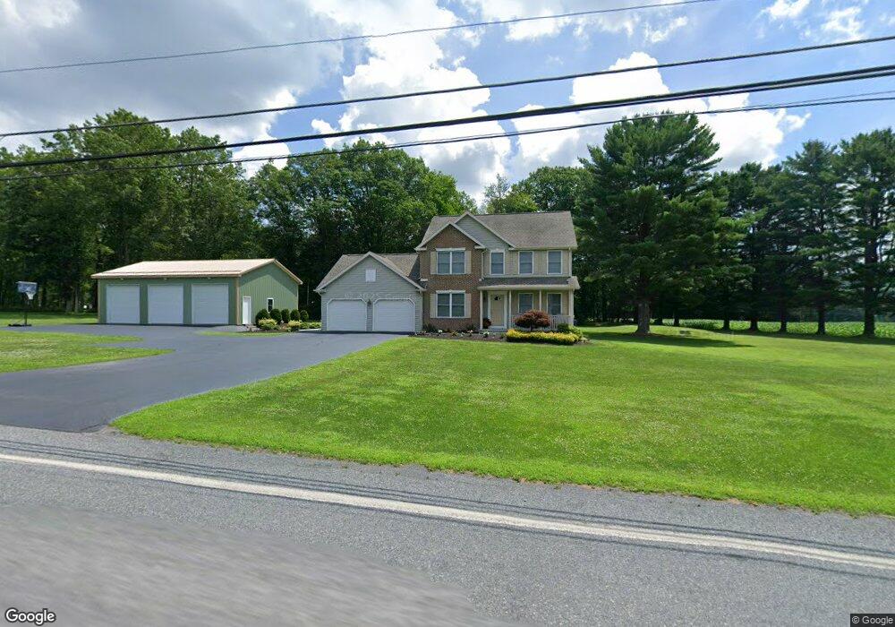
3500 Quakake Rd Weatherly, PA 18255
Estimated Value: $306,000 - $436,000
3
Beds
2
Baths
1,972
Sq Ft
$182/Sq Ft
Est. Value
About This Home
This home is located at 3500 Quakake Rd, Weatherly, PA 18255 and is currently estimated at $359,266, approximately $182 per square foot. 3500 Quakake Rd is a home located in Carbon County with nearby schools including Weatherly Elementary/ Middle School and Weatherly Area Senior High School.
Ownership History
Date
Name
Owned For
Owner Type
Purchase Details
Closed on
Nov 30, 2010
Sold by
Titus Jason E and Titus Kelly A
Bought by
Titus Jason E and Titus Kelly A
Current Estimated Value
Home Financials for this Owner
Home Financials are based on the most recent Mortgage that was taken out on this home.
Original Mortgage
$200,000
Interest Rate
4.22%
Mortgage Type
New Conventional
Purchase Details
Closed on
Mar 10, 2008
Sold by
Titus Earl and Titus Rosalie
Bought by
Titus Jason E
Create a Home Valuation Report for This Property
The Home Valuation Report is an in-depth analysis detailing your home's value as well as a comparison with similar homes in the area
Home Values in the Area
Average Home Value in this Area
Purchase History
| Date | Buyer | Sale Price | Title Company |
|---|---|---|---|
| Titus Jason E | -- | None Available | |
| Titus Jason E | -- | None Available |
Source: Public Records
Mortgage History
| Date | Status | Borrower | Loan Amount |
|---|---|---|---|
| Closed | Titus Jason E | $200,000 |
Source: Public Records
Tax History Compared to Growth
Tax History
| Year | Tax Paid | Tax Assessment Tax Assessment Total Assessment is a certain percentage of the fair market value that is determined by local assessors to be the total taxable value of land and additions on the property. | Land | Improvement |
|---|---|---|---|---|
| 2025 | $6,063 | $87,750 | $9,900 | $77,850 |
| 2024 | $5,698 | $87,750 | $9,900 | $77,850 |
| 2023 | $5,501 | $87,750 | $9,900 | $77,850 |
| 2022 | $5,501 | $87,750 | $9,900 | $77,850 |
| 2021 | $5,413 | $87,750 | $9,900 | $77,850 |
| 2020 | $5,413 | $87,750 | $9,900 | $77,850 |
| 2019 | $5,110 | $87,750 | $9,900 | $77,850 |
| 2018 | $4,985 | $87,750 | $9,900 | $77,850 |
| 2017 | $4,853 | $87,750 | $9,900 | $77,850 |
| 2016 | -- | $82,750 | $9,900 | $72,850 |
| 2015 | -- | $82,750 | $9,900 | $72,850 |
| 2014 | -- | $82,750 | $9,900 | $72,850 |
Source: Public Records
Map
Nearby Homes
- 419 Sand Spring Rd
- 0 Grist Mill Dr
- 0 Grist Mill Drive Lot Unit WP001
- 5444 Quakake Rd
- 97 Broad St
- 44 Berwick St
- 135 Dean St
- 1586 Spring Mountain Rd
- 751 Hudson Dr
- 23 W Market St
- 2001 E Broad St
- 1 Circle Dr
- 415 Lake Dr
- 0 Johns Ave
- 155 Coxe St
- 129 N Rear Sheridan St
- 237 Stock St
- 110 112 E Grant St
- 205 Yard St
- 0 Dietrich Ave
- 3511 Quakake Rd
- 3485 Quakake Rd
- 3562 Quakake Rd
- 3434 Quakake Rd
- 3453 Quakake Rd
- 3591 Quakake Rd
- 3432 Quakake Rd
- 3341 Quakake Rd
- 1741 Round Head Dr
- 3250 Quakake Rd
- 0 Round Head Dr Unit 662815
- 0 Round Head Dr
- 0 Round Head Dr Unit PM-85890
- 0 Round Head Dr Unit 529304
- 13 Center Ln
- 118 Center Ln
- 1708 Round Head Dr
- 1708 Round Head Dr
- 3096 Quakake Rd
- 62 Center Ln