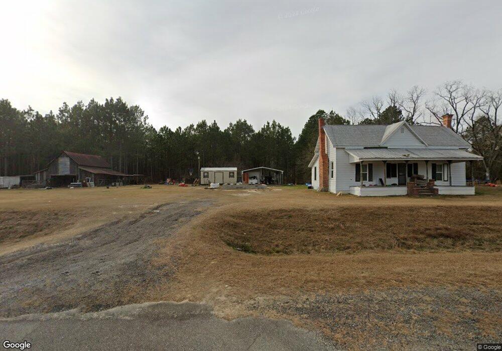
3501 Us Highway 221 N Mount Vernon, GA 30445
Estimated Value: $281,074 - $429,000
--
Bed
2
Baths
2,210
Sq Ft
$151/Sq Ft
Est. Value
About This Home
This home is located at 3501 Us Highway 221 N, Mount Vernon, GA 30445 and is currently estimated at $333,019, approximately $150 per square foot. 3501 Us Highway 221 N is a home located in Montgomery County with nearby schools including Montgomery County Elementary School, Montgomery County Middle School, and Montgomery County High School.
Ownership History
Date
Name
Owned For
Owner Type
Purchase Details
Closed on
Mar 3, 2025
Sold by
Kelley Lisa H
Bought by
Coleman Charles Leland and Coleman Kathryn Faith
Current Estimated Value
Home Financials for this Owner
Home Financials are based on the most recent Mortgage that was taken out on this home.
Original Mortgage
$216,255
Outstanding Balance
$214,617
Interest Rate
6.95%
Mortgage Type
New Conventional
Estimated Equity
$118,402
Purchase Details
Closed on
Jun 30, 2020
Sold by
Kelley Lisa H
Bought by
Kelley Lisa and Kelley Larry
Purchase Details
Closed on
Apr 8, 1999
Sold by
Page Lisa Hutchison
Bought by
Page Charles Ray
Purchase Details
Closed on
Jan 12, 1995
Bought by
Hutchison Dorothy C
Create a Home Valuation Report for This Property
The Home Valuation Report is an in-depth analysis detailing your home's value as well as a comparison with similar homes in the area
Home Values in the Area
Average Home Value in this Area
Purchase History
| Date | Buyer | Sale Price | Title Company |
|---|---|---|---|
| Coleman Charles Leland | $287,000 | -- | |
| Kelley Lisa | -- | -- | |
| Kelley Lisa | -- | -- | |
| Page Charles Ray | -- | -- | |
| Hutchison Dorothy C | -- | -- |
Source: Public Records
Mortgage History
| Date | Status | Borrower | Loan Amount |
|---|---|---|---|
| Open | Kelley Lisa | $216,255 |
Source: Public Records
Tax History Compared to Growth
Tax History
| Year | Tax Paid | Tax Assessment Tax Assessment Total Assessment is a certain percentage of the fair market value that is determined by local assessors to be the total taxable value of land and additions on the property. | Land | Improvement |
|---|---|---|---|---|
| 2024 | $2,548 | $88,132 | $1,640 | $86,492 |
| 2023 | $2,016 | $88,132 | $1,640 | $86,492 |
| 2022 | $2,573 | $88,132 | $1,640 | $86,492 |
| 2021 | $2,558 | $88,132 | $1,640 | $86,492 |
| 2020 | $2,300 | $77,502 | $1,640 | $75,862 |
| 2019 | $2,245 | $77,026 | $1,640 | $75,386 |
| 2018 | $2,085 | $77,026 | $1,640 | $75,386 |
| 2017 | $2,141 | $79,122 | $1,640 | $77,482 |
| 2016 | $2,147 | $79,122 | $1,640 | $77,482 |
| 2015 | -- | $79,122 | $1,640 | $77,482 |
| 2014 | -- | $79,122 | $1,640 | $77,482 |
Source: Public Records
Map
Nearby Homes
- 0 County Line Rd Unit n/a 113727
- 2166 Ga Highway 199
- 95 Railroad Ave
- 1936 Cedar Grove Rd
- 435 Georgia 29
- 00 Rivoli Clay Rd
- 0 Rivoli Clay Rd
- 0 Oak Ridge Dr
- 0 Cedar Grove Rd
- 4281 Sr-46
- 4281 Ga Highway 46
- 3256 Georgia 29
- 3395 Mount Vernon Rd
- 4004 E Louisiana Ave
- 7586 Eastman Rd
- 1785 Martin Luther King jr Dr
- 46 Georgia 46
- 4687 W Main St
- 928 N Mcbride St
- 812 E Pearl St
- 3517 Us Highway 221 N
- 3517 Us Highway 221 N
- 3479 Us Highway 221 N
- 299 Cedar Grove Rd
- 4364 U S 221
- 3651 Us Highway 221 N
- 3548 Us Highway 221 N
- 277 Cedar Grove Rd
- 3683 Us Highway 221 N
- 3749 Us Highway 221 N
- 521 Cedar Grove Rd
- 3127 Us Highway 221 N
- 3933 Us Highway 221 N
- 302 Shotgun Rd
- 501 Jelly Beckworth Rd