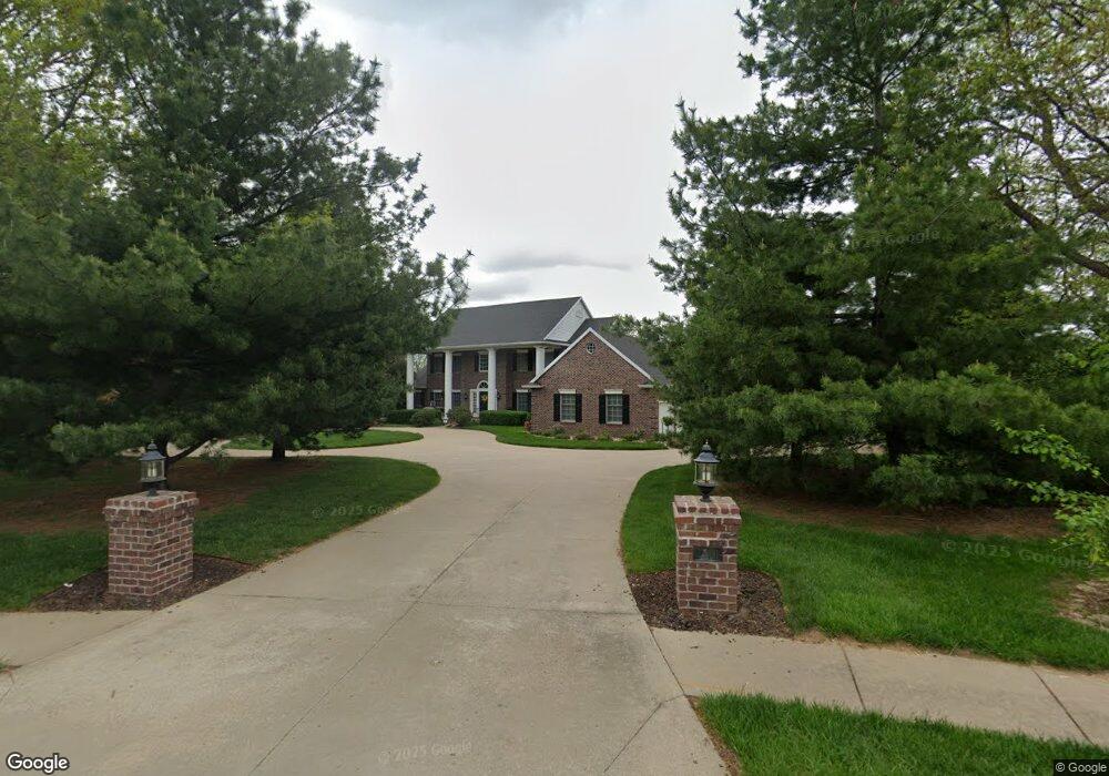
3501 Woodland Pointe Dr Saint Joseph, MO 64506
East Saint Joseph NeighborhoodEstimated Value: $512,000 - $768,000
--
Bed
--
Bath
2,873
Sq Ft
$214/Sq Ft
Est. Value
About This Home
This home is located at 3501 Woodland Pointe Dr, Saint Joseph, MO 64506 and is currently estimated at $615,722, approximately $214 per square foot. 3501 Woodland Pointe Dr is a home located in Buchanan County with nearby schools including Oak Grove Elementary School, Bode Middle School, and Central High School.
Ownership History
Date
Name
Owned For
Owner Type
Purchase Details
Closed on
Oct 25, 2023
Sold by
Richmond David T and Richmond Kathryn A
Bought by
Richmond David T and Richmond Kathryn A
Current Estimated Value
Purchase Details
Closed on
Aug 17, 2023
Sold by
Jeanne Marie Murphy Trust
Bought by
Richmond David and Richmond Kathryn
Home Financials for this Owner
Home Financials are based on the most recent Mortgage that was taken out on this home.
Original Mortgage
$525,000
Interest Rate
6.81%
Mortgage Type
New Conventional
Purchase Details
Closed on
Jun 29, 2012
Sold by
Murphy James A and Murphy Jeanne M
Bought by
Murphy Jeanne Marie and Jeanne Marie Murphy Trust
Create a Home Valuation Report for This Property
The Home Valuation Report is an in-depth analysis detailing your home's value as well as a comparison with similar homes in the area
Home Values in the Area
Average Home Value in this Area
Purchase History
| Date | Buyer | Sale Price | Title Company |
|---|---|---|---|
| Richmond David T | -- | None Listed On Document | |
| Richmond David | -- | St Joseph Title | |
| Murphy Jeanne Marie | -- | None Available |
Source: Public Records
Mortgage History
| Date | Status | Borrower | Loan Amount |
|---|---|---|---|
| Previous Owner | Richmond David | $525,000 |
Source: Public Records
Tax History Compared to Growth
Tax History
| Year | Tax Paid | Tax Assessment Tax Assessment Total Assessment is a certain percentage of the fair market value that is determined by local assessors to be the total taxable value of land and additions on the property. | Land | Improvement |
|---|---|---|---|---|
| 2024 | $7,103 | $101,330 | $14,250 | $87,080 |
| 2023 | $7,103 | $101,330 | $14,250 | $87,080 |
| 2022 | $6,576 | $101,330 | $14,250 | $87,080 |
| 2021 | $6,605 | $101,330 | $14,250 | $87,080 |
| 2020 | $6,569 | $101,330 | $14,250 | $87,080 |
| 2019 | $6,338 | $101,330 | $14,250 | $87,080 |
| 2018 | $5,711 | $101,330 | $14,250 | $87,080 |
| 2017 | $5,657 | $101,330 | $0 | $0 |
| 2015 | $2 | $101,330 | $0 | $0 |
| 2014 | $6,217 | $101,330 | $0 | $0 |
Source: Public Records
Map
Nearby Homes
- 4809 N Lakewood Dr
- 4902 Corinth Dr
- 5418 N Pointe Dr
- 5408 N Pointe Dr
- 5415 N Pointe Dr
- 5411 N Pointe Dr
- 2 N Pointe Dr
- 0 N Pointe Dr
- 4706 Donnelly Dr
- 4703 Wilshire Dr N
- 3201 Sheffield Ln
- 3804 Kingston Ct
- 5201 Cook Rd
- 4705 Huntsboro Ct
- 4304 Kensington Dr
- 4703 Woodland Shores Ct
- 3703 Durham Ct
- 4404 Kensington Dr
- 4730 Woodland Ct
- 4732 Woodland Ct
- 3503 Woodland Pointe Dr
- 3502 Woodland Pointe Dr
- 3505 Woodland Pointe Dr
- 3504 Woodland Pointe Dr
- 4904 N Lakewood Dr
- 4906 N Lakewood Dr
- 3507 Woodland Pointe Dr
- 3506 Woodland Pointe Dr
- 3508 Woodland Pointe Dr
- 3501 Harbor Pointe Dr
- 3503 Harbor Pointe Dr
- 3407 Bishop Rd
- 4905 N Lakewood Dr
- 4903 N Lakewood Dr
- 3510 Woodland Pointe Dr
- 3502 Harbor Pointe Dr
- 4907 N Lakewood Dr
- 3505 Harbor Pointe Dr
- 4901 N Lakewood Dr
- 4811 N Lakewood Dr