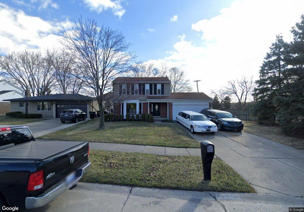
35010 Shell Dr Sterling Heights, MI 48310
Estimated Value: $308,180 - $351,000
3
Beds
2
Baths
1,700
Sq Ft
$192/Sq Ft
Est. Value
About This Home
This home is located at 35010 Shell Dr, Sterling Heights, MI 48310 and is currently estimated at $326,545, approximately $192 per square foot. 35010 Shell Dr is a home located in Macomb County with nearby schools including Susick Elementary School, Grissom Middle School, and Sterling Heights Senior H.S..
Ownership History
Date
Name
Owned For
Owner Type
Purchase Details
Closed on
Oct 6, 1997
Sold by
Guy F and Guy W
Bought by
Nance G
Current Estimated Value
Create a Home Valuation Report for This Property
The Home Valuation Report is an in-depth analysis detailing your home's value as well as a comparison with similar homes in the area
Home Values in the Area
Average Home Value in this Area
Purchase History
| Date | Buyer | Sale Price | Title Company |
|---|---|---|---|
| Nance G | $150,000 | -- |
Source: Public Records
Tax History
| Year | Tax Paid | Tax Assessment Tax Assessment Total Assessment is a certain percentage of the fair market value that is determined by local assessors to be the total taxable value of land and additions on the property. | Land | Improvement |
|---|---|---|---|---|
| 2025 | $4,524 | $147,700 | $0 | $0 |
| 2024 | $43 | $140,900 | $0 | $0 |
| 2023 | $4,090 | $126,900 | $0 | $0 |
| 2022 | $3,967 | $115,600 | $0 | $0 |
| 2021 | $4,100 | $111,600 | $0 | $0 |
| 2020 | $3,897 | $108,400 | $0 | $0 |
| 2019 | $3,659 | $105,800 | $0 | $0 |
| 2018 | $3,877 | $96,200 | $0 | $0 |
| 2017 | $3,738 | $90,600 | $17,500 | $73,100 |
| 2016 | $3,659 | $90,600 | $0 | $0 |
| 2015 | -- | $69,100 | $0 | $0 |
| 2014 | -- | $30,100 | $0 | $0 |
Source: Public Records
Map
Nearby Homes
- 3806 Partagas Dr Unit 48
- 35755 Connecticut Dr
- 4116 April Ln Unit 24
- 4215 Nickolas Dr
- 2448 Oakcrest Rd
- 3650 Veronica Dr
- 2235 Chesley Dr
- 2535 Camel Dr
- 2269 Serra Dr
- 2106 Oakcrest Rd
- 2268 Serra Dr
- 35851 Thornton Dr
- 36310 Park Place Dr
- 36217 Jeffrey Dr
- 4655 Ashburton Place
- 2071 Koper Dr
- 36311 Park Place Dr
- 36268 Jeffrey Dr
- 4274 Dickson Dr
- 36117 Del Ray Dr
- 35026 Shell Dr
- 3431 15 Mile Rd
- 35038 Shell Dr
- 3443 15 Mile Rd
- 35023 Shell Dr
- 35052 Shell Dr
- 35009 Shell Dr
- 35134 Dunston Dr
- 35035 Shell Dr
- 3350 15 Mile Rd
- 35051 Shell Dr
- 35144 Dunston Dr
- 3178 Castle Ct
- 35200 Dunston Dr
- 35111 Dunston Dr
- 35215 Dunston Dr
- 3164 Castle Ct
- 35212 Dunston Dr
- 3485 15 Mile Rd
- 3223 15 Mile Rd
Your Personal Tour Guide
Ask me questions while you tour the home.