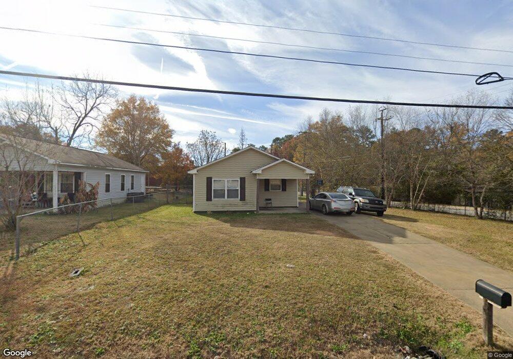
3502 Youmans St Columbus, GA 31903
Southern Columbus NeighborhoodEstimated Value: $62,000 - $93,677
4
Beds
3
Baths
1,207
Sq Ft
$62/Sq Ft
Est. Value
About This Home
This home is located at 3502 Youmans St, Columbus, GA 31903 and is currently estimated at $74,919, approximately $62 per square foot. 3502 Youmans St is a home located in Muscogee County with nearby schools including Dorothy Height Elementary School, Baker Middle School, and Spencer High School.
Ownership History
Date
Name
Owned For
Owner Type
Purchase Details
Closed on
Jun 5, 2008
Sold by
Columbus Area Habitat For Humanity Inc
Bought by
Hollis Tiffany D
Current Estimated Value
Home Financials for this Owner
Home Financials are based on the most recent Mortgage that was taken out on this home.
Original Mortgage
$20,000
Outstanding Balance
$4,479
Interest Rate
6.03%
Mortgage Type
Unknown
Estimated Equity
$70,440
Create a Home Valuation Report for This Property
The Home Valuation Report is an in-depth analysis detailing your home's value as well as a comparison with similar homes in the area
Home Values in the Area
Average Home Value in this Area
Purchase History
| Date | Buyer | Sale Price | Title Company |
|---|---|---|---|
| Hollis Tiffany D | $53,175 | None Available |
Source: Public Records
Mortgage History
| Date | Status | Borrower | Loan Amount |
|---|---|---|---|
| Open | Hollis Tiffany D | $20,000 | |
| Previous Owner | Hollis Tiffany D | $53,267 |
Source: Public Records
Tax History Compared to Growth
Tax History
| Year | Tax Paid | Tax Assessment Tax Assessment Total Assessment is a certain percentage of the fair market value that is determined by local assessors to be the total taxable value of land and additions on the property. | Land | Improvement |
|---|---|---|---|---|
| 2025 | $317 | $32,048 | $4,480 | $27,568 |
| 2024 | $315 | $40,736 | $4,480 | $36,256 |
| 2023 | $18 | $40,736 | $4,480 | $36,256 |
| 2022 | $328 | $32,684 | $4,480 | $28,204 |
| 2021 | $322 | $31,004 | $4,480 | $26,524 |
| 2020 | $322 | $31,004 | $4,480 | $26,524 |
| 2019 | $325 | $31,004 | $4,480 | $26,524 |
| 2018 | $325 | $31,004 | $4,480 | $26,524 |
| 2017 | $327 | $31,004 | $4,480 | $26,524 |
| 2016 | $330 | $21,270 | $3,600 | $17,670 |
| 2015 | $132 | $21,270 | $3,600 | $17,670 |
| 2014 | $133 | $21,270 | $3,600 | $17,670 |
| 2013 | -- | $21,270 | $3,600 | $17,670 |
Source: Public Records
Map
Nearby Homes
- 3522 Youmans St
- 1025 Fletcher Ave
- 3711 Youmans St
- 917 Fletcher Ave
- 929 Winston Rd
- 3815 Baker Plaza Dr
- 906 Winston Rd
- 920 Brooks Rd
- 824 Winston Rd
- 810 Winston Rd
- 716 Benning Dr
- 4026 Bowman St
- 1514 Bowman St
- 2451 Brownie Ln
- 1274 Providence Ln
- 2463 Brownie Ln
- 1511 Foye Ave
- 4163 Swann St
- 2463 Brownie St
- 2973 Hawthorne Dr
- 3510 Youmans St
- 1053 Benning Dr
- 1045 Benning Dr
- 3514 Youmans St
- 1039 Benning Dr
- 1049 Benning Dr
- 1055 Benning Dr
- 3518 Youmans St
- 1040 Benning Dr
- 3343 Head St
- 1035 Benning Dr
- 1103 Benning Dr
- 3339 Head St
- 3602 Youmans St
- 1033 Benning Dr
- 1107 Benning Dr
- 1026 Benning Dr
- 1064 Winston Rd
- 1060 Winston Rd
- 1058 Winston Rd