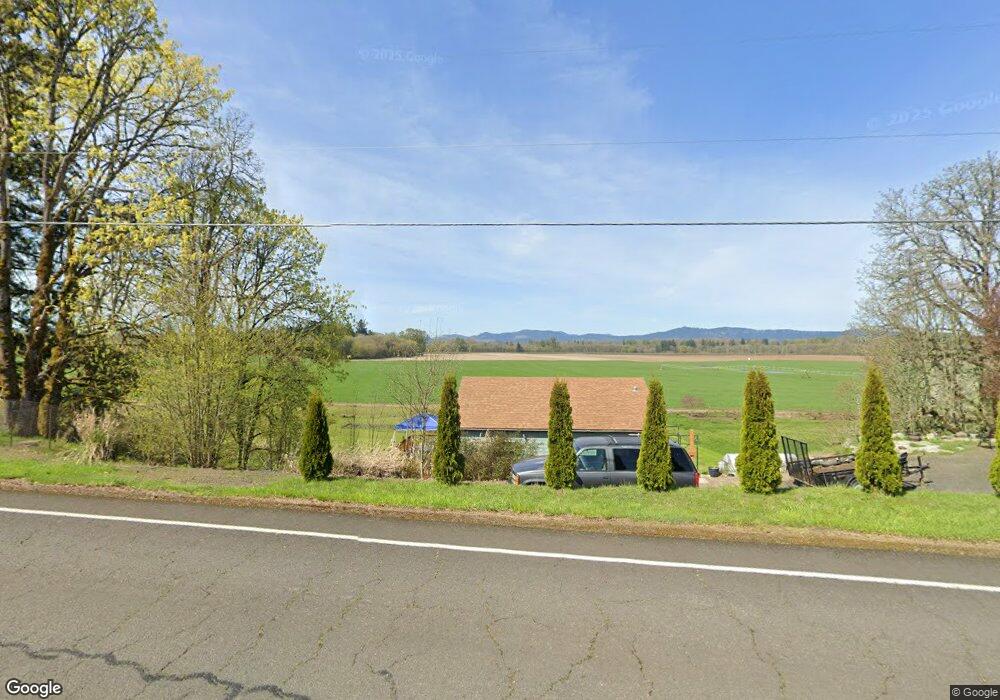
35032 Riverside Dr SW Albany, OR 97321
Estimated Value: $434,345 - $455,000
1
Bed
1
Bath
750
Sq Ft
$593/Sq Ft
Est. Value
About This Home
This home is located at 35032 Riverside Dr SW, Albany, OR 97321 and is currently estimated at $444,673, approximately $592 per square foot. 35032 Riverside Dr SW is a home with nearby schools including Takena Elementary School, Central Elementary School, and Memorial Middle School.
Ownership History
Date
Name
Owned For
Owner Type
Purchase Details
Closed on
Mar 23, 2017
Sold by
Wulf Paul R
Bought by
Cray Kenneth L
Current Estimated Value
Purchase Details
Closed on
Nov 14, 2013
Sold by
Wulf John P
Bought by
Wulf Paul R and The Paul R Wulf Revocable Living Trust
Purchase Details
Closed on
Jul 12, 2007
Sold by
Atkeson Howard
Bought by
Wulf John P and Wulf Paul R
Create a Home Valuation Report for This Property
The Home Valuation Report is an in-depth analysis detailing your home's value as well as a comparison with similar homes in the area
Home Values in the Area
Average Home Value in this Area
Purchase History
| Date | Buyer | Sale Price | Title Company |
|---|---|---|---|
| Cray Kenneth L | $89,500 | Fidelity Natl Title Co Of Or | |
| Wulf Paul R | -- | Fidelity Natl Title Co Of Or | |
| Wulf Paul R | $66,000 | None Available | |
| Wulf John P | $114,000 | Lawyers Title Insurance Corp |
Source: Public Records
Tax History Compared to Growth
Tax History
| Year | Tax Paid | Tax Assessment Tax Assessment Total Assessment is a certain percentage of the fair market value that is determined by local assessors to be the total taxable value of land and additions on the property. | Land | Improvement |
|---|---|---|---|---|
| 2025 | $3,149 | $221,040 | -- | -- |
| 2024 | $3,059 | $214,610 | -- | -- |
| 2023 | $2,972 | $208,360 | $0 | $0 |
| 2022 | $2,742 | $188,670 | $0 | $0 |
| 2021 | $2,549 | $183,180 | $0 | $0 |
| 2020 | $2,527 | $177,850 | $0 | $0 |
| 2019 | $1,893 | $132,180 | $0 | $0 |
| 2018 | $1,073 | $74,590 | $0 | $0 |
| 2017 | $1,042 | $72,420 | $0 | $0 |
| 2016 | $955 | $70,320 | $0 | $0 |
| 2015 | $942 | $68,280 | $0 | $0 |
| 2014 | $915 | $66,300 | $0 | $0 |
Source: Public Records
Map
Nearby Homes
- 34505 Riverside Dr SW
- 35676 Riverside Dr SW
- (Near 34123) Cushman (Lot 1200) Rd
- (Near 34123) Rd
- (Near 34123) Cushman (Lot 1400) Rd
- (Near 34123) Cushman (Lot 1300) Rd
- 34123 Cushman Rd Unit 1200
- 34123 Cushman Rd Unit 3 Lots
- 34123 Cushman Rd Unit 1400
- 34123 Cushman Rd Unit 1300
- 31405 Allen Ln
- 4033 NE Morning St
- 4697 Caribou Dr SW
- 29509 NE Pheasant Ave
- 4880 NE Highway 20
- 1949 Cougar Ave SW
- 1930 Salmon Run SW
- 1776 Antelope Cir SW
- 35968 Bryant Dr SW
- 1691 Bobcat Ave SW
- 35050 Riverside Dr SW
- 34995 Riverside Dr SW
- 35072 Riverside Dr SW
- 34980 Riverside Dr SW
- 35102 Riverside Dr SW
- 34957 Riverside Dr SW
- 35110 Riverside Dr SW
- 34951 Riverside Dr SW
- 35124 Riverside Dr SW
- 34917 Riverside Dr SW
- * Riverside Dr SW
- 35130 Riverside Dr SW
- 35160 Riverside Dr SW
- 35169 Riverside Dr SW
- 35175 Riverside Dr SW
- 35179 Riverside Dr SW
- 34861 Riverside Dr SW
- 35193 Riverside Dr SW
- 35186 Riverside Dr SW
- 34849 Riverside Dr SW