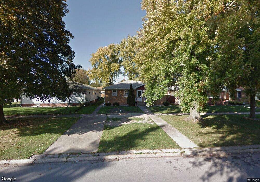
3508 178th St Lansing, IL 60438
Estimated Value: $189,247 - $241,000
3
Beds
1
Bath
1,250
Sq Ft
$165/Sq Ft
Est. Value
About This Home
This home is located at 3508 178th St, Lansing, IL 60438 and is currently estimated at $206,812, approximately $165 per square foot. 3508 178th St is a home located in Cook County with nearby schools including Coolidge Elementary School, Memorial Jr High School, and Thornton Fractnl So High School.
Ownership History
Date
Name
Owned For
Owner Type
Purchase Details
Closed on
Jan 2, 2024
Sold by
Milas Alexandru and Milas Valeria
Bought by
Milas Land Trust and Milas
Current Estimated Value
Purchase Details
Closed on
May 24, 1996
Sold by
Greischar Dennis and Moritz Arthur R
Bought by
Milas Alexandro and Milas Valeria
Home Financials for this Owner
Home Financials are based on the most recent Mortgage that was taken out on this home.
Original Mortgage
$80,000
Interest Rate
7.97%
Create a Home Valuation Report for This Property
The Home Valuation Report is an in-depth analysis detailing your home's value as well as a comparison with similar homes in the area
Home Values in the Area
Average Home Value in this Area
Purchase History
| Date | Buyer | Sale Price | Title Company |
|---|---|---|---|
| Milas Land Trust | -- | None Listed On Document | |
| Milas Alexandro | $96,000 | -- |
Source: Public Records
Mortgage History
| Date | Status | Borrower | Loan Amount |
|---|---|---|---|
| Previous Owner | Milas Alexandro | $80,000 |
Source: Public Records
Tax History
| Year | Tax Paid | Tax Assessment Tax Assessment Total Assessment is a certain percentage of the fair market value that is determined by local assessors to be the total taxable value of land and additions on the property. | Land | Improvement |
|---|---|---|---|---|
| 2025 | $1,429 | $5,938 | $1,275 | $4,663 |
| 2024 | $1,429 | $5,938 | $1,275 | $4,663 |
| 2023 | $989 | $5,938 | $1,275 | $4,663 |
| 2022 | $989 | $4,942 | $1,125 | $3,817 |
| 2021 | $1,019 | $4,942 | $1,125 | $3,817 |
| 2020 | $1,261 | $4,942 | $1,125 | $3,817 |
| 2019 | $1,862 | $4,986 | $1,050 | $3,936 |
| 2018 | $1,826 | $4,986 | $1,050 | $3,936 |
| 2017 | $1,861 | $4,986 | $1,050 | $3,936 |
| 2016 | $2,021 | $4,945 | $975 | $3,970 |
| 2015 | $1,846 | $4,945 | $975 | $3,970 |
| 2014 | $1,834 | $4,945 | $975 | $3,970 |
| 2013 | $1,962 | $5,671 | $975 | $4,696 |
Source: Public Records
Map
Nearby Homes
- 3520 Jackson St
- 17913 William St
- 17702 Bernadine St
- 17831 Community St
- 3645 177th Place
- 17821 Roy St
- 3617 Monroe St
- 3522 Washington St
- 3238 178th St
- 17831 Walter St
- 17855 Walter St
- 17926 Roy St
- 17614 Community St
- 17946 Roy St
- 3659 Madison St
- 17925 Walter St
- 17945 Maple St
- 17519 Community St
- 17552 Roy St
- 17714 Burnham Ave
Your Personal Tour Guide
Ask me questions while you tour the home.