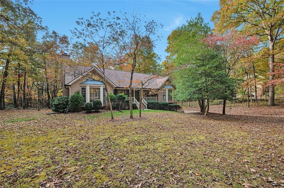
3509 Lower Bethany Rd Ball Ground, GA 30107
Estimated payment $2,458/month
Highlights
- View of Trees or Woods
- Deck
- Whirlpool Bathtub
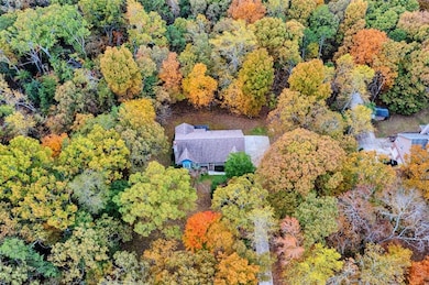
- 2.12 Acre Lot
- Traditional Architecture
- Private Yard
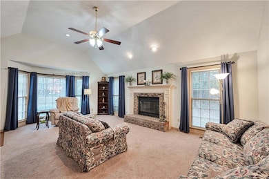
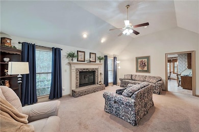
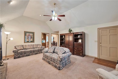
About This Home
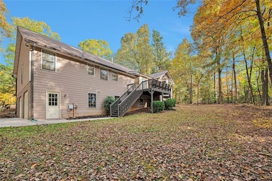
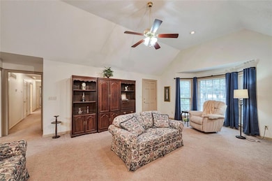
A rare opportunity in Cherokee County, Ranch style living with a rocking chair front porch on 2.12 acres. Offering three comfortable bedrooms, a fireside family room, spacious kitchen, and breakfast nook with a separate large dining room. The kitchen has been designed to have the deck access adjacent as to enjoy the wooded lot of nature, offering deer, squirrels & birds for entertainment. Private and serene; this property is ideal for a quiet lifestyle. Don't miss the generously sized built-in office in the basement with easy access to the two car garage with storage space. This is a unique find full of charm and located near Ball Ground and Canton!
Home Details
Home Type
- Single Family
Est. Annual Taxes
- $854
Year Built
- Built in 1993
Lot Details
- 2.12 Acre Lot
- Lot Dimensions are 124x49x404x78x135x392
- Private Entrance
- Private Yard
- Back and Front Yard
Parking
- 2 Car Attached Garage
- Drive Under Main Level
Home Design
- Traditional Architecture
- Block Foundation
- Composition Roof
- HardiePlank Type
Interior Spaces
- 1-Story Property
- Entrance Foyer
- Family Room with Fireplace
- Formal Dining Room
- Home Office
- Carpet
- Views of Woods
- Fire and Smoke Detector
Kitchen
- Breakfast Room
- Electric Range
- Microwave
- Dishwasher
- Laminate Countertops
- Wood Stained Kitchen Cabinets
Bedrooms and Bathrooms
- 3 Main Level Bedrooms
- 2 Full Bathrooms
- Dual Vanity Sinks in Primary Bathroom
- Whirlpool Bathtub
- Separate Shower in Primary Bathroom
Laundry
- Laundry on main level
- Dryer
- Washer
Unfinished Basement
- Walk-Out Basement
- Partial Basement
- Interior and Exterior Basement Entry
Outdoor Features
- Deck
- Rain Gutters
Schools
- Clayton Elementary School
- Teasley Middle School
- Cherokee High School
Utilities
- Forced Air Heating and Cooling System
- Dehumidifier
- Septic Tank
Listing and Financial Details
- Tax Lot 3936
- Assessor Parcel Number 14N19 044 D
Map
Home Values in the Area
Average Home Value in this Area
Tax History
| Year | Tax Paid | Tax Assessment Tax Assessment Total Assessment is a certain percentage of the fair market value that is determined by local assessors to be the total taxable value of land and additions on the property. | Land | Improvement |
|---|---|---|---|---|
| 2025 | $857 | $169,532 | $45,560 | $123,972 |
| 2024 | $828 | $156,932 | $32,560 | $124,372 |
| 2023 | $611 | $131,412 | $27,440 | $103,972 |
| 2022 | $686 | $101,412 | $23,400 | $78,012 |
| 2021 | $680 | $85,332 | $20,320 | $65,012 |
| 2020 | $654 | $77,532 | $20,320 | $57,212 |
| 2019 | $622 | $72,280 | $20,320 | $51,960 |
| 2018 | $610 | $69,680 | $20,320 | $49,360 |
| 2017 | $578 | $161,600 | $14,640 | $50,000 |
| 2016 | $559 | $152,000 | $14,640 | $46,160 |
| 2015 | $580 | $153,600 | $14,640 | $46,800 |
| 2014 | $561 | $148,900 | $14,040 | $45,520 |
Property History
| Date | Event | Price | List to Sale | Price per Sq Ft |
|---|---|---|---|---|
| 11/10/2025 11/10/25 | Pending | -- | -- | -- |
| 11/07/2025 11/07/25 | For Sale | $452,000 | 0.0% | $214 / Sq Ft |
| 11/06/2025 11/06/25 | Price Changed | $452,000 | -- | $214 / Sq Ft |
Purchase History
| Date | Type | Sale Price | Title Company |
|---|---|---|---|
| Warranty Deed | -- | -- | |
| Deed | $30,000 | -- |
Mortgage History
| Date | Status | Loan Amount | Loan Type |
|---|---|---|---|
| Previous Owner | $116,000 | Construction |
Source: First Multiple Listing Service (FMLS)
MLS Number: 7675851
APN: 014N19-00000-044-00D-0000
Disclaimer: Certain information contained herein is derived from information provided by parties other than Homes.com. All information provided is deemed reliable, but is not guaranteed to be accurate and should be independently verified.
![]() Listings identified with the FMLS IDX logo come from FMLS and are held by brokerage firms other than the owner of this website. The listing brokerage is identified in any listing details. Information is deemed reliable but is not guaranteed. If you believe any FMLS listing contains material that infringes your copyrighted work please visit www.fmls.com/dmca to review our DMCA policy and learn how to submit a takedown request. © 2025 First Multiple Listing Service, Inc.
Listings identified with the FMLS IDX logo come from FMLS and are held by brokerage firms other than the owner of this website. The listing brokerage is identified in any listing details. Information is deemed reliable but is not guaranteed. If you believe any FMLS listing contains material that infringes your copyrighted work please visit www.fmls.com/dmca to review our DMCA policy and learn how to submit a takedown request. © 2025 First Multiple Listing Service, Inc.
