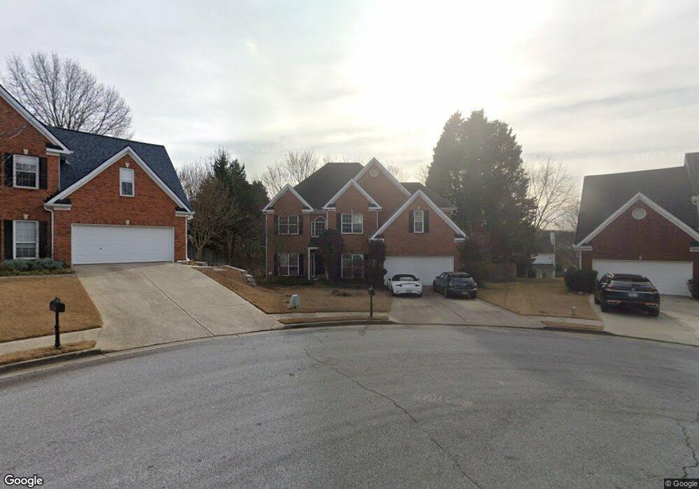
3509 Rolling Hills Dr Unit 1 Suwanee, GA 30024
Estimated Value: $542,000 - $611,000
4
Beds
3
Baths
3,062
Sq Ft
$187/Sq Ft
Est. Value
About This Home
This home is located at 3509 Rolling Hills Dr Unit 1, Suwanee, GA 30024 and is currently estimated at $572,017, approximately $186 per square foot. 3509 Rolling Hills Dr Unit 1 is a home located in Gwinnett County with nearby schools including Suwanee Elementary School, North Gwinnett Middle School, and North Gwinnett High School.
Ownership History
Date
Name
Owned For
Owner Type
Purchase Details
Closed on
May 27, 1999
Sold by
Bowen & Bowen Construction Co In
Bought by
Huffman Sharron T
Current Estimated Value
Home Financials for this Owner
Home Financials are based on the most recent Mortgage that was taken out on this home.
Original Mortgage
$184,687
Outstanding Balance
$47,116
Interest Rate
7.13%
Mortgage Type
New Conventional
Estimated Equity
$524,901
Create a Home Valuation Report for This Property
The Home Valuation Report is an in-depth analysis detailing your home's value as well as a comparison with similar homes in the area
Home Values in the Area
Average Home Value in this Area
Purchase History
| Date | Buyer | Sale Price | Title Company |
|---|---|---|---|
| Huffman Sharron T | $201,800 | -- |
Source: Public Records
Mortgage History
| Date | Status | Borrower | Loan Amount |
|---|---|---|---|
| Open | Huffman Sharron T | $184,687 |
Source: Public Records
Tax History Compared to Growth
Tax History
| Year | Tax Paid | Tax Assessment Tax Assessment Total Assessment is a certain percentage of the fair market value that is determined by local assessors to be the total taxable value of land and additions on the property. | Land | Improvement |
|---|---|---|---|---|
| 2025 | $5,726 | $221,320 | $38,000 | $183,320 |
| 2024 | $5,256 | $190,600 | $36,000 | $154,600 |
| 2023 | $5,256 | $190,600 | $36,000 | $154,600 |
| 2022 | $5,131 | $186,160 | $33,600 | $152,560 |
| 2021 | $4,202 | $137,560 | $27,320 | $110,240 |
| 2020 | $4,063 | $129,680 | $24,200 | $105,480 |
| 2019 | $3,961 | $129,680 | $24,200 | $105,480 |
| 2018 | $3,669 | $115,880 | $28,400 | $87,480 |
| 2016 | $3,385 | $101,760 | $26,000 | $75,760 |
| 2015 | $3,216 | $92,560 | $21,200 | $71,360 |
| 2014 | $3,387 | $99,600 | $21,200 | $78,400 |
Source: Public Records
Map
Nearby Homes
- 347 Canterbury Place Dr
- 3540 Hickory Branch Trail
- 189 Rutlidge Park Ln
- 200 Satellite Blvd NE
- 3645 Hickory Branch Trail Unit 1
- 515 Morning Creek Ln
- 115 Leaf Lake Dr
- 325 Morning Mist Walk Unit 2
- 3355 Smithtown Rd
- 3275 Smithtown Rd
- 3255 Smithtown Rd Unit LOT 3
- 3265 Smithtown Rd Unit LOT 4
- 3245 Smithtown Rd
- 3265 Smithtown Lot 4 Rd
- 3255 Smithtown Lot 3 Rd
- 3235 Smithtown Rd
- 3240 Smithtown Rd
- 682 Montglade Ct Unit 1
- 3612 Brookefall Ct
- 3519 Rolling Hills Dr
- 3508 Rolling Hills Dr Unit 1
- 3411 Kirkwell Place Unit 1
- 3421 Kirkwell Place Unit 1
- 426 Canterbury Place Dr
- 436 Canterbury Place Dr
- 3529 Rolling Hills Dr Unit 1
- 3431 Kirkwell Place
- 3518 Rolling Hills Dr
- 416 Canterbury Place Dr
- 3401 Kirkwell Place
- 3451 Kirkwell Place
- 446 Canterbury Place Dr Unit 1
- 3528 Rolling Hills Dr Unit 1
- 406 Canterbury Place Dr
- 3471 Kirkwell Place
- 3539 Rolling Hills Dr
- 3402 Kirkwell Place
- 456 Canterbury Place Dr
- 3481 Kirkwell Place