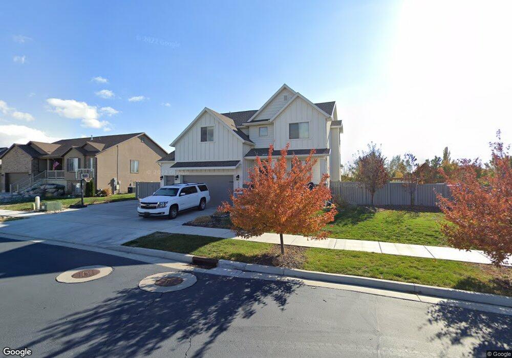
3509 W 550 N Unit 104 Layton, UT 84041
Estimated Value: $774,000 - $829,000
4
Beds
3
Baths
4,273
Sq Ft
$189/Sq Ft
Est. Value
About This Home
This home is located at 3509 W 550 N Unit 104, Layton, UT 84041 and is currently estimated at $806,754, approximately $188 per square foot. 3509 W 550 N Unit 104 is a home located in Davis County with nearby schools including Sand Springs Elementary School, Legacy Junior High School, and Layton High School.
Ownership History
Date
Name
Owned For
Owner Type
Purchase Details
Closed on
Oct 4, 2019
Sold by
Priest Kylee A
Bought by
Priest Kylee A and Priest Aaron Spencer
Current Estimated Value
Home Financials for this Owner
Home Financials are based on the most recent Mortgage that was taken out on this home.
Original Mortgage
$363,800
Outstanding Balance
$318,003
Interest Rate
3.5%
Mortgage Type
New Conventional
Estimated Equity
$488,751
Purchase Details
Closed on
Jun 13, 2016
Sold by
Nilson & Co Inc
Bought by
Robinson Scott and Robinson Laura
Create a Home Valuation Report for This Property
The Home Valuation Report is an in-depth analysis detailing your home's value as well as a comparison with similar homes in the area
Home Values in the Area
Average Home Value in this Area
Purchase History
| Date | Buyer | Sale Price | Title Company |
|---|---|---|---|
| Priest Kylee A | -- | None Available | |
| Priest Kylee A | -- | First American Title | |
| Robinson Scott | -- | Stewart Title | |
| Nilson & Co Inc | -- | Stewart Title |
Source: Public Records
Mortgage History
| Date | Status | Borrower | Loan Amount |
|---|---|---|---|
| Open | Priest Kylee A | $363,800 |
Source: Public Records
Tax History Compared to Growth
Tax History
| Year | Tax Paid | Tax Assessment Tax Assessment Total Assessment is a certain percentage of the fair market value that is determined by local assessors to be the total taxable value of land and additions on the property. | Land | Improvement |
|---|---|---|---|---|
| 2025 | $4,103 | $430,650 | $126,202 | $304,448 |
| 2024 | $3,870 | $409,200 | $136,260 | $272,940 |
| 2023 | $3,772 | $703,000 | $141,605 | $561,395 |
| 2022 | $4,027 | $407,550 | $83,995 | $323,555 |
| 2021 | $3,584 | $541,000 | $125,987 | $415,013 |
| 2020 | $3,446 | $499,000 | $107,199 | $391,801 |
| 2019 | $3,497 | $496,000 | $107,080 | $388,920 |
| 2018 | $3,174 | $452,000 | $94,237 | $357,763 |
| 2016 | $953 | $70,027 | $70,027 | $0 |
Source: Public Records
Map
Nearby Homes
- 3509 W 550 N
- 3489 W 550 N Unit 105
- 3527 W 550 N Unit 103
- 555 N 3500 W
- 481 N 3475 W Unit 24
- 481 N 3475 W
- 3473 W 550 N
- 3473 W 550 N Unit 201
- 556 N 3500 W Unit 106
- 3547 W 550 N Unit 102
- 464 N 3550 W
- 3468 W 550 N
- 569 N 3500 W Unit 112
- 471 N 3550 W
- 552 N 3550 W
- 568 N 3500 W Unit 107
- 3453 W 550 N
- 482 N 3475 W
- 463 N 3475 W
- 567 N 3450 W