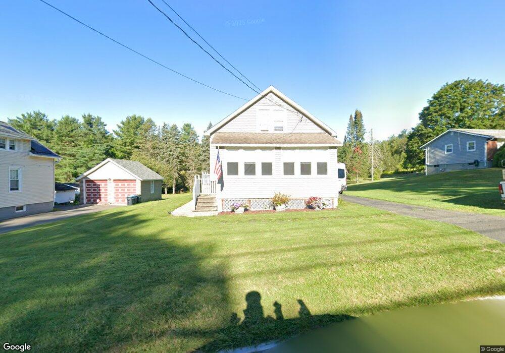
351 Benedict Rd Pittsfield, MA 01201
Estimated Value: $230,000 - $255,000
2
Beds
1
Bath
1,068
Sq Ft
$226/Sq Ft
Est. Value
About This Home
This home is located at 351 Benedict Rd, Pittsfield, MA 01201 and is currently estimated at $241,568, approximately $226 per square foot. 351 Benedict Rd is a home located in Berkshire County with nearby schools including Allendale Elementary School, Theodore Herberg Middle School, and Pittsfield High School.
Ownership History
Date
Name
Owned For
Owner Type
Purchase Details
Closed on
Jul 9, 2004
Sold by
Demary Ann Marie and Demary Dennis R
Bought by
Gaffney James F and Gaffney Penny S
Current Estimated Value
Home Financials for this Owner
Home Financials are based on the most recent Mortgage that was taken out on this home.
Original Mortgage
$76,500
Outstanding Balance
$38,468
Interest Rate
6.32%
Mortgage Type
Purchase Money Mortgage
Estimated Equity
$203,100
Purchase Details
Closed on
Sep 29, 1998
Sold by
Young Ida S and Peck Priscilla
Bought by
Demary Dennis R and Demary Ann Marie
Home Financials for this Owner
Home Financials are based on the most recent Mortgage that was taken out on this home.
Original Mortgage
$60,000
Interest Rate
6.87%
Mortgage Type
Purchase Money Mortgage
Create a Home Valuation Report for This Property
The Home Valuation Report is an in-depth analysis detailing your home's value as well as a comparison with similar homes in the area
Home Values in the Area
Average Home Value in this Area
Purchase History
| Date | Buyer | Sale Price | Title Company |
|---|---|---|---|
| Gaffney James F | $85,000 | -- | |
| Demary Dennis R | $72,000 | -- |
Source: Public Records
Mortgage History
| Date | Status | Borrower | Loan Amount |
|---|---|---|---|
| Open | Demary Dennis R | $76,500 | |
| Previous Owner | Demary Dennis R | $60,000 |
Source: Public Records
Tax History
| Year | Tax Paid | Tax Assessment Tax Assessment Total Assessment is a certain percentage of the fair market value that is determined by local assessors to be the total taxable value of land and additions on the property. | Land | Improvement |
|---|---|---|---|---|
| 2025 | $3,482 | $194,100 | $67,800 | $126,300 |
| 2024 | $3,249 | $176,100 | $67,800 | $108,300 |
| 2023 | $3,059 | $167,000 | $67,800 | $99,200 |
| 2022 | $2,791 | $150,400 | $63,000 | $87,400 |
| 2021 | $2,560 | $133,000 | $63,000 | $70,000 |
| 2020 | $2,330 | $118,200 | $50,400 | $67,800 |
| 2019 | $2,173 | $111,900 | $46,500 | $65,400 |
| 2018 | $1,893 | $94,600 | $46,500 | $48,100 |
| 2017 | $1,930 | $98,300 | $48,500 | $49,800 |
| 2016 | $1,600 | $85,300 | $36,800 | $48,500 |
| 2015 | $1,541 | $85,300 | $36,800 | $48,500 |
Source: Public Records
Map
Nearby Homes
- 123 Broadview Terrace
- 96 Broadview Terrace
- 156 Draper Ave
- 74 Norman Ave
- 0 Stanley Ave
- 71 Dickinson Ave
- 40 Roland St
- 21 Ensign Ave
- 121 Elberon Ave
- 36 Pittsfield Ave
- I11001904 Scammell Ave
- 81 Dartmouth St Unit 108
- 0 Faucett Ln
- 91 Dalton Ave
- 258 Dalton Ave
- 326 Dalton Ave
- 0 Brown St
- 0 Parker St
- 29 Glenwood Ave
- 5 Marco Dr
- 345 Benedict Rd
- 357 Benedict Rd
- 341 Benedict Rd
- 340 Benedict Rd
- 335 Benedict Rd
- 369 Benedict Rd
- Lt#307 Benedict Rd
- 0 Benedict Rd
- 331 Benedict Rd
- 373 Benedict Rd
- 332 Benedict Rd
- 329 Benedict Rd
- 270 Allengate Ave
- 385 Benedict Rd
- 328 Benedict Rd
- 277 Allengate Ave
- 266 Allengate Ave
- 391 Benedict Rd
- 320 Benedict Rd
- 262 Allengate Ave
Your Personal Tour Guide
Ask me questions while you tour the home.