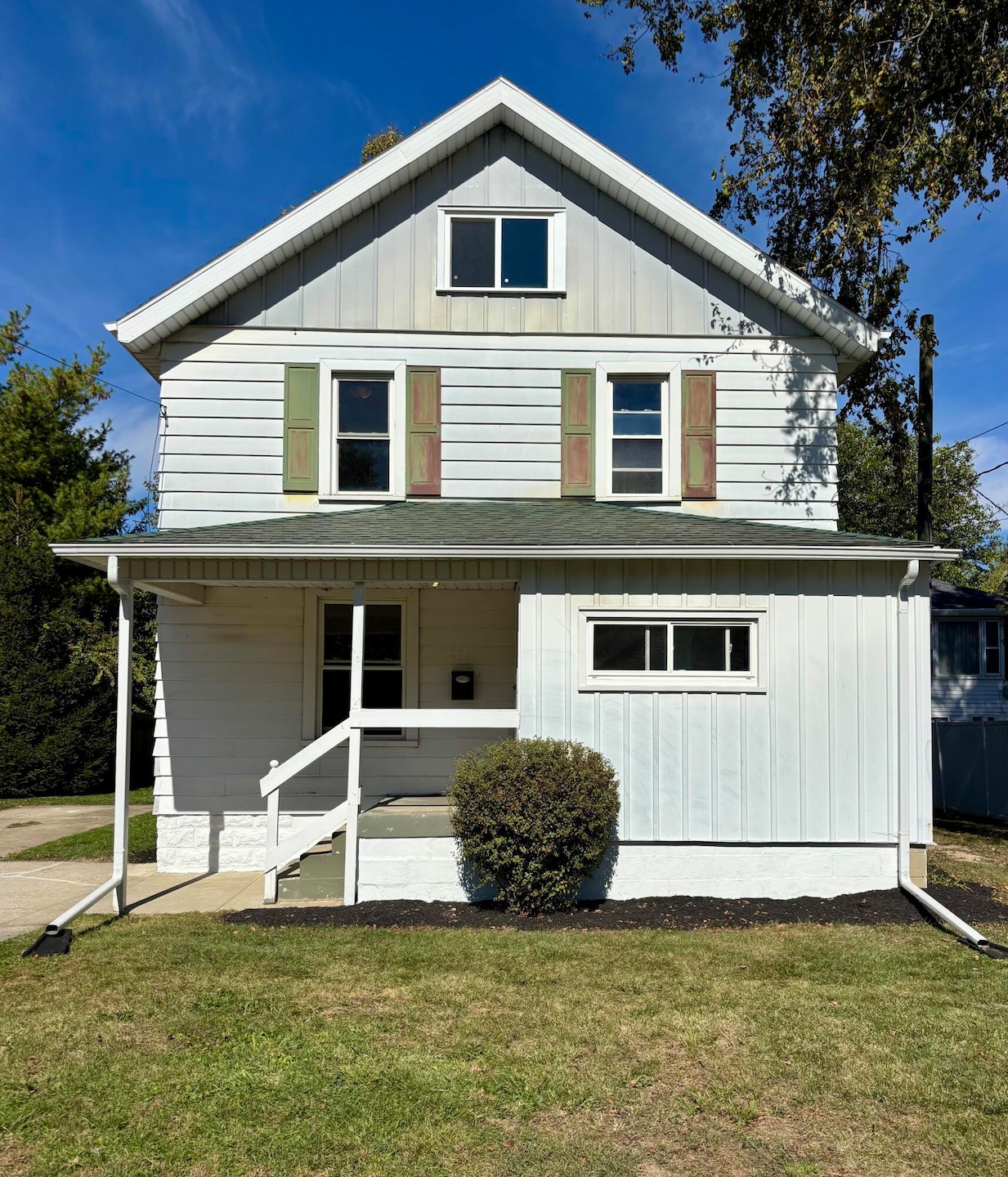
351 E Walnut St Wauseon, OH 43567
Estimated payment $1,042/month
Highlights
- Deck
- Mud Room
- Crown Molding
- Traditional Architecture
- No HOA
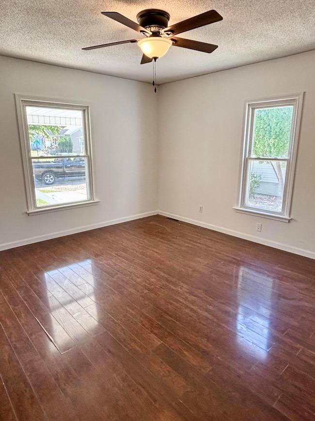
- Living Room
About This Home
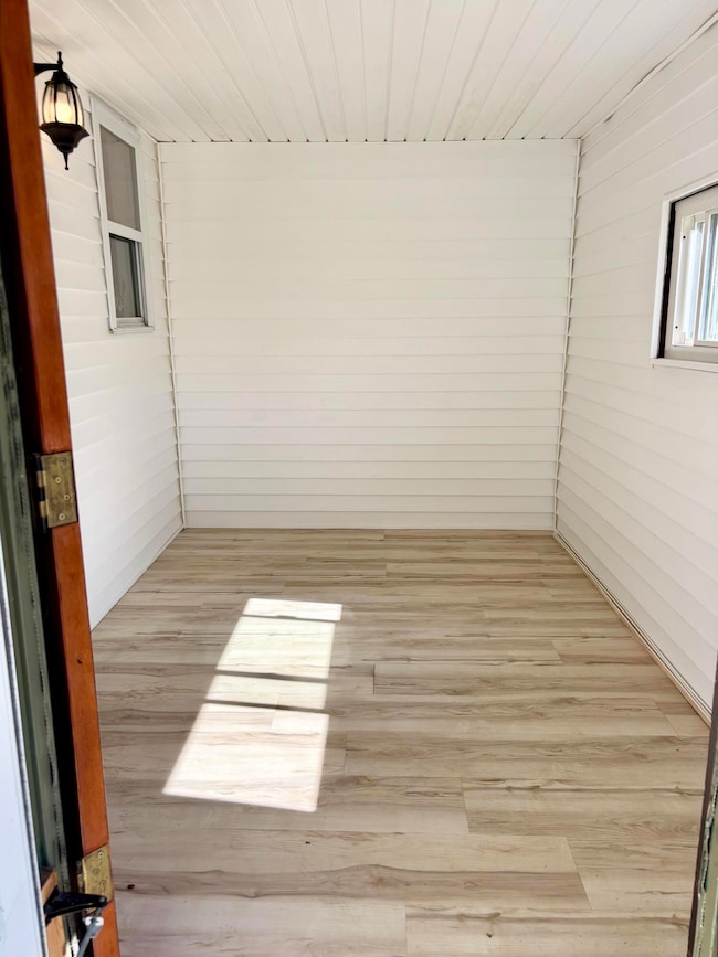
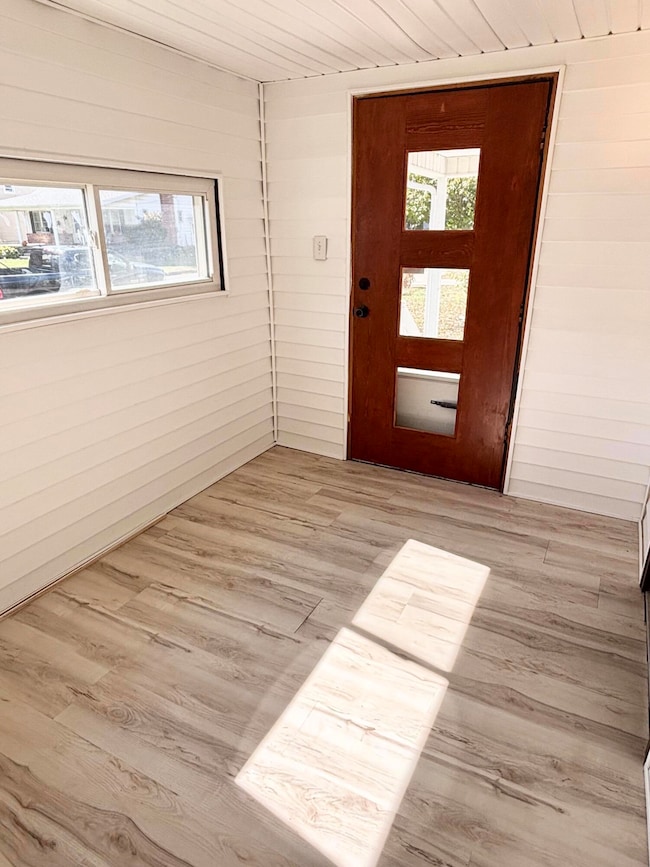
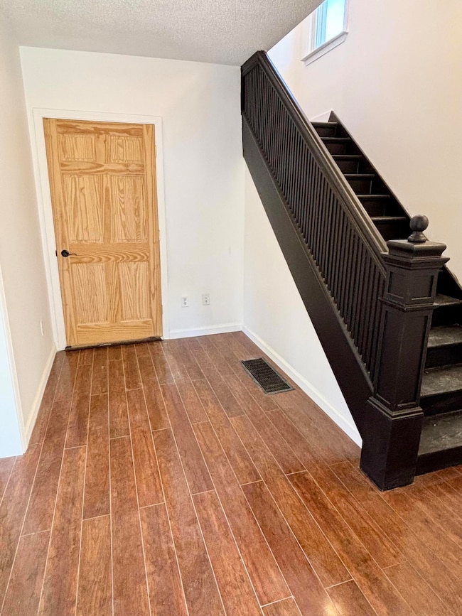
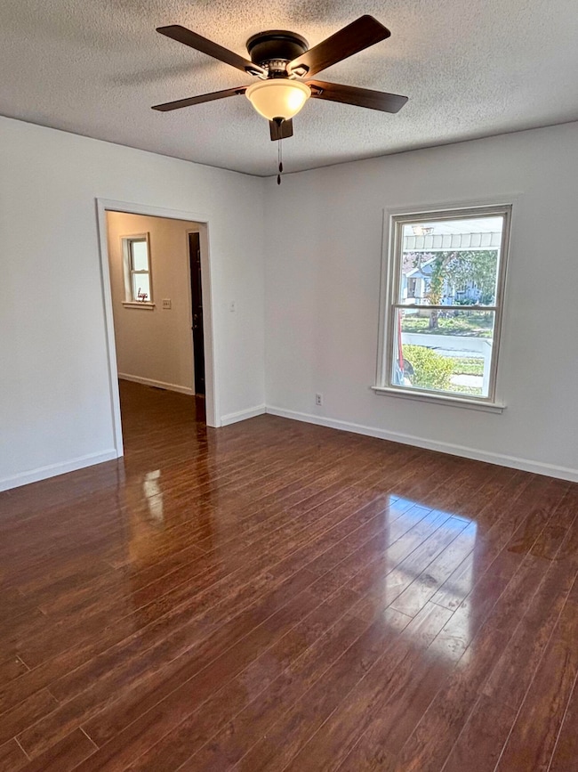
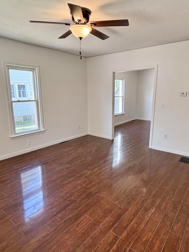
A charming home in the heart of Wauseon! You'll love the curb appeal! Move-in ready! 4 bedrooms! The enclosed front porch leads to a beautiful entry and staircase. The large living room & dining room both have ceiling fans. Freshly painted throughout with new trim & light fixtures! The eat-in kitchen boasts a new dishwasher, granite counters, & tile backsplash! The mudroom off the kitchen leads to the brand new wooden back deck. Plus a huge first floor laundry room! Updated bathroom, including new shower surround/tub & toilet. The pull down attic access is in the upstairs hallway & the attic is completely floored. Great storage! Brand new furnace & glass block windows. You'll have peace of mind with the new block foundation! 200 amp electrical. Replacement vinyl windows. Plus a private backyard with mature trees on a quarter-acre lot! There's a lot to appreciate here! Set your showing today!
Listing Agent
Jodi Harrington
Key Realty Brokerage Phone: 419-265-5634 Listed on: 10/14/2025
Home Details
Home Type
- Single Family
Year Built
- Built in 1900
Lot Details
- 10,380 Sq Ft Lot
- Lot Dimensions are 60x173
Home Design
- Traditional Architecture
- Shingle Roof
- Aluminum Siding
Interior Spaces
- 1,644 Sq Ft Home
- 2-Story Property
- Crown Molding
- Ceiling Fan
- Window Screens
- Mud Room
- Entrance Foyer
- Living Room
- Dining Room
- Utility Room
- Fire and Smoke Detector
- Dishwasher
Flooring
- Tile
- Vinyl
Bedrooms and Bathrooms
- 4 Bedrooms
- Primary Bedroom Upstairs
- 1 Full Bathroom
Laundry
- Laundry Room
- Laundry on main level
- Washer and Electric Dryer Hookup
Parking
- Driveway
- Off-Street Parking
Outdoor Features
- Deck
Schools
- Wauseon Elementary School
- None Middle School
- Wauseon High School
Utilities
- No Cooling
- Forced Air Heating System
- Heating System Uses Natural Gas
- Cable TV Available
Community Details
- No Home Owners Association
- Maplewood Addn. Subdivision
Listing and Financial Details
- Assessor Parcel Number 06-011520-00.000
Map
Home Values in the Area
Average Home Value in this Area
Tax History
| Year | Tax Paid | Tax Assessment Tax Assessment Total Assessment is a certain percentage of the fair market value that is determined by local assessors to be the total taxable value of land and additions on the property. | Land | Improvement |
|---|---|---|---|---|
| 2024 | $1,204 | $38,050 | $7,320 | $30,730 |
| 2023 | $1,945 | $38,050 | $7,320 | $30,730 |
| 2022 | $1,724 | $28,840 | $6,090 | $22,750 |
| 2021 | $1,834 | $28,840 | $6,090 | $22,750 |
| 2020 | $1,696 | $28,840 | $6,090 | $22,750 |
| 2019 | $1,646 | $27,580 | $6,090 | $21,490 |
| 2018 | $1,434 | $27,580 | $6,090 | $21,490 |
| 2017 | $1,416 | $27,580 | $6,090 | $21,490 |
| 2016 | $1,361 | $24,050 | $6,090 | $17,960 |
| 2015 | $1,275 | $24,050 | $6,090 | $17,960 |
| 2014 | $1,213 | $24,050 | $6,090 | $17,960 |
| 2013 | $1,569 | $28,780 | $5,500 | $23,280 |
Property History
| Date | Event | Price | List to Sale | Price per Sq Ft |
|---|---|---|---|---|
| 11/13/2025 11/13/25 | Price Changed | $174,900 | -5.5% | $106 / Sq Ft |
| 10/14/2025 10/14/25 | For Sale | $185,000 | -- | $113 / Sq Ft |
Purchase History
| Date | Type | Sale Price | Title Company |
|---|---|---|---|
| Sheriffs Deed | $65,900 | None Listed On Document | |
| Interfamily Deed Transfer | -- | None Available | |
| Land Contract | $80,867 | None Available | |
| Deed | $49,500 | -- | |
| Deed | -- | -- |
Mortgage History
| Date | Status | Loan Amount | Loan Type |
|---|---|---|---|
| Previous Owner | $80,367 | Seller Take Back | |
| Previous Owner | $49,500 | New Conventional |
Source: Northwest Ohio Real Estate Information Service (NORIS)
MLS Number: 10000083
APN: 06-011520-00.000
Disclaimer: Certain information contained herein is derived from information provided by parties other than Homes.com. All information provided is deemed reliable, but is not guaranteed to be accurate and should be independently verified.
![]() IDX information is provided exclusively for personal, non-commercial use, and may not be used for any purpose other than to identify prospective properties consumers may be interested in purchasing. Information is deemed reliable but not guaranteed. ©2026 NORIS. All rights reserved.
IDX information is provided exclusively for personal, non-commercial use, and may not be used for any purpose other than to identify prospective properties consumers may be interested in purchasing. Information is deemed reliable but not guaranteed. ©2026 NORIS. All rights reserved.
- 316 E Oak St
- 203 E Oak St
- 212 Jefferson St
- 625 Hemlock St
- 635 E Leggett St
- 231 W Chestnut St
- 252 W Chestnut St
- 263 W Chestnut St
- 420 Clover Ln
- 594 Douglas Dr
- 1066 Seneca Dr
- 1062 Seneca Dr
- 1067 Seneca Dr
- 749 Parkside Dr
- 744 Fairway Dr Unit 29
- 744 Fairway Dr Unit 26
- 1338 N Park Ln
- 760 Airport Hwy
- 460 Airport Hwy
- 14578 U S 20a
- 1112 Oakview Dr
- 505 Oakview Dr
- 2400 Glen Arbors Dr
- 1800 Oakwood Ave
- 129 E Main St Unit 2
- 238 Gorham St
- 811 W Coomer St Unit 8
- 811 W Coomer St Unit 2
- 811 W Coomer St Unit 3
- 811 W Coomer St Unit 7
- 111 Lincoln Ave Unit C
- 125 Shire Crest
- 10815 Waterville St
- 10815 Waterville St
- 1501 Pray Blvd
- 10 E Colony Dr
- 6225 Waterville Monclova Rd
- 3017 Coffeetree Ln
- 913 Farnsworth Rd Unit C
- 936 E Wilson St
Ask me questions while you tour the home.