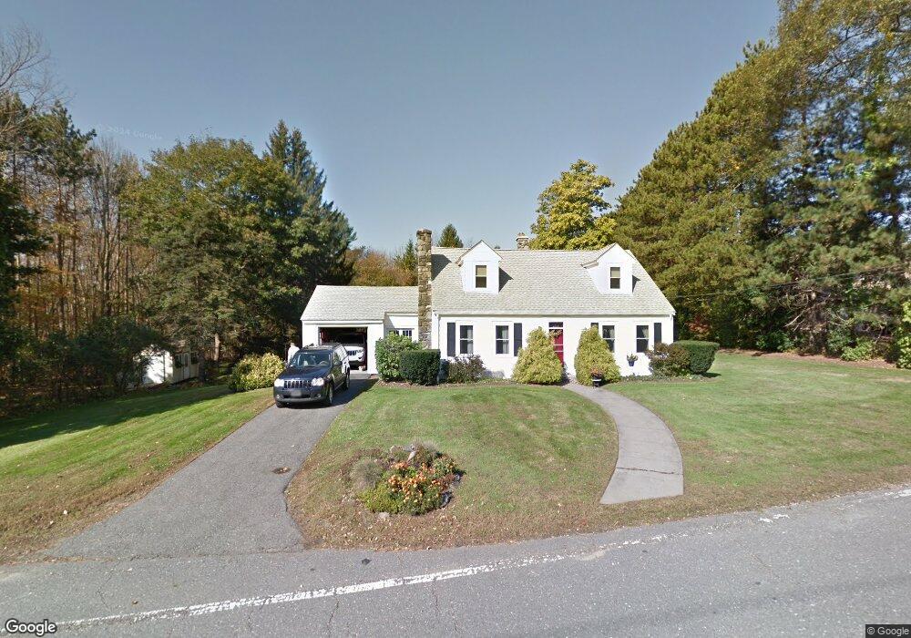
351 Lancaster St West Boylston, MA 01583
Estimated Value: $509,150 - $576,000
4
Beds
2
Baths
1,764
Sq Ft
$312/Sq Ft
Est. Value
About This Home
This home is located at 351 Lancaster St, West Boylston, MA 01583 and is currently estimated at $549,788, approximately $311 per square foot. 351 Lancaster St is a home located in Worcester County with nearby schools including Major Edwards Elementary School and West Boylston Junior/Senior High School.
Ownership History
Date
Name
Owned For
Owner Type
Purchase Details
Closed on
Jul 17, 2017
Sold by
Meleski Gerald
Bought by
Gerald Meleski Ret
Current Estimated Value
Purchase Details
Closed on
Feb 6, 2009
Sold by
Meleski Frances G and Meleski Gerald
Bought by
Meleski Gerald
Create a Home Valuation Report for This Property
The Home Valuation Report is an in-depth analysis detailing your home's value as well as a comparison with similar homes in the area
Home Values in the Area
Average Home Value in this Area
Purchase History
| Date | Buyer | Sale Price | Title Company |
|---|---|---|---|
| Gerald Meleski Ret | -- | -- | |
| Meleski Gerald | -- | -- |
Source: Public Records
Tax History Compared to Growth
Tax History
| Year | Tax Paid | Tax Assessment Tax Assessment Total Assessment is a certain percentage of the fair market value that is determined by local assessors to be the total taxable value of land and additions on the property. | Land | Improvement |
|---|---|---|---|---|
| 2025 | $59 | $428,600 | $126,100 | $302,500 |
| 2024 | $5,639 | $381,500 | $126,100 | $255,400 |
| 2023 | $5,741 | $368,500 | $124,100 | $244,400 |
| 2022 | $5,346 | $302,400 | $124,100 | $178,300 |
| 2021 | $69 | $278,500 | $108,000 | $170,500 |
| 2020 | $5,078 | $273,300 | $108,000 | $165,300 |
| 2019 | $72 | $259,900 | $108,000 | $151,900 |
| 2018 | $3,049 | $254,500 | $108,000 | $146,500 |
| 2017 | $4,533 | $241,100 | $108,000 | $133,100 |
| 2016 | $4,299 | $233,000 | $100,400 | $132,600 |
| 2015 | $4,110 | $224,100 | $99,600 | $124,500 |
Source: Public Records
Map
Nearby Homes
- 136 Sterling St Unit A3
- 21 Myrtle Ave
- 2 Lakeview Ave
- 101 Sterling St
- 12 Winthrop St
- 20 Winthrop St
- 0 Boutelle Rd
- 16 N Main St
- 112 N Main St
- 223 Worcester Rd
- 64 Worcester St
- 19 Fitch Farm Rd
- 26 Townsend Dr
- 61 Boutelle Rd
- 113 Newton St
- 1 Harmony Ln Unit 4
- 2 Harmony Ln Unit 1
- 6 Belmont Dr
- 20 Woodside Dr
- 152 Worcester St Unit 8
- 1 Campground Rd
- 357 Lancaster St
- 11 Campground Rd
- 354 Lancaster St
- 17 Campground Rd
- 335 Lancaster St
- 371 Lancaster St Unit 12
- 371 Lancaster St Unit 11
- 371 Lancaster St Unit 10
- 371 Lancaster St Unit 9
- 371 Lancaster St Unit 8
- 371 Lancaster St Unit 7
- 371 Lancaster St Unit 6
- 371 Lancaster St Unit 5
- 371 Lancaster St Unit 4
- 371 Lancaster St Unit 3
- 371 Lancaster St Unit 2
- 371 Lancaster St Unit 1
- 371 Lancaster St Unit 371
- 330 Lancaster St