Estimated Value: $175,000 - $193,773
3
Beds
2
Baths
1,600
Sq Ft
$117/Sq Ft
Est. Value
About This Home
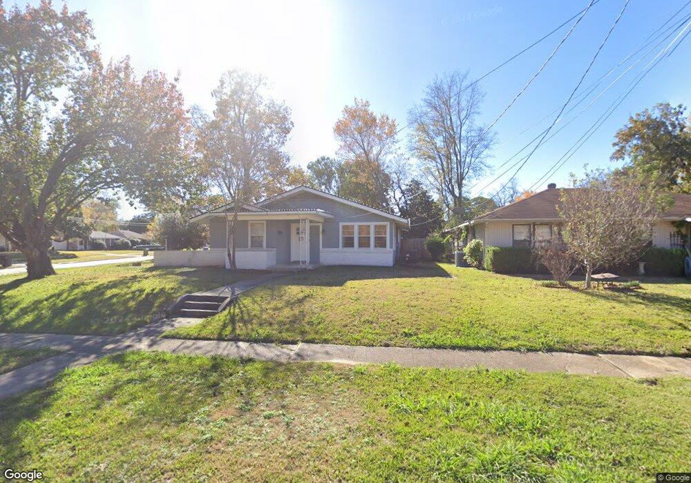
This home is located at 351 Leland Ave, Shreveport, LA 71105 and is currently estimated at $186,693, approximately $116 per square foot. 351 Leland Ave is a home located in Caddo Parish with nearby schools including Fairfield Magnet School, Judson Fundamental Elementary School, and Eden Gardens Fundamental Elementary School.
Ownership History
Date
Name
Owned For
Owner Type
Purchase Details
Closed on
Nov 16, 2021
Sold by
Hightower Jonathon and Hightower Holly
Bought by
Graham Christopher K
Current Estimated Value
Home Financials for this Owner
Home Financials are based on the most recent Mortgage that was taken out on this home.
Original Mortgage
$179,685
Outstanding Balance
$164,650
Interest Rate
2.99%
Mortgage Type
FHA
Estimated Equity
$22,043
Purchase Details
Closed on
Jan 30, 2019
Sold by
Caddo County Sheriff
Bought by
Regions Bank
Create a Home Valuation Report for This Property
The Home Valuation Report is an in-depth analysis detailing your home's value as well as a comparison with similar homes in the area
Home Values in the Area
Average Home Value in this Area
Purchase History
| Date | Buyer | Sale Price | Title Company |
|---|---|---|---|
| Graham Christopher K | $183,000 | None Available | |
| Regions Bank | $46,667 | None Available |
Source: Public Records
Mortgage History
| Date | Status | Borrower | Loan Amount |
|---|---|---|---|
| Open | Graham Christopher K | $179,685 |
Source: Public Records
Tax History Compared to Growth
Tax History
| Year | Tax Paid | Tax Assessment Tax Assessment Total Assessment is a certain percentage of the fair market value that is determined by local assessors to be the total taxable value of land and additions on the property. | Land | Improvement |
|---|---|---|---|---|
| 2024 | $2,277 | $14,605 | $4,290 | $10,315 |
| 2023 | $2,144 | $13,451 | $4,085 | $9,366 |
| 2022 | $2,144 | $13,451 | $4,085 | $9,366 |
| 2021 | $2,111 | $13,451 | $4,085 | $9,366 |
| 2020 | $2,111 | $13,451 | $4,085 | $9,366 |
| 2019 | $2,107 | $13,029 | $4,085 | $8,944 |
| 2018 | $1,678 | $13,029 | $4,085 | $8,944 |
| 2017 | $1,088 | $6,620 | $1,320 | $5,300 |
| 2015 | -- | $6,620 | $1,320 | $5,300 |
| 2014 | -- | $6,620 | $1,320 | $5,300 |
| 2013 | -- | $6,620 | $1,320 | $5,300 |
Source: Public Records
Map
Nearby Homes
- 351 Arthur Ave
- 4436 Clingman Dr
- 4622 Tibbs St
- 4606 Tibbs St
- 225 Symphony Ln
- 218 Clearwood Ln
- 255 Leland Dr
- 237 Pierremont Rd
- 381 Leo Ave
- 236 Leland Dr
- 233 Roma Dr
- 462 Gloria Ave
- 261 Pierremont Rd
- 4019 Akard Ave
- 271 Carrollton Ave
- 5918 Fern Ave
- 4421 Fern Ave
- 233 Charles Ave
- 6210 Kathy Ln
- 382 Ockley Dr
- 353 Leland Ave
- 354 Sandefur Dr
- 352 Sandefur Dr
- 355 Leland Ave
- 356 Sandefur Dr
- 4609 Steere Dr
- 358 Sandefur Dr
- 352 Leland Ave
- 4615 Steere Dr
- 357 Leland Ave
- 354 Leland Ave
- 4553 Steere Dr
- 4553 Steere Dr Unit 6-C
- 360 Sandefur Dr
- 4621 Steere Dr
- 356 Leland Ave
- 4547 Steere Dr
- 359 Leland Ave
- 351 Sandefur Dr
- 362 Sandefur Dr