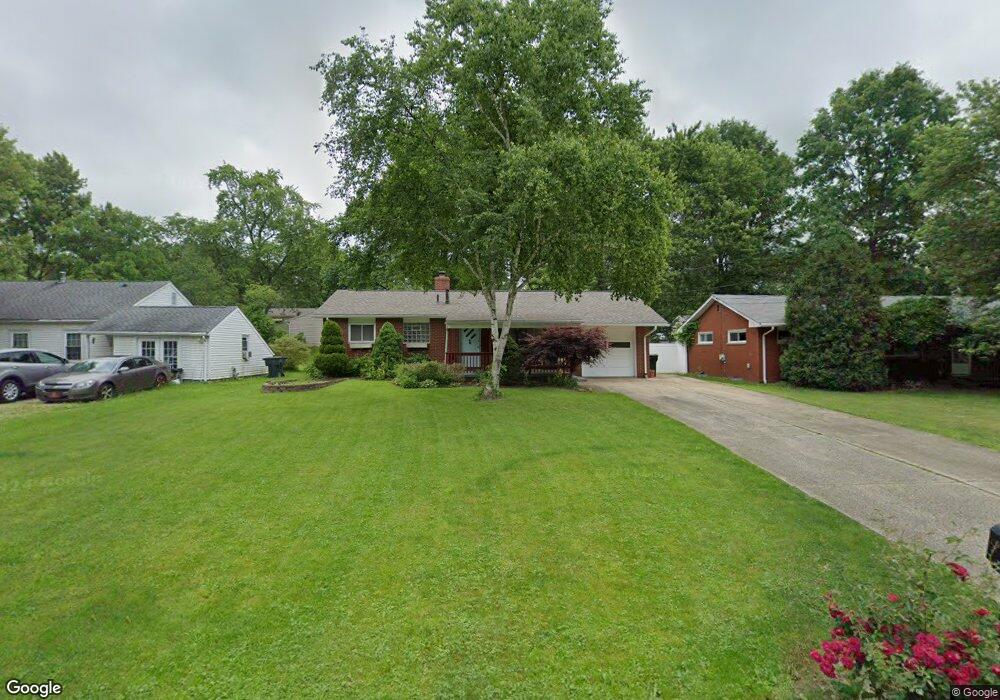
351 N Avon Ave Wadsworth, OH 44281
Estimated Value: $220,000 - $245,000
3
Beds
2
Baths
1,190
Sq Ft
$193/Sq Ft
Est. Value
About This Home
This home is located at 351 N Avon Ave, Wadsworth, OH 44281 and is currently estimated at $229,949, approximately $193 per square foot. 351 N Avon Ave is a home located in Medina County with nearby schools including Isham Memorial Elementary School, Central Intermediate School, and Wadsworth Middle School.
Ownership History
Date
Name
Owned For
Owner Type
Purchase Details
Closed on
Jun 18, 2004
Sold by
Varney Joanne
Bought by
Sideris George B and Kakava Argyroula
Current Estimated Value
Home Financials for this Owner
Home Financials are based on the most recent Mortgage that was taken out on this home.
Original Mortgage
$112,100
Outstanding Balance
$56,481
Interest Rate
6.46%
Mortgage Type
Purchase Money Mortgage
Estimated Equity
$173,468
Purchase Details
Closed on
Jan 5, 2004
Sold by
Estate Of Roy Burgess
Bought by
Varney Joanne and The Roy Burgess Revocable Living Trust
Create a Home Valuation Report for This Property
The Home Valuation Report is an in-depth analysis detailing your home's value as well as a comparison with similar homes in the area
Home Values in the Area
Average Home Value in this Area
Purchase History
| Date | Buyer | Sale Price | Title Company |
|---|---|---|---|
| Sideris George B | $118,000 | -- | |
| Varney Joanne | -- | -- |
Source: Public Records
Mortgage History
| Date | Status | Borrower | Loan Amount |
|---|---|---|---|
| Open | Sideris George B | $112,100 |
Source: Public Records
Tax History Compared to Growth
Tax History
| Year | Tax Paid | Tax Assessment Tax Assessment Total Assessment is a certain percentage of the fair market value that is determined by local assessors to be the total taxable value of land and additions on the property. | Land | Improvement |
|---|---|---|---|---|
| 2024 | $2,252 | $51,120 | $19,690 | $31,430 |
| 2023 | $2,252 | $51,120 | $19,690 | $31,430 |
| 2022 | $2,259 | $51,120 | $19,690 | $31,430 |
| 2021 | $2,134 | $40,890 | $15,750 | $25,140 |
| 2020 | $1,880 | $40,890 | $15,750 | $25,140 |
| 2019 | $1,883 | $40,890 | $15,750 | $25,140 |
| 2018 | $1,622 | $33,020 | $14,370 | $18,650 |
| 2017 | $1,623 | $33,020 | $14,370 | $18,650 |
| 2016 | $1,650 | $33,020 | $14,370 | $18,650 |
| 2015 | $1,587 | $30,290 | $13,180 | $17,110 |
| 2014 | $1,613 | $30,290 | $13,180 | $17,110 |
| 2013 | $1,615 | $30,290 | $13,180 | $17,110 |
Source: Public Records
Map
Nearby Homes
- 0 Rosalind Ave
- 406 Ivanhoe Ave
- 357 West St
- 279 Waverly Ave
- 357 Leatherman Rd
- 174 W Prospect St
- 140 W North St
- 352 Eric Ln
- V/L College St
- 612 College St
- 744 Lawrence Dr
- 199 Longview Dr
- 277 Park Place Dr
- 657 Baker Dr
- 0 Greenwich Rd
- 783 Orchard St Unit 15
- 328 Deepwood Dr Unit 328
- 189 Park Place Dr Unit 122
- 265 Westview Ave
- 440 Dohner Dr
- 345 N Avon Ave
- 357 N Avon Ave
- 359 N Avon Ave
- 412 Rosalind Ave
- 350 Stratford Ave
- 356 Stratford Ave
- 346 Stratford Ave
- 365 N Avon Ave
- 360 Stratford Ave
- 340 Stratford Ave
- 350 N Avon Ave
- 356 N Avon Ave
- 346 N Avon Ave
- 368 Stratford Ave
- 360 N Avon Ave
- 371 N Avon Ave
- 420 Rosalind Ave
- 364 N Avon Ave
- 370 Stratford Ave
- 407 Rosalind Ave Unit 415