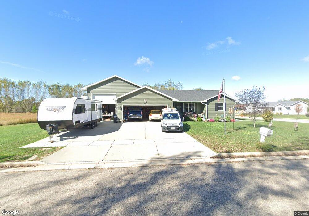
351 Ramesh Ave Fort Atkinson, WI 53538
Estimated Value: $378,000 - $464,000
--
Bed
--
Bath
--
Sq Ft
0.31
Acres
About This Home
This home is located at 351 Ramesh Ave, Fort Atkinson, WI 53538 and is currently estimated at $408,507. 351 Ramesh Ave is a home with nearby schools including Barrie Elementary School, Fort Atkinson Middle School, and Fort Atkinson High School.
Ownership History
Date
Name
Owned For
Owner Type
Purchase Details
Closed on
Oct 12, 2017
Sold by
Manley Charles W and Manley Elsie M
Bought by
Manley Charles W and Manley Elsie M
Current Estimated Value
Purchase Details
Closed on
Jun 7, 2016
Sold by
Highway 12 Llc
Bought by
Manley Charles W and Manley Elise M
Home Financials for this Owner
Home Financials are based on the most recent Mortgage that was taken out on this home.
Original Mortgage
$198,300
Outstanding Balance
$157,825
Interest Rate
3.57%
Mortgage Type
Purchase Money Mortgage
Estimated Equity
$250,682
Create a Home Valuation Report for This Property
The Home Valuation Report is an in-depth analysis detailing your home's value as well as a comparison with similar homes in the area
Home Values in the Area
Average Home Value in this Area
Purchase History
| Date | Buyer | Sale Price | Title Company |
|---|---|---|---|
| Manley Charles W | -- | None Available | |
| Manley Charles W | -- | None Available |
Source: Public Records
Mortgage History
| Date | Status | Borrower | Loan Amount |
|---|---|---|---|
| Open | Manley Charles W | $198,300 |
Source: Public Records
Tax History Compared to Growth
Tax History
| Year | Tax Paid | Tax Assessment Tax Assessment Total Assessment is a certain percentage of the fair market value that is determined by local assessors to be the total taxable value of land and additions on the property. | Land | Improvement |
|---|---|---|---|---|
| 2024 | $6,583 | $350,200 | $57,500 | $292,700 |
| 2023 | $6,529 | $350,200 | $57,500 | $292,700 |
| 2022 | $5,799 | $217,300 | $35,000 | $182,300 |
| 2021 | $5,124 | $217,300 | $35,000 | $182,300 |
| 2020 | $4,863 | $212,300 | $35,000 | $177,300 |
| 2019 | $4,664 | $212,300 | $35,000 | $177,300 |
| 2018 | $4,393 | $212,300 | $35,000 | $177,300 |
| 2017 | $4,300 | $208,000 | $35,000 | $173,000 |
| 2016 | $2 | $100 | $100 | $0 |
| 2015 | $2 | $100 | $100 | $0 |
| 2014 | $2 | $100 | $100 | $0 |
| 2013 | $2 | $100 | $100 | $0 |
Source: Public Records
Map
Nearby Homes
- Lt40 Montclair Place
- 1709 Montclair Place
- 1233 Sherman Ave W
- 1222 Sherman Ave W Unit P
- 1220 Sherman Ave W
- 1612 Commonwealth Dr Unit 3
- 1120 Van Buren St
- 42 Wilson Ave
- 609 Cloute St
- 916 Madison Ave
- 845 Messmer St
- 715 Madison Ave
- 605 Nelson St
- 125 Monroe St
- 505 Robert St
- 619 Robert St
- 1112 Menomonee Ct
- 336 Jones Ave
- 214 Hickory St
- 311 N Main St
- 343-345 Ramesh Ave
- 343 Ramesh Ave Unit 345
- Lot 133 Ila St
- Lot 132 Ila St
- Lot 131 Ila St
- Lot 129 Ila St
- Lot 127 Ila St
- Lot 126 Ila St
- Lot 125 Ila St
- Lot 124 Ila St
- Lot 123 Ila St
- Lot 122 Ila St
- Lot 121 Ila St
- Lot 102 Ila St
- Lot 130 Ila St
- Lot 141 Ila St
- Lot 98 Ila St
- Lot 97 Ila St
- Lot 95 Ila St
- Lot 94 Ila St