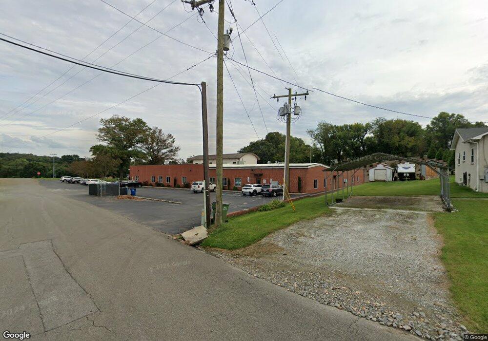
351 Riverside Dr Mount Airy, NC 27030
--
Bed
--
Bath
21,994
Sq Ft
2.5
Acres
About This Home
This home is located at 351 Riverside Dr, Mount Airy, NC 27030. 351 Riverside Dr is a home located in Surry County with nearby schools including Bruce H. Tharrington Elementary School, Mount Airy Middle School, and Mount Airy High School.
Ownership History
Date
Name
Owned For
Owner Type
Purchase Details
Closed on
Mar 30, 2023
Sold by
Lowe Dene Baldwin
Bought by
Tale Cody Ray
Purchase Details
Closed on
Mar 23, 2023
Sold by
Semones Kenneth Wayne and Semones Dianne
Bought by
Hall Patricia Lee and Hall Dana Jeffrey
Purchase Details
Closed on
Mar 22, 2023
Sold by
Marshall Edward James and Marshall Geneva Marie
Bought by
Montgomery Dillon Ryan and Aguilar Montgomery Zoraida
Purchase Details
Closed on
Dec 1, 1997
Purchase Details
Closed on
Sep 1, 1964
Create a Home Valuation Report for This Property
The Home Valuation Report is an in-depth analysis detailing your home's value as well as a comparison with similar homes in the area
Home Values in the Area
Average Home Value in this Area
Purchase History
| Date | Buyer | Sale Price | Title Company |
|---|---|---|---|
| Tale Cody Ray | -- | -- | |
| Hall Patricia Lee | $339,000 | -- | |
| Montgomery Dillon Ryan | $145,000 | -- | |
| Mendoza Maria Consuelo | $109,000 | -- | |
| Hargett Lindsey | $10,000 | -- | |
| -- | $635,000 | -- | |
| -- | -- | -- |
Source: Public Records
Tax History Compared to Growth
Tax History
| Year | Tax Paid | Tax Assessment Tax Assessment Total Assessment is a certain percentage of the fair market value that is determined by local assessors to be the total taxable value of land and additions on the property. | Land | Improvement |
|---|---|---|---|---|
| 2025 | -- | $3,575,800 | $98,440 | $3,477,360 |
| 2024 | -- | $3,158,800 | $93,750 | $3,065,050 |
| 2023 | $0 | $3,158,800 | $93,750 | $3,065,050 |
| 2022 | $0 | $3,158,800 | $93,750 | $3,065,050 |
| 2021 | $0 | $3,158,800 | $93,750 | $3,065,050 |
| 2020 | $0 | $2,674,630 | $93,750 | $2,580,880 |
| 2019 | $0 | $2,674,630 | $0 | $0 |
| 2018 | $0 | $269,130 | $0 | $0 |
| 2017 | $0 | $269,130 | $0 | $0 |
| 2016 | $0 | $269,130 | $0 | $0 |
| 2013 | -- | $297,750 | $0 | $0 |
Source: Public Records
Map
Nearby Homes
- 00 Carroll St
- 1020 Frank St
- 342 Moore Ave
- 311 E Lebanon St
- 0 Woodruff St
- 607 N Main St
- 400 Cherry St
- 165 Virginia St Unit 309
- 165 Virginia St Unit 206
- 643 Willow St
- 344 Linville Rd
- 607 Riverside Dr
- 411 Pippen St
- 415 Pippen St
- 241 Rockford St
- 0 Woltz St
- 105 Grace St
- 109 Grace St
- 455 Franklin St
- 921 N South St
- 275 Smith St
- 518 Junction St
- 522 Junction St
- 237 Spaugh St
- 123 Smith St
- 426 Junction St
- 233 Spaugh St
- 420 Junction St
- 223 Spaugh St
- 425 Junction St
- 416 Junction St
- 346 E Independence Blvd Unit 200
- 346 E Independence Blvd Unit 100
- 346 E Independence Blvd
- 419 Junction St
- 408 Junction St
- 342 E Independence Blvd Unit BVE
- 316 NW Junction Street and Oak St
- 407 Junction St
- 338 E Independence Blvd Unit BVE