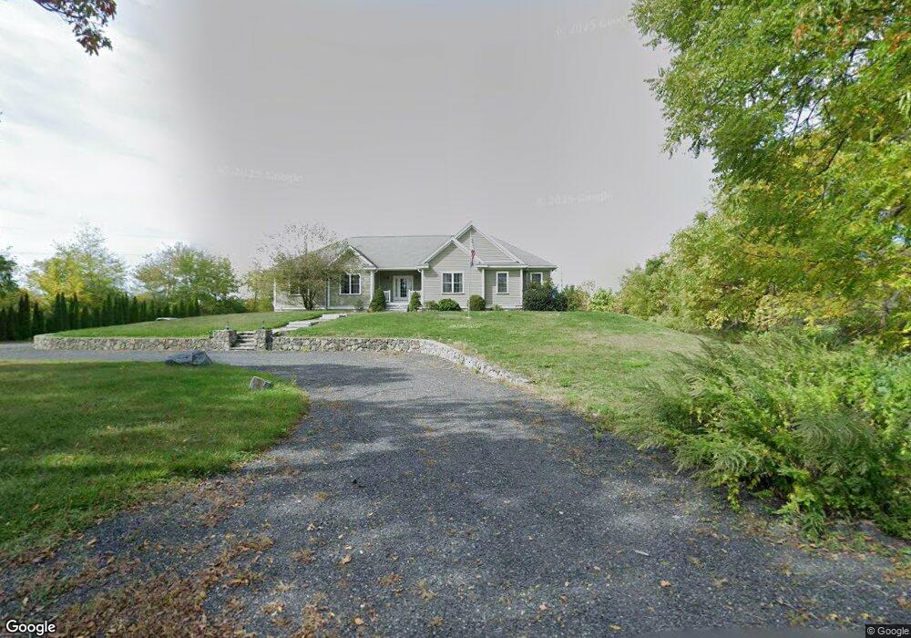
351 S Meadow Rd Lancaster, MA 01523
Estimated Value: $851,000 - $920,000
3
Beds
3
Baths
2,778
Sq Ft
$314/Sq Ft
Est. Value
About This Home
This home is located at 351 S Meadow Rd, Lancaster, MA 01523 and is currently estimated at $871,811, approximately $313 per square foot. 351 S Meadow Rd is a home located in Worcester County with nearby schools including Mary Rowlandson Elementary School, Luther Burbank Middle School, and Nashoba Regional High School.
Ownership History
Date
Name
Owned For
Owner Type
Purchase Details
Closed on
Jun 15, 2018
Sold by
Mcfarland Brad T and Mcfarland Martha
Bought by
Cordio Scott A and Cordio Alyson
Current Estimated Value
Home Financials for this Owner
Home Financials are based on the most recent Mortgage that was taken out on this home.
Original Mortgage
$225,000
Outstanding Balance
$194,587
Interest Rate
4.5%
Mortgage Type
New Conventional
Estimated Equity
$677,224
Purchase Details
Closed on
Aug 23, 2006
Sold by
Alfke John
Bought by
Mcfarland Brad T
Purchase Details
Closed on
Dec 30, 2004
Sold by
Bahosh Kathleen M and Rosman Kathleen M
Bought by
Alfke John
Create a Home Valuation Report for This Property
The Home Valuation Report is an in-depth analysis detailing your home's value as well as a comparison with similar homes in the area
Home Values in the Area
Average Home Value in this Area
Purchase History
| Date | Buyer | Sale Price | Title Company |
|---|---|---|---|
| Cordio Scott A | $490,000 | -- | |
| Mcfarland Brad T | $110,000 | -- | |
| Alfke John | $55,000 | -- |
Source: Public Records
Mortgage History
| Date | Status | Borrower | Loan Amount |
|---|---|---|---|
| Open | Cordio Scott A | $225,000 |
Source: Public Records
Tax History Compared to Growth
Tax History
| Year | Tax Paid | Tax Assessment Tax Assessment Total Assessment is a certain percentage of the fair market value that is determined by local assessors to be the total taxable value of land and additions on the property. | Land | Improvement |
|---|---|---|---|---|
| 2025 | $12,584 | $778,700 | $125,600 | $653,100 |
| 2024 | $12,512 | $716,600 | $116,900 | $599,700 |
| 2023 | $11,526 | $670,500 | $106,300 | $564,200 |
| 2022 | $10,419 | $535,700 | $108,000 | $427,700 |
| 2021 | $10,068 | $503,900 | $108,000 | $395,900 |
| 2020 | $10,370 | $522,400 | $107,900 | $414,500 |
| 2019 | $10,300 | $521,500 | $107,900 | $413,600 |
| 2018 | $9,113 | $456,100 | $107,900 | $348,200 |
| 2016 | $8,211 | $420,000 | $106,900 | $313,100 |
| 2015 | $7,733 | $412,200 | $106,900 | $305,300 |
| 2014 | $7,749 | $409,800 | $106,900 | $302,900 |
Source: Public Records
Map
Nearby Homes
- 76 Sterling St
- 290 Sterling St
- 20 Willow St
- 54 S Meadow Rd
- 19 Magnolia Ave
- 53 Beach Point Rd
- 51 Rigby St
- 19 Fitch Farm Rd
- 22 Forest Ave
- 1 Grady St
- 55 Sterling St Unit 306
- 55 Sterling St Unit 314
- 55 Sterling St Unit 212
- 1116 George Hill Rd
- 0 Parker Rd
- 57 Clark St
- 201-203 Stone St
- 201 Stone St Unit 203
- 23 Ash St
- 38 Lane Ave Unit B
- 317 S Meadow Rd
- 303 S Meadow Rd
- 299 S Meadow Rd
- 61 Moffett St
- 389 S Meadow Rd
- 344 S Meadow Rd
- 9 Rigby Rd
- 356 S Meadow Rd
- 291 S Meadow Rd
- 67 Moffett St
- 376 S Meadow Rd
- 388 S Meadow Rd
- 407 S Meadow Rd
- 55 Rigby Rd
- 278 S Meadow Rd
- 267 S Meadow Rd
- 400 S Meadow Rd
- 10 Rigby Rd
- 423 S Meadow Rd
- 70 Farm Land Ln