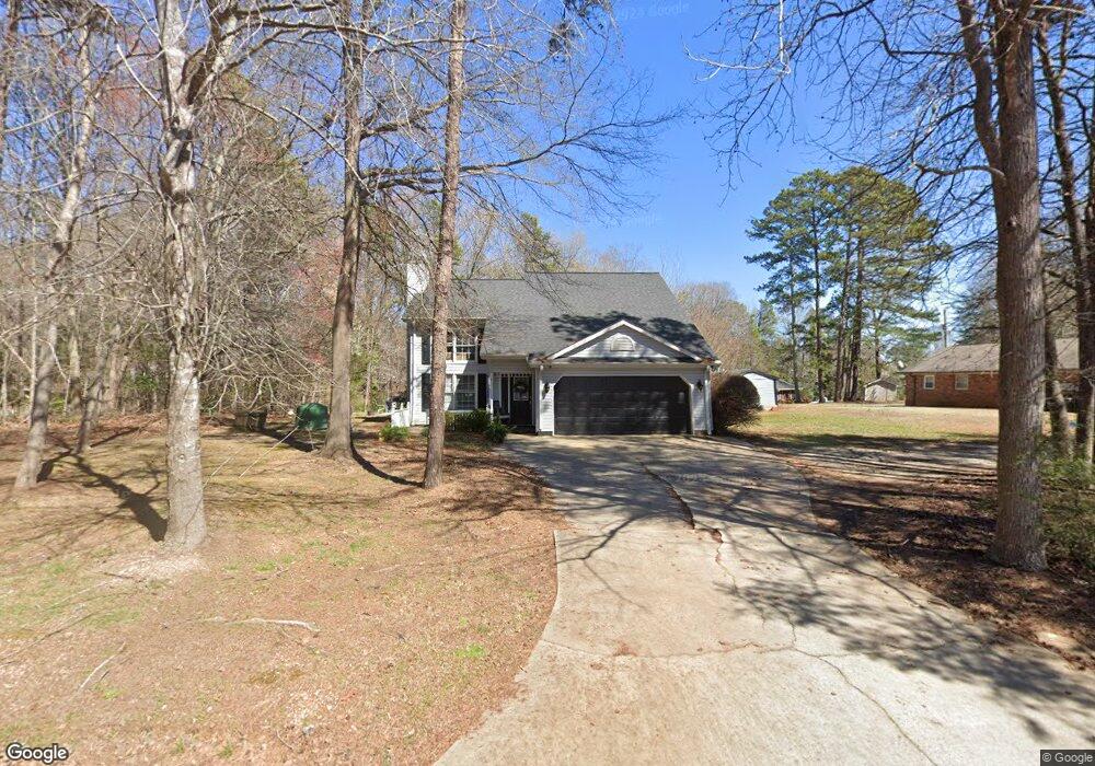
351 Southgate Rd Spartanburg, SC 29302
Estimated Value: $210,000 - $295,000
3
Beds
2
Baths
1,941
Sq Ft
$132/Sq Ft
Est. Value
About This Home
This home is located at 351 Southgate Rd, Spartanburg, SC 29302 and is currently estimated at $255,722, approximately $131 per square foot. 351 Southgate Rd is a home located in Spartanburg County with nearby schools including Broome High School.
Ownership History
Date
Name
Owned For
Owner Type
Purchase Details
Closed on
Jan 15, 2025
Sold by
Wylie Charles D
Bought by
Wylie Nicole J
Current Estimated Value
Purchase Details
Closed on
Jul 6, 2007
Sold by
Rudeen Doris S
Bought by
Wylie Charles D and Wylie Nicole J
Home Financials for this Owner
Home Financials are based on the most recent Mortgage that was taken out on this home.
Original Mortgage
$124,500
Interest Rate
6.52%
Mortgage Type
Unknown
Create a Home Valuation Report for This Property
The Home Valuation Report is an in-depth analysis detailing your home's value as well as a comparison with similar homes in the area
Home Values in the Area
Average Home Value in this Area
Purchase History
| Date | Buyer | Sale Price | Title Company |
|---|---|---|---|
| Wylie Nicole J | -- | None Listed On Document | |
| Wylie Charles D | $128,545 | None Available |
Source: Public Records
Mortgage History
| Date | Status | Borrower | Loan Amount |
|---|---|---|---|
| Previous Owner | Wylie Charles D | $124,500 |
Source: Public Records
Tax History Compared to Growth
Tax History
| Year | Tax Paid | Tax Assessment Tax Assessment Total Assessment is a certain percentage of the fair market value that is determined by local assessors to be the total taxable value of land and additions on the property. | Land | Improvement |
|---|---|---|---|---|
| 2025 | $1,050 | $5,936 | $335 | $5,601 |
| 2024 | $1,050 | $5,936 | $335 | $5,601 |
| 2023 | $1,050 | $5,936 | $335 | $5,601 |
| 2022 | $889 | $5,161 | $331 | $4,830 |
| 2021 | $889 | $5,161 | $331 | $4,830 |
| 2020 | $871 | $5,161 | $331 | $4,830 |
| 2019 | $1,014 | $5,161 | $331 | $4,830 |
| 2018 | $804 | $5,161 | $331 | $4,830 |
| 2017 | $725 | $4,488 | $324 | $4,164 |
| 2016 | $725 | $4,488 | $324 | $4,164 |
| 2015 | $690 | $4,488 | $324 | $4,164 |
| 2014 | $686 | $4,488 | $324 | $4,164 |
Source: Public Records
Map
Nearby Homes
- 4921 S Pine St
- 736 Bethesda Rd
- 4730 S Pine St
- 0 Pinewood Rd
- 380 Indian Creek Rd
- 0 Whitestone Glendale Rd
- 271 Bethesda Rd
- 00 Goldmine Rd
- 141 Townsend Ct
- 161 Townsend Ct
- 302 Sundance Way
- 451 Emma Cudd Rd
- ESSEX Plan at Riverdale Hills
- BERKSHIRE Plan at Riverdale Hills
- DUPONT Plan at Riverdale Hills
- CABOT Plan at Riverdale Hills
- BEAUMONT Plan at Riverdale Hills
- 170 Sutton Rd
- 150 Emma Cudd Rd
- 0 Bethesda Rd
- 111 Burton Rd
- 121 Burton Rd
- 350 Southgate Rd
- 110 Providence Rd
- 390 Southgate Rd
- 130 Providence Rd
- 131 Burton Rd
- 120 Painter Rd
- 115 Providence Rd
- 140 Providence Rd
- 296 Southgate Rd
- 125 Providence Rd
- 131 Painter Rd
- 295 Southgate Rd Unit 297
- 420 Southgate Rd
- 110 Harris Rd
- 290 Southgate Rd
- 161 Harris Rd
- 211 Burton Rd
- 135 Providence Rd