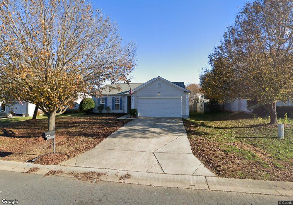
3510 Southern Ginger Dr Unit 169 Indian Trail, NC 28079
Estimated Value: $307,000 - $338,000
3
Beds
2
Baths
1,218
Sq Ft
$266/Sq Ft
Est. Value
About This Home
This home is located at 3510 Southern Ginger Dr Unit 169, Indian Trail, NC 28079 and is currently estimated at $323,904, approximately $265 per square foot. 3510 Southern Ginger Dr Unit 169 is a home located in Union County with nearby schools including Sardis Elementary School, Porter Ridge Middle School, and Porter Ridge High School.
Ownership History
Date
Name
Owned For
Owner Type
Purchase Details
Closed on
Sep 26, 2019
Sold by
Sfr Jv 1 Property Llc
Bought by
Sfr Jv 1 2019 1 Borrower Llc
Current Estimated Value
Home Financials for this Owner
Home Financials are based on the most recent Mortgage that was taken out on this home.
Original Mortgage
$359,758
Outstanding Balance
$315,808
Interest Rate
3.6%
Mortgage Type
Commercial
Estimated Equity
$8,096
Purchase Details
Closed on
Sep 14, 2018
Sold by
Murray Anthony
Bought by
Sfr Jv 1 Property Llc
Purchase Details
Closed on
Aug 5, 2016
Sold by
Stuart David F
Bought by
Muarray Anthony
Home Financials for this Owner
Home Financials are based on the most recent Mortgage that was taken out on this home.
Original Mortgage
$162,011
Interest Rate
3.5%
Mortgage Type
FHA
Purchase Details
Closed on
Jun 30, 2015
Sold by
Stuart Rosa Mae
Bought by
Stuart David F
Home Financials for this Owner
Home Financials are based on the most recent Mortgage that was taken out on this home.
Original Mortgage
$103,460
Interest Rate
3.89%
Mortgage Type
New Conventional
Purchase Details
Closed on
Dec 7, 2010
Sold by
Stuart Rosa Mae
Bought by
Stuart David F
Purchase Details
Closed on
Aug 29, 2007
Sold by
Clark Brian E and Clark Natalie R
Bought by
Stuart Rosa M and Stuart David F
Home Financials for this Owner
Home Financials are based on the most recent Mortgage that was taken out on this home.
Original Mortgage
$100,000
Interest Rate
6.7%
Mortgage Type
Unknown
Purchase Details
Closed on
May 25, 1999
Sold by
The Mulvaney Group Ltd
Bought by
Clark Brian E and Bennett Natalie R
Home Financials for this Owner
Home Financials are based on the most recent Mortgage that was taken out on this home.
Original Mortgage
$110,900
Interest Rate
6.84%
Mortgage Type
FHA
Create a Home Valuation Report for This Property
The Home Valuation Report is an in-depth analysis detailing your home's value as well as a comparison with similar homes in the area
Home Values in the Area
Average Home Value in this Area
Purchase History
| Date | Buyer | Sale Price | Title Company |
|---|---|---|---|
| Sfr Jv 1 2019 1 Borrower Llc | -- | None Available | |
| Sfr Jv 1 Property Llc | $186,000 | None Available | |
| Muarray Anthony | $165,000 | None Available | |
| Stuart David F | -- | Attorney | |
| Stuart David F | -- | None Available | |
| Stuart Rosa M | $140,000 | None Available | |
| Clark Brian E | $112,500 | -- |
Source: Public Records
Mortgage History
| Date | Status | Borrower | Loan Amount |
|---|---|---|---|
| Open | Sfr Jv 1 2019 1 Borrower Llc | $359,758 | |
| Previous Owner | Muarray Anthony | $162,011 | |
| Previous Owner | Stuart David F | $103,460 | |
| Previous Owner | Stuart Rosa M | $100,000 | |
| Previous Owner | Clark Brian E | $110,900 |
Source: Public Records
Tax History Compared to Growth
Tax History
| Year | Tax Paid | Tax Assessment Tax Assessment Total Assessment is a certain percentage of the fair market value that is determined by local assessors to be the total taxable value of land and additions on the property. | Land | Improvement |
|---|---|---|---|---|
| 2024 | $1,763 | $207,500 | $38,900 | $168,600 |
| 2023 | $1,749 | $207,500 | $38,900 | $168,600 |
| 2022 | $1,749 | $207,500 | $38,900 | $168,600 |
| 2021 | $1,749 | $207,500 | $38,900 | $168,600 |
| 2020 | $1,035 | $132,700 | $24,000 | $108,700 |
| 2019 | $1,333 | $132,700 | $24,000 | $108,700 |
| 2018 | $0 | $132,700 | $24,000 | $108,700 |
| 2017 | $1,402 | $132,700 | $24,000 | $108,700 |
| 2016 | $1,082 | $132,700 | $24,000 | $108,700 |
| 2015 | $1,098 | $132,700 | $24,000 | $108,700 |
| 2014 | $894 | $125,130 | $25,000 | $100,130 |
Source: Public Records
Map
Nearby Homes
- 3415 Braefield Dr Unit 156
- 3900 Crimson Wing Dr
- 2006 Paddington Dr
- 3013 Doughton Ln
- 2026 Union Grove Ln
- 1009 Kemp Rd
- 3702 Arthur St
- 1010 Glen Hollow Dr
- 3612 Esther St
- 5706 Sustar Dr
- 4311 Ethel Sustar Dr
- 5205 Sustar Dr
- 5508 Burning Ridge Dr
- 6017 Creft Cir
- 2218 Tree Ridge Rd
- 3722 Society Ct
- 6107 Margaret Ct
- 6045 Creft Cir
- 3319 Creek Trail Rd
- 7002 Creft Cir
- 3510 Southern Ginger Dr
- 3508 Southern Ginger Dr
- 3600 Southern Ginger Dr
- 3804 Red Robin Ct
- 3506 Southern Ginger Dr
- 3602 Southern Ginger Dr
- 4001 Quail Hollow Ct
- 3805 Red Robin Ct
- 4000 Quail Hollow Ct
- 3802 Red Robin Ct
- 3606 Southern Ginger Dr
- 3902 Golden Rod Ct
- 3904 Golden Rod Ct
- 3507 Southern Ginger Dr
- 3603 Southern Ginger Dr
- 3803 Red Robin Ct
- 3505 Southern Ginger Dr
- 4003 Quail Hollow Ct
- 4002 Quail Hollow Ct
- 3608 Southern Ginger Dr