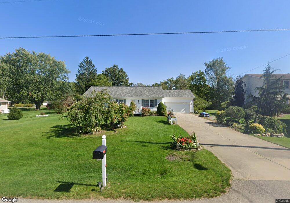
3511 2nd Ave Spring Arbor, MI 49283
Estimated Value: $230,000 - $283,000
Studio
--
Bath
1,627
Sq Ft
$157/Sq Ft
Est. Value
About This Home
This home is located at 3511 2nd Ave, Spring Arbor, MI 49283 and is currently estimated at $255,774, approximately $157 per square foot. 3511 2nd Ave is a home located in Jackson County with nearby schools including Western High School and Trinity Lutheran School.
Ownership History
Date
Name
Owned For
Owner Type
Purchase Details
Closed on
Oct 19, 2018
Sold by
Chan Kwok Cheung and Cheung Suk Fan
Bought by
Chan Kwok C and Cheung Sukfun
Current Estimated Value
Purchase Details
Closed on
Oct 22, 1997
Bought by
Chan Kwok-Cheung and Chan Suk-Fun
Purchase Details
Closed on
Aug 15, 1997
Sold by
Loveless Larry and Loveless Julie
Bought by
Kowach, Inc
Purchase Details
Closed on
Jan 15, 1997
Bought by
Loveless Larry
Purchase Details
Closed on
Dec 11, 1996
Sold by
Crofoot Jack C and Crofoot Connie M
Bought by
Kowach Inc
Purchase Details
Closed on
Feb 1, 1995
Bought by
Crofoot
Create a Home Valuation Report for This Property
The Home Valuation Report is an in-depth analysis detailing your home's value as well as a comparison with similar homes in the area
Home Values in the Area
Average Home Value in this Area
Purchase History
| Date | Buyer | Sale Price | Title Company |
|---|---|---|---|
| Chan Kwok C | -- | None Available | |
| Chan Kwok-Cheung | $121,600 | -- | |
| Kowach, Inc | -- | -- | |
| Loveless Larry | -- | -- | |
| Kowach Inc | $12,000 | -- | |
| Crofoot | $10,000 | -- |
Source: Public Records
Tax History
| Year | Tax Paid | Tax Assessment Tax Assessment Total Assessment is a certain percentage of the fair market value that is determined by local assessors to be the total taxable value of land and additions on the property. | Land | Improvement |
|---|---|---|---|---|
| 2025 | $3,642 | $135,700 | $0 | $0 |
| 2024 | $21 | $132,700 | $0 | $0 |
| 2023 | $2,141 | $120,900 | $0 | $0 |
| 2022 | $3,308 | $128,700 | $0 | $0 |
| 2021 | $3,249 | $111,430 | $0 | $0 |
| 2020 | $3,211 | $91,290 | $0 | $0 |
| 2019 | $3,056 | $82,440 | $0 | $0 |
| 2018 | $3,045 | $79,140 | $12,750 | $66,390 |
| 2017 | $2,883 | $76,820 | $0 | $0 |
| 2016 | $1,819 | $94,520 | $94,520 | $0 |
| 2015 | $74,736 | $86,690 | $86,690 | $0 |
| 2014 | $74,736 | $77,740 | $77,740 | $0 |
| 2013 | -- | $77,740 | $77,740 | $0 |
Source: Public Records
Map
Nearby Homes
- 329 E Main St
- V/L S Dearing Rd Unit 40 Acres Vacant Land
- 7315 King Rd
- 68 Dickens St
- 4055 Mathews Rd
- 2503 Milford Rd
- 6728 King Rd
- 0 King Rd Unit 25060444
- 2926 S Sandstone Rd
- 1864 Chapel Rd
- 1570 Chapel Rd
- 5427 Vrooman Rd
- 1126 Chapel Rd
- 2659 Fairway Dr
- 20 AC VL Sears Rd
- 7870 Sears Rd
- 0 S Parma Rd Unit 26002151
- 0 S Parma Rd Unit 26002152
- 6820 Bowerman Rd
- 4920 Slayton Rd
Your Personal Tour Guide
Ask me questions while you tour the home.