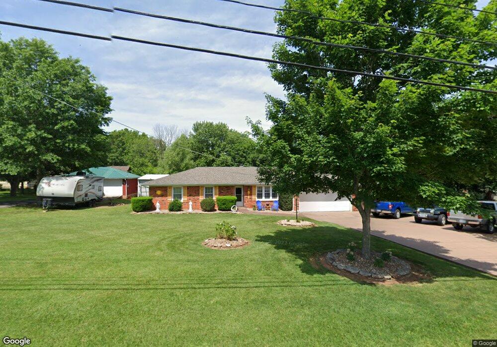
3511 N Farm Road 171 Springfield, MO 65803
Estimated Value: $231,627 - $299,000
3
Beds
1
Bath
1,530
Sq Ft
$169/Sq Ft
Est. Value
About This Home
This home is located at 3511 N Farm Road 171, Springfield, MO 65803 and is currently estimated at $258,407, approximately $168 per square foot. 3511 N Farm Road 171 is a home located in Greene County with nearby schools including Fremont Elementary School, Pleasant View Elementary School, and Pleasant View K-8 School.
Ownership History
Date
Name
Owned For
Owner Type
Purchase Details
Closed on
May 27, 2010
Sold by
Hunt Fred A and Hunt Kimberly A
Bought by
Hunt Troy T
Current Estimated Value
Home Financials for this Owner
Home Financials are based on the most recent Mortgage that was taken out on this home.
Original Mortgage
$103,604
Interest Rate
5.25%
Mortgage Type
FHA
Create a Home Valuation Report for This Property
The Home Valuation Report is an in-depth analysis detailing your home's value as well as a comparison with similar homes in the area
Home Values in the Area
Average Home Value in this Area
Purchase History
| Date | Buyer | Sale Price | Title Company |
|---|---|---|---|
| Hunt Troy T | -- | None Available |
Source: Public Records
Mortgage History
| Date | Status | Borrower | Loan Amount |
|---|---|---|---|
| Closed | Hunt Troy T | $103,604 |
Source: Public Records
Tax History Compared to Growth
Tax History
| Year | Tax Paid | Tax Assessment Tax Assessment Total Assessment is a certain percentage of the fair market value that is determined by local assessors to be the total taxable value of land and additions on the property. | Land | Improvement |
|---|---|---|---|---|
| 2025 | $1,386 | $29,220 | $8,320 | $20,900 |
| 2024 | $1,386 | $23,940 | $4,180 | $19,760 |
| 2023 | $1,379 | $23,940 | $4,180 | $19,760 |
| 2022 | $1,293 | $22,000 | $4,180 | $17,820 |
| 2021 | $1,237 | $22,000 | $4,180 | $17,820 |
| 2020 | $1,191 | $20,120 | $4,180 | $15,940 |
| 2019 | $1,158 | $20,120 | $4,180 | $15,940 |
| 2018 | $994 | $17,180 | $3,230 | $13,950 |
| 2017 | $985 | $16,040 | $3,230 | $12,810 |
| 2016 | $918 | $16,040 | $3,230 | $12,810 |
| 2015 | $911 | $16,040 | $3,230 | $12,810 |
| 2014 | $910 | $16,040 | $3,230 | $12,810 |
Source: Public Records
Map
Nearby Homes
- 3481 N Marwin Ave
- Lot 1 E Stoneridge Dr
- 3839 N Stewart Ave
- 4260 N State Highway H
- 0 N State Highway H Unit 60272431
- 3320 N Weller Ave
- 4159 N Farm Road 173
- 1439 E McClernon St
- 3749 N Pickwick Ave
- 3753 N Pickwick Ave
- 1425 E McClernon St
- 1464 E Burntwood St
- 1316 E Smith St
- 1255 E Smith St
- 2611 N Marlan Ave
- 1338 E Burntwood St
- 3250 N National Ave
- 1234 E McClernon St
- 4541b N Lanier Ln
- 4541 N Lanier Ln
- 3514 N Darwin Ave
- 3531 N Farm Road 171
- 3522 N Darwin Ave
- 3530 N Darwin Ave
- 3506 N Darwin Ave
- 3459 N Farm Road 171
- 3500 N Darwin Ave
- 3456 N Darwin Ave
- 2122 E Ryan St
- 2129 E Ryan St
- 3464 N Farm Road 171
- 2150 E Valley Water Mill Rd
- 2123 E Lon St
- 3548 N Farm Road 171
- 3448 N Darwin Ave
- 2114 E Ryan St
- 2121 E Ryan St
- 3435 N Farm Road 171
- 3435 N Barnes Ave
- 2115 E Lon St