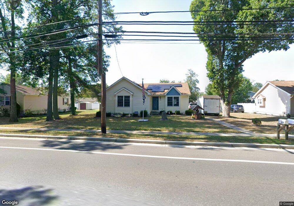
3514 Bayshore Rd Cape May, NJ 08204
Estimated Value: $431,268 - $544,000
--
Bed
--
Bath
1,332
Sq Ft
$369/Sq Ft
Est. Value
About This Home
This home is located at 3514 Bayshore Rd, Cape May, NJ 08204 and is currently estimated at $491,067, approximately $368 per square foot. 3514 Bayshore Rd is a home located in Cape May County with nearby schools including David C. Douglass Veterans Memorial School, Carl T. Mitnick School, and Maud Abrams School.
Ownership History
Date
Name
Owned For
Owner Type
Purchase Details
Closed on
Sep 11, 2013
Sold by
Smith Andrea F and Bumgardner Andrea
Bought by
Biersbach Martin J
Current Estimated Value
Purchase Details
Closed on
Sep 6, 2013
Sold by
Lochel Sadie M
Bought by
Layman John Thomas and Layman Thelma Ann
Purchase Details
Closed on
Aug 25, 1994
Sold by
Ros Len Inc
Bought by
Unk Andrew and Smith Andrea
Home Financials for this Owner
Home Financials are based on the most recent Mortgage that was taken out on this home.
Original Mortgage
$74,000
Interest Rate
8.44%
Create a Home Valuation Report for This Property
The Home Valuation Report is an in-depth analysis detailing your home's value as well as a comparison with similar homes in the area
Home Values in the Area
Average Home Value in this Area
Purchase History
| Date | Buyer | Sale Price | Title Company |
|---|---|---|---|
| Biersbach Martin J | $135,000 | None Available | |
| Layman John Thomas | -- | None Available | |
| Unk Andrew | $81,982 | -- |
Source: Public Records
Mortgage History
| Date | Status | Borrower | Loan Amount |
|---|---|---|---|
| Previous Owner | Unk Andrew | $74,000 |
Source: Public Records
Tax History Compared to Growth
Tax History
| Year | Tax Paid | Tax Assessment Tax Assessment Total Assessment is a certain percentage of the fair market value that is determined by local assessors to be the total taxable value of land and additions on the property. | Land | Improvement |
|---|---|---|---|---|
| 2025 | $3,397 | $167,500 | $75,100 | $92,400 |
| 2024 | $3,397 | $167,500 | $75,100 | $92,400 |
| 2023 | $3,348 | $167,500 | $75,100 | $92,400 |
| 2022 | $3,246 | $167,500 | $75,100 | $92,400 |
| 2021 | $3,149 | $167,500 | $75,100 | $92,400 |
| 2020 | $3,099 | $167,500 | $75,100 | $92,400 |
| 2019 | $3,022 | $167,500 | $75,100 | $92,400 |
| 2018 | $2,950 | $167,500 | $75,100 | $92,400 |
| 2017 | $2,953 | $167,500 | $75,100 | $92,400 |
| 2016 | $2,908 | $167,500 | $75,100 | $92,400 |
| 2015 | $2,814 | $167,500 | $75,100 | $92,400 |
| 2014 | $2,722 | $167,500 | $75,100 | $92,400 |
Source: Public Records
Map
Nearby Homes
- 113 Heidi Ave
- 215 Roseann Ave
- 217 Mindy Ave
- 105 Orchard Dr
- 118 Old Mill Dr
- 226 Joanne St
- 207 Old Mill Dr
- 236 Roseann Ave
- 4 Osprey Dr
- 319 Roseann Ave
- 54 Heron Way
- 113 Beachhurst Dr
- 305 Whildam Ave
- 66 Beachhurst Dr
- 507 Scotty Blvd Unit 12
- 100 Breakwater Terrace Unit UN100
- 402 Whildam Ave
- 702 Gordon Terrace
- 67 Capewoods Rd
- 219 Town Bank Rd
- 3516 Bayshore Rd
- 3512 Bayshore Rd
- 213 Amhurst Rd
- 211 Amhurst Rd
- 3518 Bayshore Rd
- 215 Amhurst Rd
- 209 Amhurst Rd
- 3510 Bayshore Rd
- 207 Amhurst Rd
- 217 Amhurst Rd
- 3520 Bayshore Rd
- 3508 Bayshore Rd
- 212 Amhurst Rd
- 214 Amhurst Rd
- 210 Amhurst Rd
- 219 Amhurst Rd
- 205 Amhurst Rd
- 216 Amhurst Rd
- 208 Amhurst Rd
- 1 Fire Ln